| Heavy
Showers Produce Historic Rainfall at Lubbock |
| |
| |
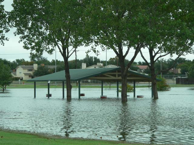
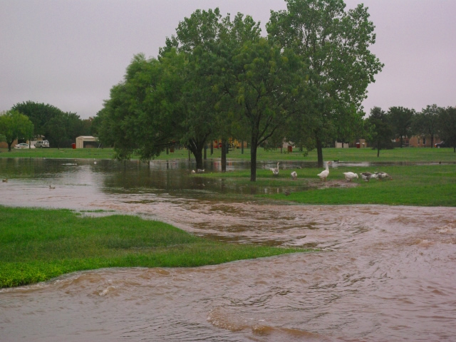
High
water at McCullough Park in southwest Lubbock. Photo by
Gary Skwira, NWS |
Early September brought record-setting
rainfall to portions of the South Plains and Rolling Plains.
From late on the 10th, to early on the 12th, numerous rain showers
moved across the region. The area from Lubbock and Lynn Counties
northeast to Hall and Childress counties were hit hardest as
lines of heavy showers repeated tracked across this area. The
weather pattern responsible for this featured a deep trough
of low pressure across the western U.S. This resulted in southwest
winds aloft moving from the Pacific Ocean into West Texas. These
winds tapped into some rich moisture - including some from Tropical
Storm Lowell located near the southern tip of the Baja Peninsula.
This combined with a weak front which tended to concentrate
the showers across the South Plains area. Lubbock received it's
highest ever 24 hour rainfall - 7.80 inches.
Interestingly, the previous 24-hour record (5.82 inches) was
set back in October of 1983 when the area was impacted by the
remnants of Pacific Hurricane Tico. In Lubbock, the rainfall
inundated the playa lakes, parks and streets across the city,
and resulted in a number of flooded homes and flooded out vehicles.
To read a detailed public information statement including some
other rainfall totals CLICK HERE.
For a more complete listing of
4-day rainfall totals CLICK
HERE.
|
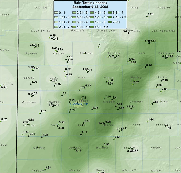
| Graphic displaying
measured rainfall that fell between 8 am on the 9th (Tuesday)
and 8am on the 13th (Saturday) of September 2008. A majority
of the rainfall fell between Thursday afternoon (11th) and
the first half of Friday (12th). Rainfall data is courtesy
of the NWS COOP and the Texas Tech West Texas Mesonet. Click
on the image for a larger view. |
Above is a map that displays the
rainfall totals recorded between Tuesday morning and Saturday
morning (9-13 September 2008). The map shows that a large swath
of 3+ inches fell from the southern South Plains through the
southeast Texas Panhandle, with a remarkably large area of 7+
inches running from Lubbock and Lynn counties northeast into
Hall county. Although rainfall amounts were much lighter outside
the very heavy rain axis, most of the remainder of West Texas
still saw between 1/2 and 2 1/2 inches.
Below is a map showing rainfall
across the region as estimated by the Lubbock radar. Radar estimates
can have varying degrees of error and actual rainfall may be
lower or higher depending on the location. Regardless, you can
see that the radar estimate does give a good approximation of
where the heavy rain fell (comparing the below image to the
above map), with the estimated amounts generally on the low
side for this event.
|
|
30 hour rainfall
estimate from the Lubbock radar for the period 1 am September
11 to 7 pm September 12th. Click to enlarge the image. |
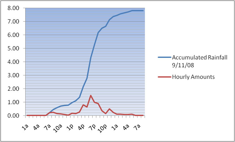
Below is a graph of the hourly
rainfall rate and accumulated rainfall for the record breaking
rain at the Lubbock airport. Of note, the rainfall rates are
stout but never incredible, peaking at 1.50 inches in one hour
between 5 and 6 pm on the 11th. However, the duration of moderate
to heavy rain is impressive, with rain reported every hour between
6 am on the 11th and 6 am on the 12th. In fact, every hour but
one between 2 pm and midnight on the 11th had at least two tenths
of an inch, with 5 consecutive hours having rain rates over
one half inch an hour.
|
| Graph of the hourly
rainfall rate and the accumulated rainfall for the Lubbock
airport during the record setting rains on September 11th.
The scale on the left is in inches, with the hour of the
day on the bottom. Information is plotted from 1 am Thursday
morning (11 Sep 2008) to 8 am Friday morning (12 Sep 2008).
Click on the graph for a larger view. |
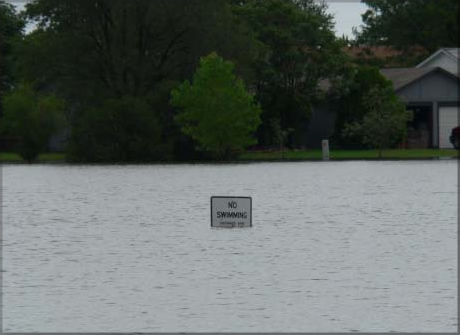
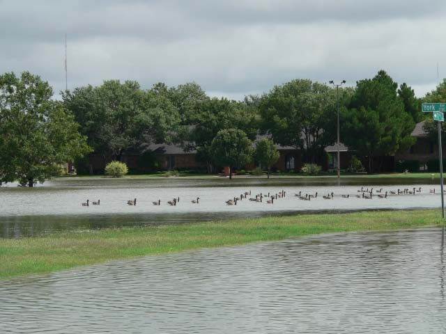
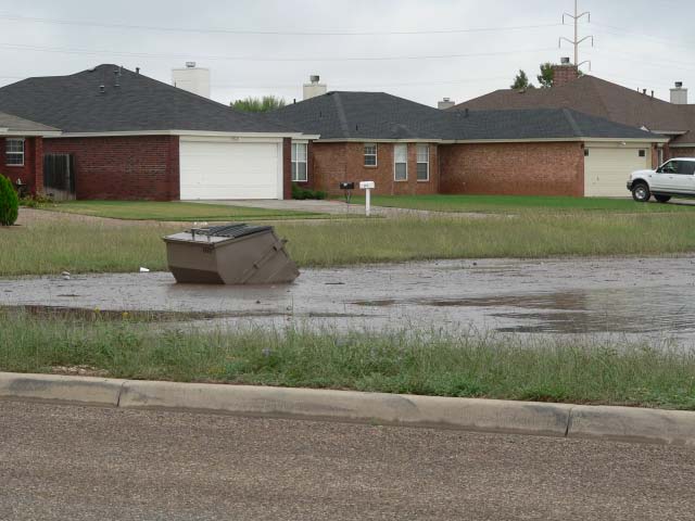
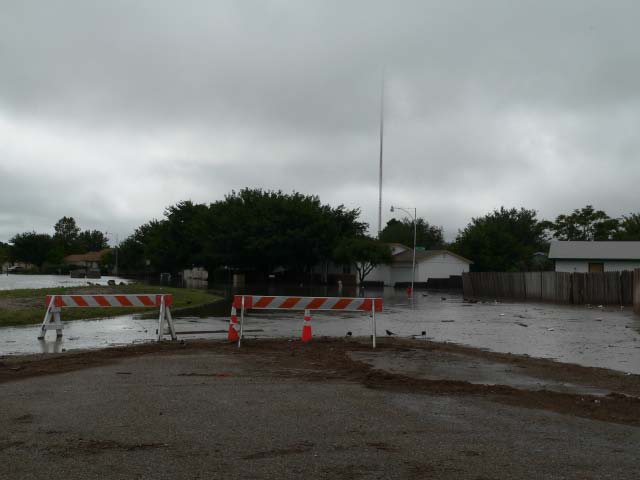
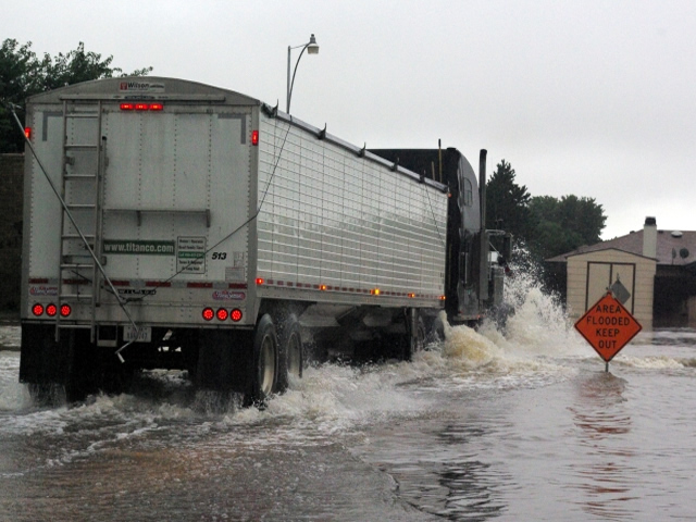
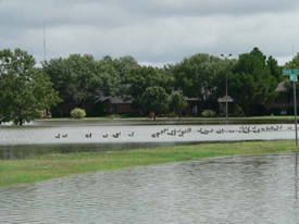
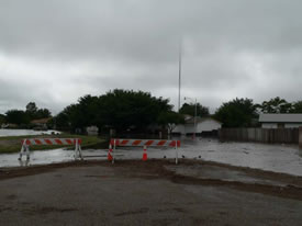
As alluded to earlier, the tremendous
amounts of rain did create some problems around the area. Below
are some pictures of high water and flooding across the southwest
side of Lubbock.
|
 |
|
 |
|
 |
| Pictures taken on September
11th and 12th across the southwest side of Lubbock. The
picture from the upper left is at Charles Guy Park; upper-right
is from Jan Jennings Park; center pictures are from around
Earl Crow Park; and the bottom two pictures were taken near
Phil Hoel Park. Click on each image to view a larger version.
|