Coastal Relief Model CD-ROMs/DVD-ROMData Announcement 04-MGG-01 (updated Dec 2004)
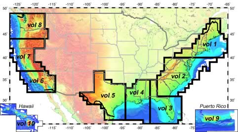
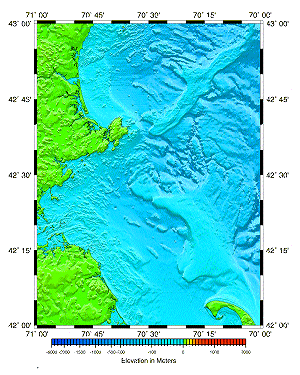
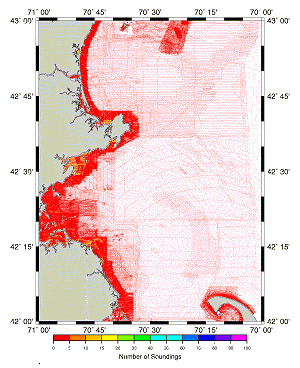
National Geophysical Data Center The National Geophysical Data Center is addressing the need for topographic-bathymetric relief models that integrate land and seafloor elevations by assembling a gridded database which merges the US Geological Survey 3-arc-second DEMs with a vast compilation of hydrographic soundings collected by the National Ocean Service and various academic institutions. Eight CD-ROMs are available covering the US East, Gulf, and West Coasts (see above). In addition to the US Geological Survey and National Ocean Service data, volumes 3 through 5 also include bathymetric contours from the International Bathymetric Chart of the Caribbean Sea and the Gulf of Mexico project. These eight volumes, plus volumes 9 and 10 (Puerto Rico and Hawaii) are also available on one DVD-ROM. All volumes are also available for free download. The NGDC Coastal Relief Model is a new and innovative data product providing a never-before-seen detailed view across the US coastal zone. Our team is using the restructured National Ocean Service (NOS) Hydrographic Database combined with the US Geological Survey DEM grids to assemble a gridded database of coastal zone elevations. For Volumes 3 through 5, in areas where there is no NOS coverage, bathymetric contours from the International Bathymetric Chart of the Caribbean Sea and Gulf of Mexico (IBCCA) were used. The Coastal Relief Model extends from the coastal state boundaries to as far offshore as the NOS hydrographic data will support a continuous view of the seafloor. The principal components of the database are 3-arc-second elevation grids 1 degree in latitude by 1 degree in longitude. The product also includes auxiliary grids for non-land areas: a set containing the number of soundings encompassed by each cell and a set containing distances to the nearest original data for each cell. The principal component of the database is 3-arc-second elevation grids, of areas 1° in longitude by 1° in latitude, in which elevations are resolved to 1/10 of a meter. There are also images of shaded relief elevation and bathymetric sounding density. (In areas of no NOS coverage, contour lines are substituted for density on the density images.) The database also includes grids containing the number of soundings enclosed by each cell in the offshore areas of the elevation grids, and images of both the elevation and sounding density grids (Figures 1 & 2). The images are in common graphic formats that can be displayed by a range of UNIX-based and personal computer software. select an image above for an expanded view Both data and images on the CD-ROMs/DVD-ROM are accessible through software called Grid Translator, which can be accessed and navigated using any common web browser. Grid Translator has been developed and added to the NGDC GEOphysical DAta System (GEODAS) to enable users to create custom-sized grids of areas within the coastal zone at a variety of resolutions and in several common grid formats. Due to the immense amount of data involved in this project, grids are being released in regional volumes. The first two volumes available were for the US east coast. The second release of three additional volumes covered the remainder of the Southeast Atlantic US Coast and the US Gulf of Mexico Coast. This updated announcement includes volumes six through ten, covering the US West Coast, Hawaii, and Puerto Rico. Subsequent updates and/or additional volumes will be released as they are completed. For more information and updates on the NGDC Coastal gridding project, please see URL: http://www.ngdc.noaa.gov/mgg/coastal/ For technical assistance with software, please contact Dan Metzger, phone: 303-497-6542, email: . |


