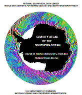
GRAVITY ATLAS OF THE SOUTHERN OCEANNGDC DATA ANNOUNCEMENT NUMBER: 92-MGG-04
Color Atlas from the National Geophysical Data Center
Report MGG-7K.M. Marks and D.C. McAdooNOAA/National Ocean Service/Office of Ocean & Earth Science/Geoscience Lab
High resolution gravity fields for the Southern Ocean computed exclusively from GEOSAT satellite radar altimeter data, both the Exact Repeat Mission (ERM) data and the recently declassified US Navy's Geodetic Mission (GM) data, are presented in this color atlas. The circum-Antarctic region between 60 deg. S and 72 deg. S is divided into six geographic regions each spanning 60 deg. of longitude. For each of these regions three high quality color images are provided, these include both the ascending and descending deflections of the vertical, as well as the computed gravity anomalies. Also provided for each region are plots of the GEOSAT ground track coverage (both ERM and GM) and ETOPO5 seafloor bathymetry. The Southern Ocean has had fewer surface ship surveys than any of the other ocean basins; as a result very little detailed information on its morphology and tectonics is available. The gravity fields presented in this atlas reveal many previously unknown short wavelength (10-500 km) features in the seafloor such as seamounts, fracture zones, and mid-ocean ridge structures. The strong correlation between short wavelength gravity anomalies and seafloor topography makes it possible to 'see' these bathymetric features in the gravity fields. Also presented are details of regional tectonic history, based on analysis of these seafloor features, for the last 100 million years. This new color gravity atlas derived from GEOSAT radar altimeter data highlights the marine gravity field around Antarctica. The information provided in this atlas has many potential applications. One of these applications is the mapping of the tectonic fabric imprinted in the seafloor and the consequent improvements in our understanding of the relative plate motions following the breakup of the supercontinent Gondwana. Another possible application is an improved physiographic mapping of the circum-Antartica region. The Gravity Atlas of the Southern Ocean is available as an 8 1/2" x 11" paperback from the National Geophysical Data Center and serves as a companion to Report MGG-6, Gravity Field over the Southern Ocean from GEOSAT. The digital data used to produce the gravity images in this atlas are available from the National Geophysical Data Center. |
