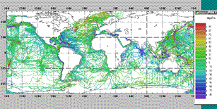
1999 composite plot: marine free-air gravity anomaly data. For the latest marine data, please follow the "Get Geophysical Data" link at the upper right of this page.
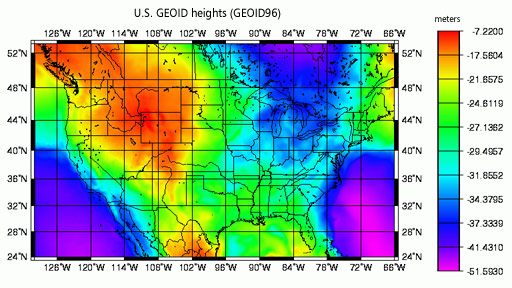
NOAA's National Geodetic Survey provides online computations of estimated gravity for locations in the United States.
|
Land and Marine Gravity Data
1999 Compilation
In 1999, NGDC released a 2 CD-ROM set titled Land and Marine
Gravity Data - 1999 Edition. This collection included one CD-ROM with
primarily land surveys and correlative data and a second CD-ROM containing
marine surveys.
Data are grouped either by general type (Land) or by region
(Marine). All available meta-data, browse imagery, and source
information are accessible online by following the "About the Data"
link. While only a few of the land data files are available
for download, all of the marine data are online.
To view and access the latest marine data, follow the "Get Geophysical Data" on the
top navigation bar at the top of this page.
|