SURFRAD Network: Penn State, Pennsylvania
|
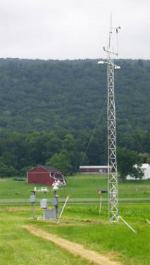
Latitude: 40.72 degrees North Longitude: 77.93 degrees West Elevation: 376 meters Time Zone: Local Time + 5 hours = UTC Installed: June 1998 The Penn State University SURFRAD station is located on the grounds of PSU's agricultural research farm. It is in a broad Appalachian valley between Tussey and Bald Eagle Ridges, and is hosted by the Meteorology Department. |
Please click here to download SURFRAD data from the Pennsylvania site.
Or click here to return to SURFRAD Sites Page.