Privacy Policy

Disclaimer

Tropical Atlantic/Pacific

Severe Storm Sectors

GOES Full Disk

Color Enhanced Imagery

High Density Winds

METEOSAT Images

MTSAT Images

Indian Ocean Images

Daily Significant Event Imagery

CoastWatch

Interactive Archive


GOES East Archive

GOES West Archive

GOES Products

Satellite Services Division

Other Satellite Links

NESDIS Home Page
goes web page logo

Tropical Sectors

Pacific
(8km res)
Gulf/Atlantic
(8km res)
Atlantic
(12km res)
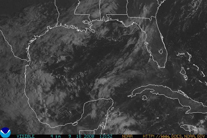
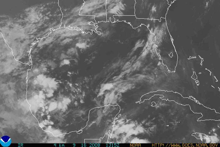
Gulf of Mexico
(4km res)
East Coast
(4km res)
Full Size Hurricane Sector IR Image (Pacific)
InfraRed

IR Tropical Applet Loop

Full Size Hurricane Sector VIS Image (Pacific)
Visible

VIS Tropical Applet Loop

Full Size Hurricane Sector WV Image (Pacific)
Water Vapor

WV Tropical Applet Loop

Full Size Hurricane Sector IR Image (Atlantic)
InfraRed

IR Tropical Applet Loop

Full Size Hurricane Sector VIS Image (Atlantic)
Visible

VIS Tropical Applet Loop

Full Size Hurricane Sector WV Image (Atlantic)
Water Vapor

WV Tropical Applet Loop

Full Size Atlantic Sector IR Image (Pacific)
InfraRed

IR Atlantic Applet Loop

Full Size Atlantic Sector VIS Image (Pacific)
Visible

VIS Atlantic Applet Loop

Full Size Atlantic Sector WV Image (Pacific)
Water Vapor

WV Atlantic Applet Loop

Gulf Mexico IR Image
InfraRed

Gulf Mexico IR Applet Loop

Gulf Mexico VIS Image
Visible

Gulf Mexico VS Applet Loop

Gulf Mexico WV Image
Water Vapor

Gulf Mexico WV Applet Loop

East Coast IR Image
InfraRed

IR East Coast Applet Loop

East Coast VIS Image
Visible

VIS East Coast Applet Loop

East Coast WV Image
Water Vapor

WV East Coast Applet Loop