 A dozen major trails cross the Presidio. Each reveals a different aspect of the park’s character. Some routes, such as the California Coastal Trail and the Juan Bautista de Anza National Historic Trail, are regional trails connecting to open spaces throughout the Bay Area and as far as Mexico. Presidio trails and overlooks are being transformed thanks to a lead gift and challenge grant from the Evelyn and Walter Haas, Jr. Fund. For information about meeting the challenge and giving to the park, contact the Golden Gate National Parks Conservancy at kmorelli@parksconservancy.org or (415) 561-3000.
Download a Trails Map
Download a Map of Presidio Trails and Overlooks (PDF color map – updated March 2008)
SCENIC OVERLOOKS
Immigrant Point (off Washington Boulevard near Kobbe)
 The stone plaza at Immigrant Point, dedicated to our nation’s newcomers, offers sweeping views of the Pacific Ocean and Marin Headlands. A recently completed extension of the Anza National Historic Trail links Immigrant Point with the Presidio’s forested ridgetops. A picnic area located nearby offers a peaceful place to take a break from a hike. The overlook was made possible by a gift from the Sarlo Foundation of the Jewish Community Endowment Fund.
Inspiration Point (just inside the Arguello Gate)
 Take in views of San Francisco Bay, Alcatraz, Angel Island, and the Presidio forest from the Inspiration Point overlook. The site offers a perspective on Tennessee Hollow’s spring-fed tributaries, historic homes, the El Polin Spring picnic area, playing fields, and trails such as Lovers’ Lane and the Ecology Trail. Inspiration Point was funded by a gift from the James R. Harvey Presidio Restoration Fund.
Crissy Field Overlook (open Spring 2008)
 The Presidio Trust is constructing a new scenic overlook above Crissy Field. The vista point will feature a stone plaza, benches, an ornamental railing, interpretive panels, and visitor parking. Crissy Field Overlook will offer spectacular views of San Francisco Bay, Alcatraz and Angel Island, the marsh and historic grass airfield, and the city skyline. It will open in spring 2008. The overlook is being constructed with support from the Evelyn and Walter Haas, Jr. Fund.
TRAILS
Batteries to Bluffs Trail
 Access Points: Battery Godfrey, Washington Boulevard
Length: 0.7 miles (1.1 kilometers)
A dramatic upgrade along the Batteries to Bluffs trail allows visitors to experience the wild western shoreline as never before, including new access to Marshall’s Beach. The project was led by the Golden Gate National Parks Conservancy, in partnership with the National Park Service and Presidio Trust. Highlights: Batteries Godfrey and Crosby, beach access, wilderness and ocean views.
Bay Area Ridge Trail
 Access Points: Presidio Golf Course, Inspiration Point overlook, Battery East parking area (Part of City Bike Route #65)
Length: 2.7 miles (4.4 kilometers)
The Bay Area Ridge Trail is a 400-mile route around San Francisco Bay; the Presidio leg links the park’s highest points, from Arguello Gate to the Golden Gate Bridge. Highlights: the historic forest, Presidio Golf Course, San Francisco National Cemetery, overlook at cemetery (planned), Fort Scott, coastal defense batteries.
California Coastal Trail
 Access Points: Golden Gate Bridge Toll Plaza, Battery Godfrey parking area, Baker Beach (Part of City Bike Route #95)
Length: 4.2 miles (6.8 kilometers)
The Presidio portion of the California Coastal Trail connects Baker Beach to the Golden Gate Bridge; at its north end, it continues across the Golden Gate Bridge, and a side trail beneath the bridge branches off through Battery East to Fort Point. Highlights: overlook at Batteries East and Godfrey (planned), coastal defense fortifications, wildflowers, hawk sightings, blazing sunsets, dramatic serpentine rock, Battery Chamberlin and its “disappearing gun,” Fort Scott overlook.
Ecology Trail
 Access Points: Behind the Presidio Officers’ Club, Inspiration Point overlook
Length: 1.4 miles (2.1 kilometers)
The Ecology Trail offers a contemplative experience; a spur trail connects to the picnic area at El Polin Spring. (A free KIDS on Trails activity guide for the Ecology Trail is available.) Highlights: the Presidio’s largest redwood grove, serpentine grasslands abounding with springtime wildflowers, Inspiration Point overlook.
Golden Gate Promenade (Bay Trail)
 Access Points: Fort Point, Marina Gate (Part of City Bike Route #2)
Length: 1.7miles (2.8 kilometers)
The Golden Gate Promenade along Crissy Field (part of the San Francisco Bay Trail) displays natural and historic treasures against the city skyline. The trail continues along the Marina Green.
Highlights: beach, dune, and salt marsh habitats; shorebirds; a marine sanctuary visitor center; the Crissy Field Center and Warming Hut.
Juan Bautista de Anza National Historic Trail
 Access Points: Mountain Lake, Coastal Batteries parking area (Part of City Bike Route #69)
Length: 2.7 miles (4.3 kilometers)
The Juan Bautista de Anza National Historic Trail commemorates the 1,200 mile route followed by the 1775–1776 Anza expedition from Sonora, Mexico, to establish a presidio at what we known today as the Golden Gate. (A free KIDS on Trails activity guide for the Anza Trail is available.) Presidio section highlights: Mountain Lake, where the expedition camped; Fort Scott; Immigrant Point overlook at Washington Boulevard.
Lobos Creek Valley Trail
Access Points: Trailhead near 25th Avenue Gate (across from Bowley Street), Former Public  Health Service Hospital Complex
Length: 0.8 mile (1.3 kilometers)
The Lobos Creek Valley Trail, a half-mile-long boardwalk, skirts one of San Francisco’s last free-flowing streams, which is a water source for the Presidio and haven for flora and fauna.
Highlights: overlook at Lobos Valley (planned), recently restored dune habitat, native wildflowers, birds.
Lovers’ Lane
 Access Points: Presidio Gate, Funston Avenue, Visitor Center
Length: 1 mile (1.6 kilometers)
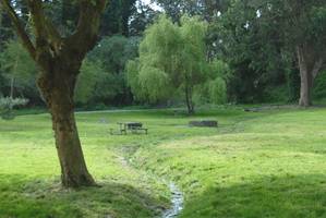
Lovers’ Lane, used by Spanish soldiers and padres traveling to Mission Dolores and American soldiers visiting their sweethearts, links the Main Post to the Presidio Gate through the Tennessee Hollow watershed. Highlights: eucalyptus stands, willow woodland, a quaint residential neighborhood, small historic footbridge.
Mountain Lake Trail
 Access Points: Broadway and Presidio Gates, Baker Beach
Length: 2.6 miles (4.1 kilometers)
The Mountain Lake Trail passes through several natural areas as it traces the Presidio’s southern boundary. Highlights: overlook at Presidio Boulevard (planned), Julius Kahn Playground, Presidio Golf Course, Mountain Lake Park.
Park Boulevard Trail
 Access Points: West Pacific Avenue, East Beach at Crissy Field
Length: 1.5 miles (2.4 kilometers)
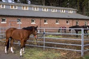
Park Boulevard Trail, which will be greatly improved and expanded over the next three years, travels north-south through the middle of the park from Crissy Field to Mountain Lake. Highlights: the historic grass air field and hangars at Crissy Field, Cavalry Stables, the forest, and Presidio Golf Course.
Presidio Promenade
 Access Points: Lombard Gate, Golden Gate Bridge Toll Plaza
Length: 2.1 miles (3.4 kilometers)
The Presidio Promenade passes through the Main Post and connects Lombard Gate to the Golden Gate Bridge. Highlights: 19th-century officers’ homes, enlisted men’s barracks, Main Parade Ground, San Francisco National Cemetery, Crissy Field Overlook.
Tennessee Hollow Trail
 Access Points: West Pacific Avenue, East Beach at Crissy Field
Length: 1.2 miles (1.9 kilometers)
The Tennessee Hollow Trail runs south-north through the Presidio, traversing the park’s largest watershed from seeps to outlay at Crissy Field Marsh. Highlights: Julius Kahn Playground, El Polin Springs picnic area, Wayburn Redwood Grove, Crissy Field Marsh, East Beach.