


by
admin
—
last modified
2008-12-08 14:38
 |
|
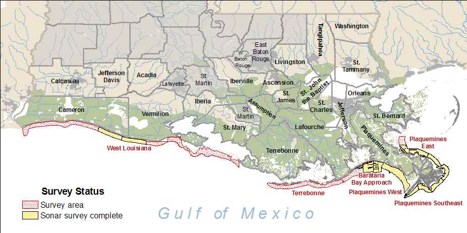
Please click on the area name to view map and status information for the desired area.
|
 |
| Additionally, NOAA has partnered with other Gulf agencies to create a Gulf Storms Information Portal, housing relevant information and links on storm activity,preparedness, impacts and response. You can visit this site at - http://masgc.org/gulfstorms/index.htm |
 Click on the icon to launch the Interactive Mapper to explore and download data in GIS format. Check back often as we will be adding new data layers. |
 See all kinds of photos and different video clips associated with this project. Both photos and videos are regularly updated so be sure to check often. |
 Click on the icon to view assorted survey statistics reports. |
| Project Description - Learn more about this project, from how it began and some achievements so far to a few future projects currently in work. |
| Outreach - Learn more about the project outreach strategy and access special materials. |