Objectives
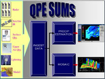
The goal of Project QPESUMS is to research, develop, and deploy multisensor precipitation algorithms that are adaptable to different types of weather for flash flood, river flood, agricultural, and water resources management applications worldwide. Originally prototyped for use in the mountainous terrain of the southwest US, QPESUMS uses a unique blend of WSR-88D radar data, TDWR radar data, private sector C-band radar data, satellite imagery, lightning strikes, rain gauge data, surface and upper air observations, and numerical model output to estimate precipitation types and rates on a 1x1 km grid, every 5 minutes.
Descriptive Overview of QPESUMS Algorithms


