skip navigation link
 NOAA > NESDIS > NGDC > MGGD > marine geology & geophysics > bathymetry & relief
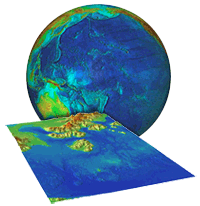
relief globe and tsunami dem


Related Data at NGDC:

iho, gebco, ioc logos

International Ocean Mapping

Bathymetry, Topography & Relief

Scientific stewardship, products, and services for ocean depth data
and derived digital elevation models

Bathymetry (Ocean Depths)
line
Bathymetric & Fishing Maps
Great Lakes
IHO Data Center for Digital Bathymetry (IHO DCDB)
International Ocean Mapping Projects
Multibeam Data
NOS Hydrographic Survey Data
Satellite-derived Data
Trackline Data
Combined Bathymetry & Topography
line
Coastal Relief Model (U.S. coastal areas only)
Coastlines & Coastline Extractor
Digital Elevation Model (DEM) Discovery Portal   
Global Relief (ETOPO1new ETOPO2 ETOPO5)
Tsunami Inundation Gridding Project
Topography (Land Elevations)
line
All Topography
Global Land 1-km Base Elevation Project (GLOBE)
U.S. State images of 30-second Topographic Data
Lidar Archive
NGDC compiles, archives, and distributes bathymetric data from coastal and open ocean areas, including acting as the long-term archive for NOAA National Ocean Service (NOS) data collected in support of charting and navigation.

NGDC compiles the global ETOPO1 1-minute relief database, coastal relief models for US coastal areas, creates digital elevation models for tsunami inundation research, and stewards gridded topographic data from the GLOBE project.

NGDC participates in numerous international ocean mapping projects, and operates the International Hydrographic Organization (IHO) Data Center for Digital Bathymetry (IHO DCDB) on behalf of the member nations.