• Data via anonymous ftp
• Ka'imimoana Home Page
• Columbus Waikato / Cap Victor Data
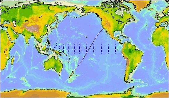
• 165°E Cruise Data
• 180° Cruise Data
• 170°W Cruise Data
• 155°W Cruise Data
• 140°W Cruise Data
• 125°W Cruise Data
• 110°W Cruise Data
• 95°W Cruise Data
pCO2 System Description
• Publications
• Graphics of uwpCO2 systems and data
Equatorial Pacific Underway pCO2 Measurements
As a companion project to the biannual deployment and recovery of the Tropical Atmospheric Ocean (TAO) Array, pCO2 has been routinely measured along 165°E, 180°, 170°W, 155°W, 140°W, 125°W, 110°W, and 95°W between 10°N and 10°S on the NOAA Ship Ka'imimoana.
For data and plots from specific transects, including the Columbus Waikato / Cap Victor trackline, click on a link to the left, or on a region below.