
 Feeds & Data
Magnitude 4.4 - GALAPAGOS TRIPLE JUNCTION REGION
2008 September 14 09:18:19 UTC
Earthquake Details
| Magnitude | 4.4 |
|---|---|
| Date-Time |
|
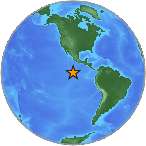
| Location | 5.001°N, 103.093°W |
| Depth | 10 km (6.2 miles) set by location program |
| Region | GALAPAGOS TRIPLE JUNCTION REGION |
| Distances | 900 km (560 miles) SE of Clipperton Island 1650 km (1020 miles) SSW of MEXICO CITY, D.F., Mexico |
| Location Uncertainty | horizontal +/- 13.2 km (8.2 miles); depth fixed by location program |
| Parameters | NST= 91, Nph= 91, Dmin=>999 km, Rmss=0.86 sec, Gp=151°, M-type=body magnitude (Mb), Version=Q |
| Source |
|
| Event ID | us2008wyat |
- This event has been reviewed by a seismologist.
- Did you feel it? Report shaking and damage at your location. You can also view a map displaying accumulated data from your report and others.
Earthquake Maps
Earthquake Location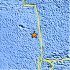
Location Maps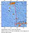
Historical Seismicity
Seismic Hazard Map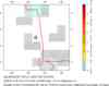
EQ Density Map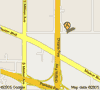
Google Map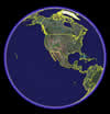
Google Earth KML
(Requires Google Earth)- Did you feel it? Report shaking and damage at your location. You can also view a map displaying accumulated data from your report and others.
Scientific & Technical Information
 Historic Moment Tensor Solutions
- Preliminary Earthquake Report
- U.S. Geological Survey, National Earthquake Information Center:
World Data Center for Seismology, Denver
