
 Feeds & Data
Magnitude 4.9 - PAPUA, INDONESIA
2008 September 13 07:58:02 UTC
Earthquake Details
| Magnitude | 4.9 |
|---|---|
| Date-Time |
|
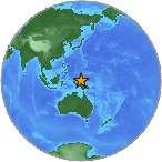
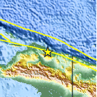
| Location | 2.324°S, 138.953°E |
| Depth | 34 km (21.1 miles) (poorly constrained) |
| Region | PAPUA, INDONESIA |
| Distances | 195 km (120 miles) W of Jayapura, Papua, Indonesia 260 km (160 miles) W of Vanimo, New Guinea, PNG 1440 km (890 miles) NE of DARWIN, Northern Territory, Australia 3600 km (2230 miles) E of JAKARTA, Java, Indonesia |
| Location Uncertainty | horizontal +/- 10.1 km (6.3 miles); depth +/- 35.1 km (21.8 miles) |
| Parameters | NST= 43, Nph= 43, Dmin=>999 km, Rmss=0.9 sec, Gp= 54°, M-type=body magnitude (Mb), Version=R |
| Source |
|
| Event ID | us2008wxav |
- This event has been reviewed by a seismologist.
- Did you feel it? Report shaking and damage at your location. You can also view a map displaying accumulated data from your report and others.
Earthquake Summary
Earthquake Information for Indonesia
 Tsunami Information
- NOAA West Coast & Alaska Tsunami Warning Center
- NOAA Pacific Tsunami Warning Center
- Tsunami Information Links
The earthquake locations and magnitudes cited in these NOAA tsunami bulletins are very preliminary and may be superceded by USGS locations and magnitudes computed using more extensive data sets.
Earthquake Maps
Earthquake Location
Location Maps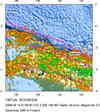
Historical Seismicity
Seismic Hazard Map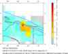
EQ Density Map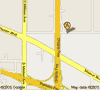
Google Map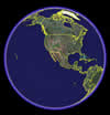
Google Earth KML
(Requires Google Earth)- Did you feel it? Report shaking and damage at your location. You can also view a map displaying accumulated data from your report and others.
Scientific & Technical Information
 Historic Moment Tensor Solutions
- Preliminary Earthquake Report
- U.S. Geological Survey, National Earthquake Information Center:
World Data Center for Seismology, Denver
