
 Feeds & Data
Magnitude 2.5 - CENTRAL CALIFORNIA
2008 September 09 09:05:49 UTC
Earthquake Details
| Magnitude | 2.5 |
|---|---|
| Date-Time |
|
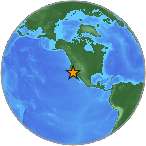
| Location | 36.070°N, 120.206°W |
| Depth | 9.9 km (6.2 miles) |
| Region | CENTRAL CALIFORNIA |
| Distances |
|
| Location Uncertainty | horizontal +/- 0.3 km (0.2 miles); depth +/- 0.6 km (0.4 miles) |
| Parameters | NST= 78, Nph= 78, Dmin=9 km, Rmss=0.11 sec, Gp= 68°, M-type=duration magnitude (Md), Version=1 |
| Source | |
| Event ID | nc51207868 |
- This is a computer-generated message -- this event has not yet been reviewed by a seismologist.
- Did you feel it? Report shaking and damage at your location. You can also view a map displaying accumulated data from your report and others.
Earthquake Maps
Earthquake Location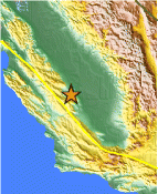
Location Maps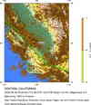
Historical Seismicity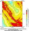
Seismic Hazard Map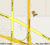
Google Map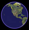
Google Earth KML
(Requires Google Earth)- Did you feel it? Report shaking and damage at your location. You can also view a map displaying accumulated data from your report and others.
 Historic Moment Tensor Solutions