 move your mouse over the globe to make it rotate
|
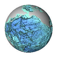
World Data Center for Marine Geology & Geophysics, Boulder Marine Geophysical Trackline DataNGDC's GEODAS Marine Trackline Geophysics database contains bathymetry, magnetics, gravity and seismic navigation data collected during marine cruises from 1953 to the present. Coverage is worldwide. Data sources include both US and foreign oceanographic institutions and government agencies. This database is distributed both On-line and on DVD using the GEODAS Search and Retrieval software. Searches by geographic area, year of cruise, institution, platform, cruise, date or parameter are available. Downloads can be customized to area, parameter and format. Digital data files are in the MGD77 exchange format, and contain a documentation header record and a series of data records. Header records document the content and structure of the data records. Data records contain geophysical data (bathymetry, magnetics, gravity and seismic shot-point ids) with time and position. NGDC also archives analog geophysical data including seismic reflection and refraction, side-scan sonar, and other data types. Analog underway geophysical data are inventoried and searchable through the GEODAS Search and Retrieval software. NGDC is pleased to accept contributions of underway geophysical data on almost any media, preferably in the MGD77 format. Any data received are in the international public domain, readily available globally to any interested individual or group. |