
PODCASTS ABOUT PODCASTS ABOUT RSS
Research in NOAA
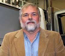
Interview with Doug Forsyth
November 8, 2007
BARRY REICHENBAUGH: This is Barry Reichenbaugh with the NOAA Research Communications Office, and I'm in Norman, Oklahoma, at the National Severe Storms Laboratory with Doug Forsyth. Doug, can you tell me what it is you do here?
DOUG FORSYTH: Well, I'm Chief of Radar Research and Development for the National Severe Storms Lab. And I've also been the program manager for the National Weather Center building project, but that's coming to an end so I'm reverting back to concentrating more on my Chief of Radar Research and Development here.
BARRY REICHENBAUGH: Let's talk a little bit about that. Â What types of radar research are done here at the National Severe Storms Lab?
DOUG FORSYTH: Well, we're actually doing research on various frequencies or wavelengths. We've concentrated in the past mainly at the 10cm, also called S-band frequency of wavelengths of radars. And we started back in the early days, I guess, in 1962 when we had a weather radar lab here and wasn't really even called the National Severe Storms Lab. And then in 1964 we became the National Severe Storms Laboratory and moved to Norman and combined with that weather radar lab. But we were looking at the WSR-57 at that time and how we used it and doing research with it.
And over time we started looking at Doppler weather radar, and then in the late '60s we actually acquired a Doppler weather radar. It was an excessed radar that came from the Air Force, had worked in the dew line basically, and it was an S-band radar also, 10cm. But it had this Doppler capability, so we started looking at the Doppler capability and what it could do for identifying severe weather.
It came operational in 1971, the Norman Doppler. And in 1973 we actually got a second Doppler system running at Cimarron, which was about 25 miles to the northwest of our Norman location. And that gave us the capability to do dual Doppler, and we were the first folks to actually do that kind of research of looking at -- if you'll recall, Doppler radar only measures winds coming towards and away from the radar so we really only get a signature of what's going on, as far as what's going on in the wind field. And by using dual Doppler, you could actually get two looks at it and by combining that information, you can actually figure out the true wind. So then you get a real wind field and being able to map that, and that's what dual Doppler gave us the capability to do.
So that was a new thing for NSSL. And over time we saw signatures that were of rotating thunderstorms that are called mesocyclones, and that's really what got us into moving this technology to the National Weather Service. And in about 1977 they ran a program called JDOP, the Joint Doppler Operational Project. And I became part of that. I was in the Air Force at the time, but I became an Air Force person that came down here and actually worked in JDOP to prove these concepts to the public and to the National Weather Service that Doppler radar really was an advantage, and that we ought to put that on the fleet of radars out there. And that led to the WSR-88D which is our operational radar today.
Over that time we've also worked on improving that radar. We've improved algorithms on that radar. I wrote the original tracking algorithm that was on the radar that actually tracked cells, and that's long gone by the wayside with the research we've done. But we've improved algorithms over time. And so building up, we're continuing to do that and looking at new advantages. And I'll tell you about a few of those in a moment.
But we have gotten into other wavelengths of radars and studying the use of those. And mainly with our mobile radar program called SMART-R's and we started off at X-band and then went to a C-band system. C-band is about 5GHz in frequency and it's able to look at smaller particles, really, but it has more attenuation than the S-band radars do. So it has a capability that you're looking with a finer beam width normally for the size of the antenna so it's capable of being mobile, much more capable of being mobile than an S-band system is.
And then we're now also building an X-band dual polarized system, and I'm going to talk about Dual-Pole in a minute. But we've gotten into these other frequencies of looking at how they might contribute to our understanding of severe weather.
BARRY REICHENBAUGH: So Doppler radar took a while before it actually matured and got recognized as a valuable tool and then budgeted for and fielded.
DOUG FORSYTH: Yes.
BARRY REICHENBAUGH: Pretty long transition.
DOUG FORSYTH: Pretty long transition. I mean, in 1971 we were first starting to do our first things with Doppler radar. Of course, if you remember, in '71 computers were pretty archaic and we didn't have a whole lot of processing capability. In fact on the original ones, we didn't even have color displays or any real type of good displays of the Doppler information.
They developed a special display here at NSSL for looking at the various, what we called moments, but it was reflectivity, velocity, and spectrum width. And it could show them all in one character on a display at a given range gate and azimuth and it actually was one of the first ways of looking at this Doppler velocity information.
Then over time we got the color displays, where we displayed data coming inbound in one color and data going out in another and by the color differences, we could see these rotations and differences in the wind field. But it took from '71 to almost '81 to even get a program started. That's ten years. And then from the time we started the program 'til the time the radars were implemented in the field, that took until about 1993. So they started implementing them in 1988, but then finished that up in 1993 or '94. So it took a long time and we find that in the radar development business, that even the Dual-Pole research -- dual-polarization is looking at both vertical and horizontally polarized waves.
Weather radars that we work with today are only horizontally polarized. They send out a wave in the atmosphere that's long and horizontal and receive it back that way. And we found that theory said that you could probably use both polarizations and figure out something about the size of raindrops and various information.
Well, that research started back in the late -- well, kind of the early '70s, but we really didn't have a system to collect that data until about 1988, when we started collecting real data on Dual-Pole. And Dual-Pole's just now starting to go into the field. It'll be fielded in 2009.  So here's another very long transition from the time we started recognizing a potential, to the time that we actually are going to have it fielded. But, you know, 2011 we'll probably have it fielded out on all the radars out there.
BARRY REICHENBAUGH: You alluded to some of the other things that are in the works. Why don't you talk a little bit about that?
DOUG FORSYTH: Well, dual-polarization, of course, is a great new -- going to be a great new tool out there, and it may be as revolutionizing as the Doppler was when it came along, because of our ability to improve data quality based on dual-polarization.
We can actually tell what are bugs and what are birds, as opposed to what is rain, as opposed to what is hail and frozen precip. So we can start mapping out where these things are located and improve our data quality a little bit. We have the ability to do better rainfall estimates because we now use not the power being returned, but the phase change. So when we send out a wave, the timing gets moved slightly as it goes through water.
And by measuring those differences in the vertical and horizontal, we can actually tell how big the raindrop is. And the other thing is, is that when we have power being returned, if we don't get -- if the calibration of the radar, the transmitter that's putting out the power, if it loses power, then we get less power returned. So we have to make sure that everything's calibrated pretty precisely.
With the phase change you don't have to do that. So as long as you get some power on the target, being a raindrop or whatever we're trying to measure, we get a better estimate of what's going on, the precip that's going on; therefore, we can make better rainfall estimates. So we're going to improve our rainfall estimates tremendously.
And then now we can map the hydrometeors and where they're located:  raindrops, hail, frozen precip. We can map where that's located within the storm. Now we're starting to get a feel so that we can put that into models. We can start to understand which hydrometeors are contributing to various aspects in the model, and we'll be able to improve or parameterizaion of those types of parameters in the models, just by knowing where they're at and how they're moving. And so having this ability to map where various types of precip are in a storm will allow us to improve our models, so we should have much improvement there too. So Dual-Pole is going to be a great advantage to us.
And as our chief scientist Duson Zrnic loves to say, ‘It's going to be revolutionizing.’ Probably more than the Doppler radar did when it came along, and it was pretty revolutionizing. We've improved our warnings across the country tremendously by having the Doppler capability.
The other things we're working on, we're always trying to improve the WSR-88D. We have programs that go on and the National Weather Service funds us in a program called the NEXRAD Product Improvement. And we do various upgrades to algorithms. We're working on various improvements in data collection, etc.
But the next real big thing that'll happen after dual-polarization is implemented is that we'll go to looking at a system called Phased Array. Now, it's a new technology, been around a long time in the military but new to weather. This technology was implemented on ships in the mid-70s, so it's been used a lot for aircraft tracking, etc.
But when I talk about Phased Array, phasing is just a word for timing. And we do that every day with our ears. So I like to use that analogy. If a sound wave comes from a given direction, it hits one ear first and then the other. And our brain tells us it came from that direction. That's phasing. That's actually the phasing and the elements where the two arrays are ears.
Well, a phased array has multiple elements. So our current testing system has 4,352 elements on the array, so each one of those is doing the same thing. They're measuring the wave return and the timing and so they know exactly where that return came from. But in this case, we can also send energy out from those arrays, so I can form a beam in the atmosphere by the timing of when I release energy from each one of these elements. And that forms a beam in the atmosphere.
Conventional radars, they have what's called a feed horn and then you have to move the antenna to point where the beam's going to go. But with a phased array system, you just tell which elements to release their energy at what time, and that moves the beam within plus or minus 45 degrees.
So I can scan a 90-degree sector electronically, and I get a lot of speed and I get a lot of versatility out of that. And so we're just now trying this technology on weather and we're just starting to test that. So that's going to be some exciting technology that we feel we can adapt to weather but we're still trying to prove that.
BARRY REICHENBAUGH: Now, the way I understand Doppler is that it basically spins around in a 360-degree circle.
DOUG FORSYTH: That's a conventional radar. But both of these have Doppler capability. And a conventional radar does have to move the antenna 360 degrees in order to see the full 360 degrees. With a four-faced phased array antenna, you do everything electronically. There's no moving parts. You just scan plus or minus 90 degrees off each face if it's a four-face system. And I can do that all electronically. And I can do that, of course, four times faster than I can scan a rotating one, just because I can process each one of these faces separately. So that's quite an advantage.
BARRY REICHENBAUGH: Â If you've got a severe storm or something moving at an angle and you've got that conventional radar, you can only get an updated picture of that every --
DOUG FORSYTH: Well, on average today they'll get it about four minutes or so in their fastly scanned strategy, six minutes in some of their other scan strategies. But the WSR-88Ds normally take that long to actually scan. It doesn't take them that long to scan 360 degrees, but to get a full volumetric picture of what's going on in the atmosphere, it does take them that long.
BARRY REICHENBAUGH: Right. Yeah.
DOUG FORSYTH: And we can do that same type of thing in less than a minute. So we get volume scans of less than a minute. And we're starting to see details in storms that we have never seen before, just because of this faster scanning.
I've got a tornado that we captured on May 29th of 2004 that we're just starting to look at with Phased Array, but the volume scans are every 15 seconds. And you see things moving in the atmosphere that we've never seen before by looking at the storm, and it's pretty amazing stuff.
Now, what that means we don't know yet, but we do know that we're seeing detail that we haven't been able to see before.
BARRY REICHENBAUGH: Anything else you want to add?
DOUG FORSYTH: Well, the Phased Array Program based on research funding, we're looking at how that actually applies to weather, and we're making good progress in that direction. But we still need to test out a few things, like putting dual-polarization on a phased array system.
Once the fleet of radars go to a polarization, they're not going to want to go back to conventional radar just because I can scan it faster. And so we need to test that particular idea out, and we're moving in that direction to try to do that.
We also have to understand how we're going to display this stuff to the user, how we're going to make decisions, the decision theory that comes along, how the algorithms are going to work on these faster updated databases. All of that is research that needs to be done. So we've got a lot of research ahead of us before we're ready to make a decision on whether this is technology that ought to be implemented in a fleet of radars out there.
BARRY REICHENBAUGH: Right. And as I understand it, the research in that area is collaborative, with the academic arena and also other federal players, I guess?
DOUG FORSYTH: That's right. This has been a collaborative program from day one. NOAA did not have the money to be able to build a phased array system even for testing. And so this National Weather Radar Testbed was a collaborative project between the Navy, NOAA, the FAA, Oklahoma State Board of Regents, the University of Oklahoma. And then we have private partners, Lockheed-Martin and Basic Commerce Industries. And all of us have combined money, basically, to actually build the facility that we have for testing right now. And it's a great collaborative partnership, and we're continuing to improve on that.
And basically our C-band radars, our mobile radars are collaborative projects between Texas A&M and Texas Tech and the University of Oklahoma and NSSL, are all partners in two of the C-band radars. And we're getting ready to dual-polarize one of the C-bands, so we're going to have a dual-polarization capability there. And then we're collaborating with the University of Oklahoma on the X-band Dual-Pole. So we've got a lot of collaborative efforts.
And really to do science these days you need to be collaborating, because there's just not enough funding to go around. And by having these extra resources and people, we get a lot more done in a shorter period of time.
BARRY REICHENBAUGH: I guess there's the potential that people who have different uses for radar could share a single radar rather than, the FAA has one over here, and NOAA has one here, and then the Air Force has one over there.
DOUG FORSYTH: That's exactly right. And the concept with the multifunction phased array -- and that's something that we're now starting to look at -- we knew that it could track missiles and aircraft, but what was its application to weather and could we make it a weather radar? Well, we've now shown that aspect. Now we want to bring those back together and do both missions at the same time.
And if we can do this multifunction mission at the same time, we can save installing a lot of radars across the country. The FAA has over 500 radars that they think they could reduce down to about 300 or so by this application of a multifunction radar. Â And NOAA could ride right along with that and be on that same amount of 350 radars.
Well, that's a great reduction in cost to the infrastructure of the United States or the public that needs to pay for that. And if we can do this multi-mission function, which we feel we can but we need to get a system out there, a prototype to show that that's possible. And so that's exciting, too.
And then we have Homeland Security and the Department of Defense that also have missions that might benefit from -- and probably would benefit from -- this multifunction radar. So we're looking at all these partners from the FAA and DoD and Homeland Security, and combining with NOAA to actually build a multifunction system.
BARRY REICHENBAUGH: You've been here quite a while. I'd like you to maybe go back in time a little bit and just tell us -- you mentioned you were in the Air Force, but how did you get into this career field?
DOUG FORSYTH: Well, I got into meteorology through the Air Force basically. And I really had gone through Air Force ROTC and wanted to be a pilot and my eyes weren't good enough. And then I thought I could probably be a navigator and as I got to my final physical, they said, ‘No, your eyes aren't good enough for that either. And so what would you like to do in the Air Force?’
And I said, ‘Well, I was trained as an electrical engineer,’ but I said, ‘What are my options?’ And they said, ‘Well, we really need meteorologists, and if you'd really like to get into that field, we'll send you off to school for another year.’ And of course being a young person as I was, going off to school for my first year in the Air Force seemed like a pretty good thing to do.
So they sent me to Penn State, and I got a degree in Meteorology and that's how I got into the meteorology field. I worked various aspects of automation concerning that field. I was at the Air Force Global Weather Central, and I actually went out and installed a telescope or helped work on one at Palehua Solar Observatory solar site. But then I got into the radar business. I came back to the Pentagon and then they sent me out here for JDOP. They were looking for someone to be part of the Joint Doppler Operational Project, and I just happened to be available and I knew some folks that were working that program.
And that got me into a Master's program here at the University of Oklahoma where I got my degree and also worked on this Joint Doppler Operational Project. From there I went to the Air Force Geophysics Lab. So that's how I got into the radar business and it kind of fit with my EE degree. And so I was happy being in that arrangement.
And I ended up back here in what was the initial group of now called the Radar Operations Center, but at the time it was called the Initial Operational Test Facility, IOTF for NEXRAD. And we had a DoD component, and the NEXRAD Program is a multi-agency (DoD, FAA, and NOAA) program.
And I came back as part of that. And then DoD was going to move me, and I decided that I really loved radar and I ought to stay in it. And so I asked Ed Kessler at the time if I could get a position here. He was the director of the National Severe Storms Lab, and he thought maybe we could work that out.
And over the next six months -- it took a while -- and some finagling on they didn't want to pay me what my original salary was, so we had some salary issues. But we finally worked all those out through the Department of Commerce, and I came on as a special projects manager here at the National Severe Storms Lab in 1985. And I've been here ever since. And I've moved through various positions. I've been division director or manager several times. Moved up to be the assistant director and was deputy director, acting director for a period of time. And then went back to being a manager of a division. And so I've gone back to the radar side of the group. And a very enjoyable career so far, and I really love being at the National Severe Storms Lab. When I was assistant director, that's how I got involved in the building stuff and eventually became program manager for helping build the National Weather Center here. So that's been a fun career.
BARRY REICHENBAUGH: Yeah. And you're collocated with so many other assets here. I know you're probably interacting with young students. I'm wondering if you could talk a little bit about advice you offer them, in terms of careers in this field.
DOUG FORSYTH: Well, meteorology is a great field and there's a lot of aspects to meteorology. And you can get into the radar side of things or you can get into modeling of the atmosphere. You can get into looking at climate. You can get into looking at surface observations. There's just so many aspects of that.
But I encourage folks that are interested in observing the atmosphere to get into this type of business and find your niche of where you really like to work, because there's so many of them out there. And across NOAA, I mean, we have air quality research that you can do. You can be involved in the upper atmosphere, high atmosphere. You can be involved in the oceans, if that's where you want to be, and that link to the atmosphere. So there's just a lot of things that you can be involved with coming through meteorology.
And if you're interested in water and hydrology, I mean, there's another connection. So we've just got so many opportunities within NOAA. You've got to have an interest in some math, because you're going to get into some heavier maths so you've got to have a fairly good background in that. But once you get by the dynamics courses, you're pretty well set. It's a fun career field and if you're interested in the atmosphere, you ought to go into it, or chasing storms or whatever aspect that might be. I mean, lots of folks like to observe tornadoes and severe weather. And of course that's what we're well-known for.
But you get an opportunity to be involved in lots of different aspects, whether it's going into the field and doing observations or working with radar development or various aspects.
BARRY REICHENBAUGH: Okay. Well, thanks, Doug.
DOUG FORSYTH: You're welcome. Thank you, Barry.
BARRY REICHENBAUGH: All right.
