NESDIS banner image
Office of Satellite Data Processing & Distribution
Information Processing Division
   
Product Systems Branch
Computer Operations Branch
CLASS
 
Comprehensive Large Array-data Stewardship System Computer Operations Branch Product Systems Branch link with links to EPS, SPP, Winds, Ozone, MODIS,Images, Soundings, Calibration, and Navigation/Earth Location information

link to the NOAA Home page  link to the National
Environmental Satellite, Data, and Information Service Home Page

Current SST Anomaly and HotSpot Charts

For information about these images, go to the methodology webpage.

SST Anomaly Charts


Global Sea Surface Temperature Climatology Map


Coral Bleaching HotSpots


Maximum Monthly Sea Surface Temperature Climatology showing the Pacific and Atlantic

Maximum Monthly Sea Surface Temperature Climatology showing the Indian Ocean


Regularly Updated Sea Surface Temperature (SST) Imagery
SST contour charts | SST analyzed fields | high resolution CoastWatch imagery

Regularly Updated Operational Coral Bleaching Monitoring Products:
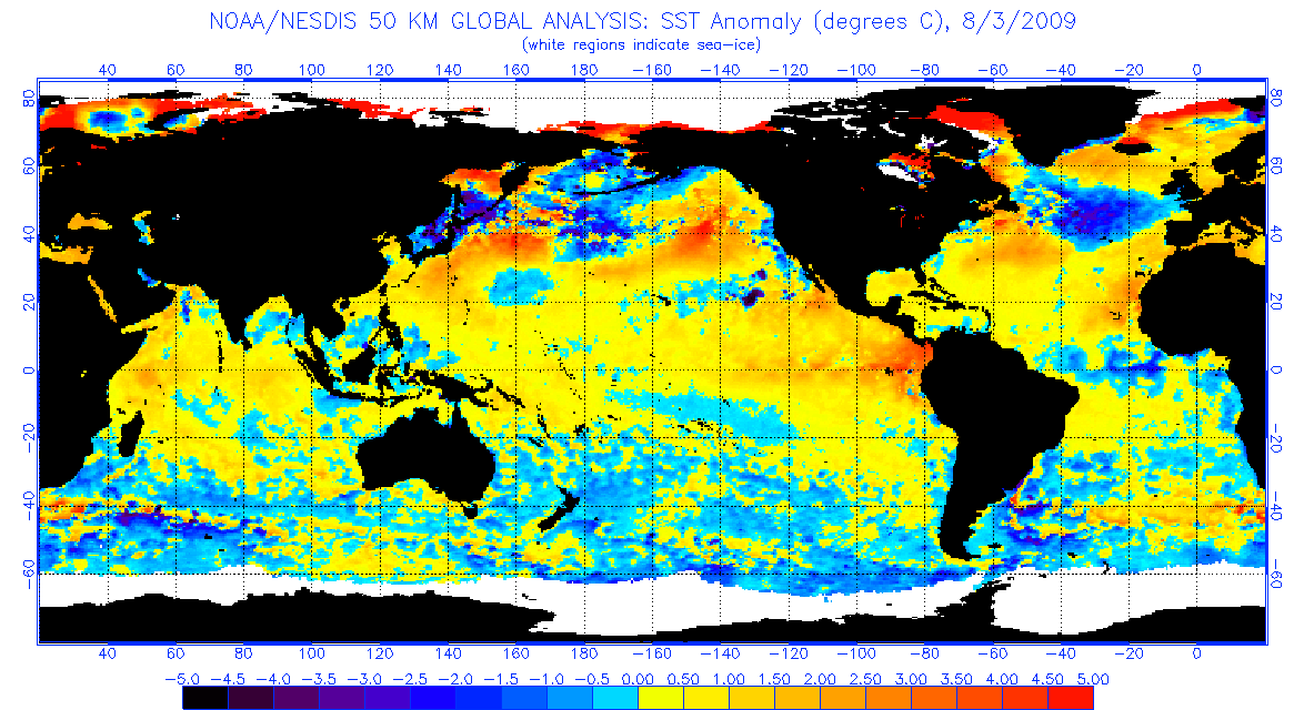
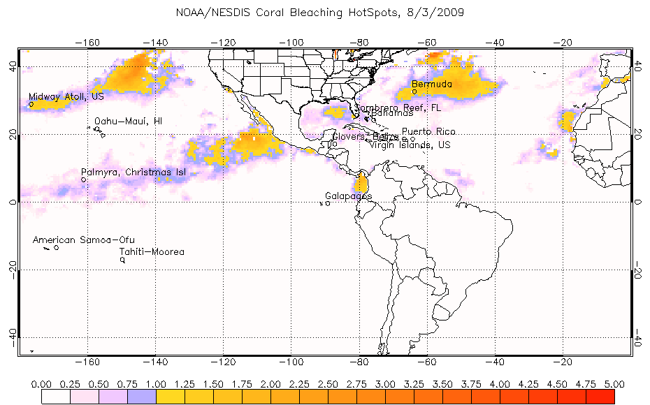
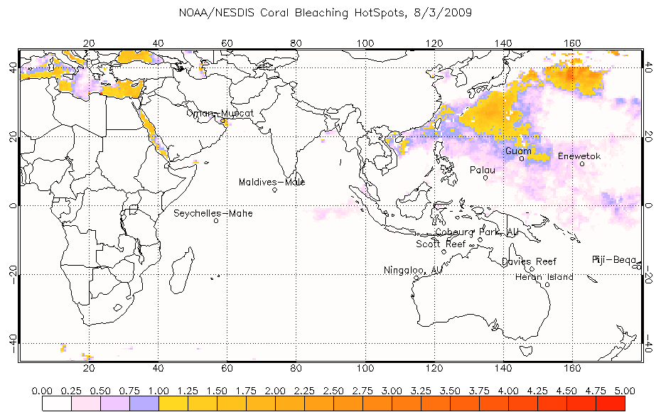
SST Anomalies | Anomaly Animations | HotSpots | HotSpot Animations | Current HotSpots and Anomalies | Degree Heating Weeks | DHW Animations | Coral Bleaching Indices | Satellite Bleaching Alert System

Retrospective Imagery and Research:
1983-1998 SST monthly means | 1983-1998 SST monthly mean Anomalies | 1998 coral bleaching events and animations | 1998/1999 seasonal DHWs | 1985-1999 SST time series for 24 global coral reef sites

Other Links of Interest:
ORA Satellite Oceanography Division | Comprehensive Large Array-data Stewardship System | National Climatic Data Center | Polar Orbiter Data and NOAA KLM User's Guides


Privacy Policy | Disclaimer

Last Modified July 06, 2005 (jw)

Contact Environmental Products team.

Contact OSDPD Webmaster.

Computer Operations Branch Comprehensive Large Array-data Stewardship System Computer Operations Branch CLASS
NOAA/NESDIS/OSDPD; Revised July 06, 2005