Presidio Project Office
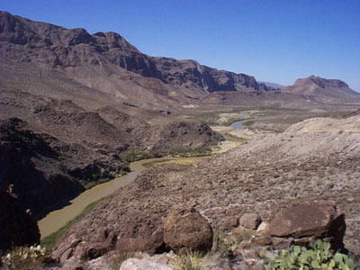
The Presidio Flood Control Project provides flood protection to urban, suburban and agricultural lands, and stabilizes the international boundary. The Project is 15.2 miles in length and is located along the Rio Grande within the sister cities of Presidio, Texas and Ojinaga, Chihuahua. The United States and Mexico is responsible for the maintenance of its portion of the facilities and floodway.
The jurisdictional limits of the office extend along a 400 mile stretch of the Rio Grande from the Presidio, Hudspeth, Jeff Davis tri-county line to Heath Canyon, Texas.
Responsibilities include:
- Flood control to protect urban, suburban, and agricultural lands, and against loss of life and property.
- Maintenance of 15.2 miles of levee, including vegetation control.
- Semi-annual mowing of 400 acres of floodway.
- Operation and maintenance of twelve flood warning, water accounting, rainfall and evaporation stations.
- Collection of samples for the Texas Clean Rivers Programs and other water quality monitoring programs.
- Coordination with local, state and federal agencies; landowners and the general public on issues pertaining to the operation and maintenance of the Project.
Links to Other Field Offices
Amistad Dam | Falcon | Las Cruces | Mercedes | Nogales |San Diego | Yuma |Zac Dominguez
|