|
 |
 |
| Home | News | Organization |
|
|
Station List Observations Recent Historical Obs Search Ship Obs Report NOAA Obs APEX DART MMS ADCP TAO DODS HF Radar OSMC Dial-A-Buoy RSS Feeds Email Access Station Status NDBC Maintenance NDBC Platforms Partner Platforms Program Info About NDBC Met/Ocean Moored Buoy C-MAN TAO DART VOS CSP IOOS DAC Publications Hurricane Data Plots Mariners Weather Log Observing Handbook No. 1 Science Education FAQ Contact Us Links |
Station 62091 - M2 - 20 NM East of Lambay
|
|||||||||||||||||||||||||||||||||||||||||||||||||||||||||||||||||||||||||||||||||||||||||||||||||||||||||||||||||||||||||||||||||||||||||||||||||||||||||||||||||||||||||||||||||||||||||||||||||||||||||||||||||||||||||||||||||||||||||||||||||||||||||||||||||||||||||||||||||||||||||||||||||||||||||||||||||||||||||||||||||||||||||||||||||||||||||||||||||||||||||||||||||||||||||||||||||||||||||||||||||||||||||||||||||||||||||||||||||||||||||||||||||||||||||||||||||||||||||||||||||||||||||||||
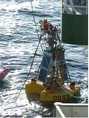
Owned by the Irish Department of Transport and maintained by the Marine Institute in cooperation with Met Eireann and the UK Met Office. |
Data from this station are not quality controlled by NDBC
|
Click on the graph icon in the table below to see a time series plot of the last 24 hours of that observation. | ||
 | Wind Direction (WDIR): | WSW ( 250 deg true ) |
| Wind Speed (WSPD): | 7.0 kts |
| Wave Height (WVHT): | 1.6 ft |
| Average Period (APD): | 3 sec |
| Atmospheric Pressure (PRES): | 30.17 in |
| Pressure Tendency (PTDY): | -0.01 in ( Falling ) |
| Air Temperature (ATMP): | 55.6 °F |
| Dew Point (DEWP): | 52.5 °F |
| Combined plot of Wind Speed, Gust, and Air Pressure | |
Data from this station are not quality controlled by NDBC
| MM | DD | TIME (GMT) | WDIR | WSPD kts |
GST kts |
WVHT ft |
DPD sec |
APD sec |
MWD | PRES in |
PTDY in |
ATMP °F |
WTMP °F |
DEWP °F |
SAL psu |
VIS mi |
TIDE ft | |
|---|---|---|---|---|---|---|---|---|---|---|---|---|---|---|---|---|---|---|
| 09 | 17 | 1300 | WSW | 7.0 | - | 2.0 | - | 3 | - | 30.18 | -0.01 | 55.4 | - | 52.7 | - | - | - | |
| 09 | 17 | 1200 | W | 6.0 | - | 2.0 | - | 4 | - | 30.18 | -0.01 | 55.8 | - | 53.2 | - | - | - | |
| 09 | 17 | 1100 | WNW | 8.0 | - | 1.3 | - | 4 | - | 30.19 | -0.00 | 55.8 | - | 53.8 | - | - | - | |
| 09 | 17 | 1000 | W | 11.1 | - | 1.3 | - | 4 | - | 30.19 | +0.01 | 55.9 | - | 54.3 | - | - | - | |
| 09 | 17 | 0900 | W | 9.9 | - | 1.3 | - | 4 | - | 30.19 | +0.02 | 55.9 | - | 54.3 | - | - | - | |
| 09 | 17 | 0800 | NW | 11.1 | - | 1.6 | - | 3 | - | 30.19 | +0.01 | 56.3 | - | 54.7 | - | - | - | |
| 09 | 17 | 0700 | NW | 12.0 | - | 2.6 | - | 3 | - | 30.18 | +0.01 | 55.8 | - | 54.1 | - | - | - | |
| 09 | 17 | 0600 | NW | 13.0 | - | 2.6 | - | 3 | - | 30.17 | -0.01 | 55.8 | - | 54.3 | - | - | - | |
| 09 | 17 | 0500 | NW | 14.0 | - | 2.6 | - | 3 | - | 30.17 | -0.01 | 56.1 | - | 54.5 | - | - | - | |
| 09 | 17 | 0400 | NNW | 14.0 | - | 2.6 | - | 3 | - | 30.17 | -0.01 | 56.5 | - | 54.9 | - | - | - | |
| 09 | 17 | 0300 | NNW | 13.0 | - | 2.6 | - | 4 | - | 30.18 | -0.01 | 56.8 | - | 54.9 | - | - | - | |
| 09 | 17 | 0200 | NNW | 13.0 | - | 3.3 | - | 4 | - | 30.18 | -0.01 | 56.8 | - | 55.0 | - | - | - | |
| 09 | 17 | 0100 | NNW | 14.0 | - | 3.6 | - | 4 | - | 30.18 | -0.01 | 56.5 | - | 55.0 | - | - | - | |
| 09 | 17 | 0000 | N | 13.0 | - | 3.9 | - | 4 | - | 30.19 | -0.02 | 57.6 | - | 55.2 | - | - | - | |
| 09 | 16 | 2300 | NNW | 14.0 | - | 3.6 | - | 5 | - | 30.19 | -0.03 | 57.6 | - | 55.6 | - | - | - | |
| 09 | 16 | 2200 | NNW | 14.0 | - | 2.3 | - | 5 | - | 30.19 | -0.02 | 57.7 | - | 55.6 | - | - | - | |
| 09 | 16 | 2100 | NNW | 15.0 | - | 1.0 | - | 4 | - | 30.20 | +0.01 | 57.7 | - | 56.1 | - | - | - | |
| 09 | 16 | 2000 | NW | 7.0 | - | 1.0 | - | 4 | - | 30.22 | +0.03 | 56.7 | - | 55.9 | - | - | - | |
| 09 | 16 | 1900 | NW | 5.1 | - | 1.3 | - | 4 | - | 30.21 | +0.02 | 56.1 | - | 55.9 | - | - | - | |
| 09 | 16 | 1800 | N | 8.0 | - | 1.3 | - | 3 | - | 30.20 | +0.01 | 55.6 | - | 55.2 | - | - | - | |
| 09 | 16 | 1700 | N | 11.1 | - | 1.3 | - | 3 | - | 30.19 | +0.01 | 55.6 | - | 54.9 | - | - | - | |
| 09 | 16 | 1600 | NNW | 11.1 | - | 1.6 | - | 3 | - | 30.19 | +0.00 | 56.3 | - | 54.9 | - | - | - | |
| 09 | 16 | 1500 | N | 8.9 | - | 2.0 | - | 3 | - | 30.19 | +0.00 | 56.7 | - | 55.0 | - | - | - |
| U.S. Dept. of Commerce National Oceanic and Atmospheric Administration National Weather Service National Data Buoy Center 1007 Balch Blvd. Stennis Space Center, MS 39529 Feedback Page last modified: September 5, 2008 |
Disclaimer Credits Glossary |
Privacy Policy About Us Career Opportunities |