NOAA: Warm June for U.S. with Wet and Dry Extremes
July 9, 2008
June 2008 was the 27th warmest June for the contiguous United States, based on records dating back to 1895, according to an analysis by NOAA’s National Climatic Data Center in Asheville, N.C. The average June temperature, 70.4 degrees F, was 1.1 degrees above the 20th century mean, based on preliminary data.
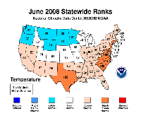
U.S. Temperature Highlights
High resolution (Credit: NOAA)
- June temperatures were warmer than average across the southern and eastern states, and cooler than average across the Northwest and northern Plains.
- New Jersey and Rhode Island ranked second warmest and Delaware ranked third warmest, based on statewide data going back to 1895. Nine states (Connecticut, Delaware, Maryland, New Jersey, Rhode Island, Texas, Virginia, and North and South Carolina) were much warmer than average, and 23 were warmer than average.
- Seven states (Minnesota, Montana, Oregon, Washington, Wyoming, and North and South Dakota) were cooler than average.
- Unusually warm June temperatures translated into a higher temperature-related residential energy demand. Based on NOAA’s Residential Energy Demand Temperature Index, contiguous U.S. temperature-related energy demand was approximately 7.5 percent above average in June.
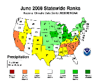
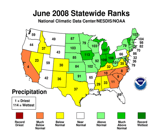
U.S. Precipitation Highlights
High resolution (Credit: NOAA)
- Rainfall patterns across the country in June consisted of both extremely wet and extremely dry conditions. Heavy rain and flooding occurred in the Midwest, while parts of the Southeast, southern Plains, and West were dry.
- Five states (Indiana, Iowa, Michigan, Ohio, and Vermont) were much wetter than average for June, with Iowa ranking second wettest on record.
- Persistent heavy rain across the Midwest triggered flooding along the Cedar River in Iowa, and many tributaries to the Mississippi River in eastern Iowa and southern Wisconsin. Flooding also occurred along the Mississippi River in parts of western Illinois and eastern Missouri. By the end of June, 26 percent of the contiguous U.S. was classified in moderate-to-extreme “wet spell” conditions compared to 24 percent a month ago, based on the Palmer Index.
- Over the past six months, Iowa, Ohio, and Missouri had the wettest January – June on record. Iowa had its wettest April – June period on record with an average of 20.4 inches of precipitation — 8.7 inches above average.
- Five states (California, Georgia, Tennessee, and the Carolinas) were much drier than average, with California having the fourth driest June on record and North Carolina ranking eighth driest.
- Continued lack of rainfall across much of the Southeast and parts of the southern Plains and West worsened drought conditions. Twenty-eight percent of the contiguous U.S. was classified in moderate-to-exceptional drought at the end of June compared to 22 percent a month ago, based on the U.S. Drought Monitor.
Western Wildfires
- Dry conditions set the stage for increased fire potential across the western U.S. By the end of June, many large wildfires were raging in northern California and Arizona, largely due to lightning strikes. As of June 30, more than 2.1 million acres have burned so far this year in the United States, according to the National Interagency Fire Center. Already, January – June 2008 ranks third behind the same periods for 2006 and 2002 in the amount of burnt acreage.
The National Oceanic and Atmospheric Administration, an agency of the U.S. Commerce Department, is dedicated to enhancing economic security and national safety through the prediction and research of weather and climate-related events and information service delivery for transportation, and by providing environmental stewardship of our nation's coastal and marine resources. Through the emerging Global Earth Observation System of Systems (GEOSS), NOAA is working with its federal partners, more than 70 countries and the European Commission to develop a global monitoring network that is as integrated as the planet it observes, predicts and protects.