

|
|
Climate of 2005
|
Use these links to access detailed analyses of Global and U.S. data.

|
MONTHS: |
|

|
There were a record 27 named storms, of which 15 were hurricanes, exceeding the 1969 record of 12 hurricanes, and 7 were major hurricanes. Of the 7 major hurricanes, an unprecendented 4 reached category 5 status. The season was remarkable for its early beginning and number of storms as well as the intensity of the hurricanes, including the most intense hurricane on record for the Atlantic. Many records were broken during the season and a list of the most notable are available at the end of this summary. |
 Click for larger image
 |
Since reliable records began around the middle of the 20th century (1944) with routine reconnaisance aircraft missions, no season has exceeded 19 named storms until 2005. However, it is known that at least one other season exceeded 20 named storms before 1944 and that was 1933 (21). Prior to the launch of satellites in the 1970s, and particularly before the routine reconnaissance aircraft missions, it was difficult to detect storms that did not affect land or ships, and it is therefore likely that activity in some seasons before the middle of the 20th century is underestimated. |
|
Instead of examining only the number of tropical storms and hurricanes as an indicator of activity, NOAA's Accumulated Cyclone Energy Index takes into account the cumulative strength and duration of each storm. As shown in the figure to the right, 2005 is the third most active season on record behind 1950 and 1995 in terms of the ACE index. Tropical cyclone activity in the Atlantic basin has been above normal since 1995. This has been largely in response to the active phase of the multi-decadal signal. The average number of named storms since 1995 has been 13, compared to 8.6 during the preceding 25 years during which time the multi-decadal signal was in an inactive phase. An average of 7.7 hurricanes and 3.6 major hurricanes since 1995 compares to 5 hurricanes and 1.5 major hurricanes from 1970-1994. |
 Larger image  Larger image |
|
**preliminary estimates and subject to significant revision. Estimates are based on insurance industry estimates (Insurance Industry Institute), with uninsured losses not tallied yet, so using a factor of at least 2 times insured losses for the total. Insured losses do not include flood insurance coverage (FEMA).
Overview of the 2005 hurricane season: |
|
|
|
|
During October, six tropical systems formed in the Atlantic, setting a new record for the most named storms in any season in the Atlantic (23). The six storms were Hurricane Stan in the southwestern Gulf of Mexico, which made landfall in Mexico; Tropical Storm Tammy that made landfall in the southeastern U.S.; Hurricane Vince which developed southwest of Portugal in the far eastern Atlantic in a region of the sub-tropics where the occurrence of tropical cyclones is extremely rare; Hurricane Wilma, which became the most intense storm on record based on measurements of central pressure; and Tropical Storm Alpha and Hurricane Beta. There is a preliminary summary of the 2005 hurricane season in the section above. |
 Image courtesy of Univ. of Wisconsin/CIMMS (Larger image) |
Hurricane Stan became a tropical storm just before making landfall on the Yucatan Peninsula on October 2nd. Weakening over land, Stan sooned regained tropical storm strength in the Bay of Campeche and continued to strengthen until reaching hurricane intensity on October 4th. With peak sustained winds of 80 mph (kts) (category 1 status), Stan made landfall about 90 miles east-southeast of Veracruz and dissipated the next day over the Mexican mountains. Torrential rains caused flooding and mud slides over portions of Mexico and Central America around the time of Stan's existence and led to hundreds of deaths. However, it is impossible to relate the rainfall directly to Hurricane Stan. |
|
Tropical Storm Tammy developed off the east coast of central Florida on October 5th and moved parallel to the coast, turning northeastward to make landfall in northeastern Florida near Mayport. Maximum sustained winds were 50 mph and although significant damage was not sustained from winds, some localized flooding was reported from rainfall of 3-5 inches. Tammy moved westward over Georgia and Alabama before becoming absorbed by a larger extratropical low pressure system on the 6th. |
 Larger image |
 Larger image |
Vince was a notable storm due to its unusual track. Vince became a tropical storm on October 9th in the eastern Atlantic about 515 miles south-southeast of the Azores. Moving slowly northeastward, it became a hurricane later that day to the northwest of the Madeira Islands. Accelerating to the east-northeast, Vince weakened back to a tropical storm on the 10th and made landfall the next day in the southwestern most area of Spain (near Huelva) as a tropical depression. Vince is the first known tropical cyclone to make landfall in Spain. |
|
There is a special Hurricane Wilma page outlining the development and impacts of this historic storm. It became the most intense hurricane on record for the Atlantic Basin based on a central pressure of 882mb (eclipsing the previous lowest pressure of 888mb in the Atlantic measured during Hurricane Gilbert in 1988). |
 Larger image |
| For the first time since the naming convention began, activity exceeded the 21 available letters to name storms, invoking the need for the Greek alphabet for the 22nd and 23rd storms of the season. |
 Larger image of Hurricane Beta |
Tropical Storm Alpha developed south of Puerto Rico on the 22nd and moved northwestward to make landfall in the Dominican Republic with 50 mph winds. Heavy rain led to 20 deaths in Hispaniola as Alpha weakened over the high terrain, re-emerging over the Atlantic on the 23rd. Alpha weakened to a trough as it was affected by the much larger circulation of Hurricane Wilma approaching Florida from the west. |
|
|
There were five named tropical systems in September (Maria, Nate, Ophelia, Phillipe and Rita), all of which became hurricanes. Two of the hurricanes in September, Rita and Maria were classified as 'major' (category 3-5 on the Saffir-Simpson scale). Hurricane Rita impacted the Gulf coast of the U.S. causing serious damage and destruction, while Maria remained in the central North Atlantic and did not affect any land. There is a dedicated web-site available that summarizes major Hurricane Rita's development and impacts. |
 Image courtesy of Univ. of Wisconsin/CIMMS (Larger image) |
Hurricane Maria developed into a tropical storm on September 2nd in the central Atlantic from a wave off the coast of Africa several days prior. Becoming a hurricane on the 4th, Maria tracked north-northwest and reached a peak intensity of 115 mph (100 kts; category 3 status) about 470 miles east of Bermuda. Moving to the north-northeast, Maria weakened to a tropical storm and then regained hurricane strength on the 7th. Slowly weakening back to a tropical storm by the 9th, Maria eventually became a strong extra-tropical storm and moved northeast towards Scandinavia.
Hurricane Nate followed a similar track to Maria, becoming a tropical storm on September 5th about 300 miles southwest of Bermuda. |
| Over the next 2 days, Nate tracked northeastward strengthening to hurricane intensity, with maximum sustained winds of 90 mph (78 kts) by the 7th. The hurricane's forward speed increased as it passed to the southeast of Bermuda and then weakened back to a tropical storm by the 9th. Nate continued to weaken and became an extra-tropical low pressure system on the 10th. |
|
Hurricane Ophelia developed on September 7th about 115 miles east-southeast of Cape Canaveral, FL, from a tropical depression which had been located in the northwestern Bahamas before moving north-northwestward. Ophelia drifted off the coast of Florida during the next 2 days briefly becoming a hurricane on the 8th. Reaching hurricane strength twice more during the next several days, Ophelia moved northeastward before stalling again on the 11th about 235 miles south of Cape Hatteras, NC. Ophelia looped slowly during the 12th and 13th before tracking north towards the North Carolina coast, reaching hurricane strength for a 4th time with maximum sustained winds of 85 mph (74 kts; category 1 strength). |
 Larger image |
 Larger image |
The northern eyewall of the storm brushed the coast near Cape Fear on the 14th and then Ophelia turned to the east-northeast moving parallel to the coast, passing south of Cape Fear, NC. The hurricane once again weakened to a tropical storm on the 16th and then tracked to the northeast passing east of Cape Cod on the 17th. Ophelia transitioned to an extratropical system on the 18th near Nova Scotia.
|
|
Hurricane Rita developed on September 18th from a tropical depression that formed early the same day. The storm increased in intensity over the next 48 hours, becoming a category 1 hurricane on the 20th and a category 2 hurricane later that afternoon. Tracking through the Florida Straits, Hurricane Rita neared the Florida Keys on the 20th, causing sustained tropical storm force winds on Key West with gusts of up to 76 mph (66 kts). Rapidly intensifying, Hurricane Rita tracked westward into the Gulf of Mexico and by the afternoon of the 21st, Rita had reached category 5 strength on the Saffir-Simpson scale, with winds of 165 mph (143 kts). Continuing to intensify to reach windspeeds of 175 mph (152 kts), the minimum central pressure of the storm dropped to 897 mb, the third lowest on record for the Atlantic Basin, after Hurricane Gilbert in 1988 (888 mb), and the 1935 Labor Day Hurricane (892 mb). This year marks the first time in recorded history that two hurricanes (Katrina and Rita) have reached category 5 strength in the Gulf of Mexico in a single hurricane season. Weakening during the afternoon of the 22nd, due to an eyewall replacement cycle and perhaps some influence of slightly cooler sea-surface temperatures, Rita's intensity dipped to a sustained windspeed of 145 mph (125 kts) and continued to weaken gradually over the next 36 hours prior to landfall. Rita tracked west-northwest on the 23rd and made landfall at the Texas/Louisiana border early on the 24th, at category 3 strength with sustained winds of 120 mph (105 kts). Hurricane force winds were observed more than 150 miles inland and tropical storm force winds were felt as far north as the LA-TX-AR border. Rita's pressure as it came ashore was 937 mb. More information on the storm, including some details regarding impacts can be found on NCDC's dedicated Hurricane Rita Summary page. |
 Larger image  Satellite image of Rita near its peak intensity  Larger image |
|
|
There is an official NOAA technical summary and a dedicated web-site summarizing Katrina's development and impact available. The Accumulated Cyclone Energy (ACE) Index values are available for all Atlantic storms in 2005. Hurricane Katrina was one of the strongest storms to impact the coast of the United States during the last 100 years. With sustained winds during landfall of 125 mph (110 kts; a strong category 3 hurricane on the Saffir-Simpson scale) and minimum central pressure the third lowest on record at landfall (920 mb), Katrina caused widespread devastation along the central Gulf Coast states of the US. Cities such as New Orleans, LA, Mobile, AL, and Gulfport, MS bore the brunt of Katrina's force and will need weeks and months of recovery efforts to restore normality. |
 Larger image  Larger image  Image courtesy of Univ. of Wisconsin/CIMMS (Larger image) |
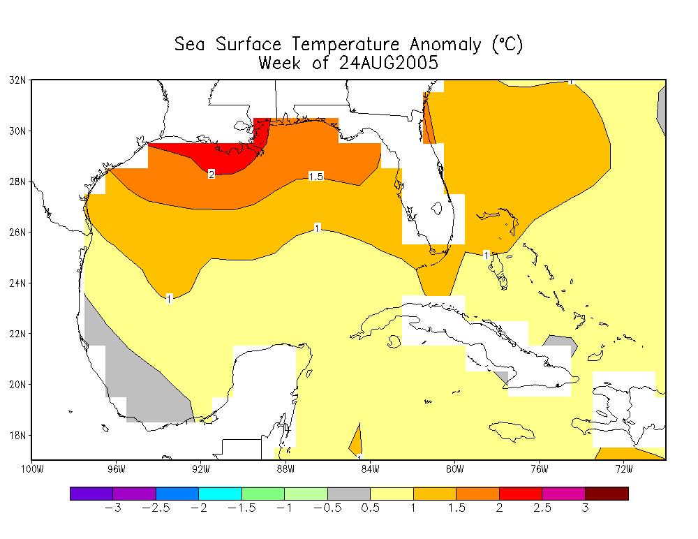
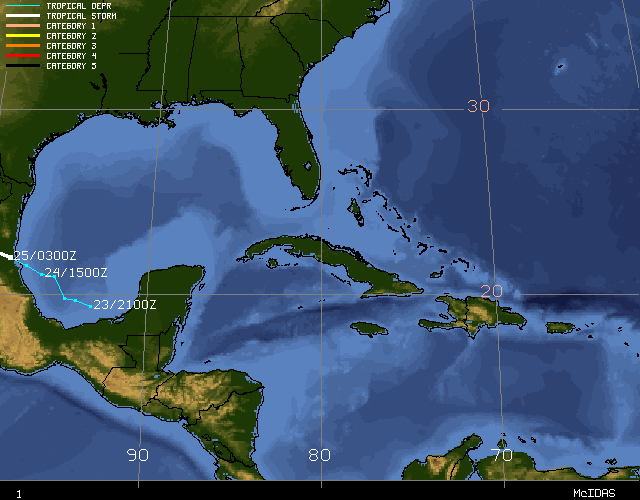
Hurricane Katrina developed initially as a tropical depression (TD #12 of the season) in the southeastern Bahamas on August 23rd. This tropical depression strengthened into Tropical Storm Katrina the next day. It then moved slowly along a northwesterly then westerly track through the Bahamas, increasing in strength during this time. A few hours before landfall in South Florida at around 6.30pm EDT on August 25th, Katrina strengthened to become a category 1 (windspeeds of 75 mph or greater) hurricane. Landfall occurred between Hallandale Beach and North Miami Beach, Florida, with windspeeds of approximately 80 mph. Gusts of above 90 mph were measured as Katrina came ashore. As the storm moved southwest across the tip of the Florida peninsula, Katrina's winds decreased slightly before regaining hurricane strength in the Gulf of Mexico. Given that Katrina spent only seven hours over land, its strength was not significantly diminished and it quickly re-intensified shortly after moving over the warm waters of the Gulf. Katrina moved almost due westward after entering the Gulf of Mexico. A mid-level ridge centered over Texas weakened and moved westward allowing Katrina to gradually turn to the northwest and then north into the weakness in the ridging over the days that followed. Atmospheric and sea-surface conditions (an upper level anticyclone over the Gulf and warm SSTs) were conducive to the cyclone's rapid intensification, which led to Katrina attaining 'major hurricane' status on the afternoon of the 26th. Continuing to strengthen and move northwards during the next 48 hours, Katrina reached maximum windspeeds on the morning of Sunday August 28th of 150 kts (175 mph, category 5), and its minimum central pressure dropped to 902 mb - the 4th lowest on record for an Atlantic storm. Although Katrina at its peak strength was comparable to Hurricane Camille's (1969) intensity, it was a significantly larger storm and impacted a broader area of the Gulf Coast. |
|
Although tropical cyclones of category 5 strength are rarely sustained for long durations (due to internal dynamics), Katrina remained a strong category 4 hurricane despite the entrainment of drier air and an opening of the eyewall to the south and southwest before landfall on the morning of the 29th (go to NCDC's NEXRAD viewer site for additional radar imagery and animations of Katrina). Landfalling windspeeds at Plaquemines Parish in southeastern Louisiana were approximately 140 mph with a central pressure of 920 mb - the 3rd lowest on record for a landfalling Atlantic storm in the US. Rainfall amounts for Louisiana and along the Gulf are described in a separate page summarizing Katrina's impacts along with other effects of the storm. |
 Click for animation |
|
In addition to Katrina, four further tropical cyclones formed during August. |
 Image courtesy of Univ. of Wisconsin/CIMMS Click for larger image of IRENE |
Harvey became a tropical storm on August 3rd southwest of Bermuda. The storm passed within 45 miles of Bermuda on a northeasterly track and reached a peak intensity of 65 mph causing gusts of over 50 mph on the island of Bermuda. Harvey lost tropical characteristics on August 8th about 535 miles southeast of Cape Race, Newfoundland. Hurricane Irene was a long-lived storm originating from a tropical wave moving off the coast of Africa. The storm reached tropical storm strength on August 7th in the central tropical Atlantic, weakened back to a tropical depression, then regained tropical storm strength on August 10th. Irene turned northwestward and moved between Cape Hatteras, NC and Bermuda on August 14th, then curved towards the northeast becoming a hurricane, reaching its peak intensity of 105 mph on the 15th. The hurricane then turned eastward and weakened over cooler waters, becoming extratropical on the 18th.
|
|
Tropical Storm Jose was short-lived, forming on August 22nd in the Bay of Campeche and made landfall later that evening about 35 miles north of Veracruz, Mexico, with sustained winds of near 50 mph. Tropical Storm Lee was also short-lived forming in the central tropical Atlantic on August 31st and dissipating by the following observation, 6 hours later.
|
 Image courtesy of Univ. of Wisconsin/CIMMS Click for larger image of JOSE |
|
|
On July 5th, when Tropical Storm Dennis developed, it became the earliest date on record for 4 named storms to have formed in the Atlantic. Dennis also broke the record for the earliest development of a category 4 hurricane. *Emily, in both strength and intensity then eclipsed Dennis becoming the earliest category 5 storm on record, with a minimum pressure of 929 mb and maximum windspeeds of 140 kts. With 5 named storms, July 2005 also set a new record for the most Atlantic named storms in any July. |
|
**Hurricane Cindy, the third named storm of the season and first hurricane, formed during the morning of July 5th from a depression that had tracked across the Yucatan Peninsula and re-emerged over the central Gulf of Mexico during the previous 2 days. Cindy continued to track northwards and then northeastward through the day of July 5th, strengthening to make landfall near Grand Isle, Louisiana with maximum sustained winds of near 75 mph, a category 1 hurricane. Heavy rainfall and inland flooding accompanied Cindy as it tracked northeastward across the eastern U.S., weakening to a tropical depression and ultimately dissipating. |
 larger image |
 larger image |
Hurricane Dennis also formed as a tropical storm on July 5th in the eastern Caribbean Sea. The storm strengthened to hurricane intensity on the 6th, prompting hurricane watches and warnings for Jamaica and southern Cuba. Rapidly intensifying further, Dennis tracked just to the north of Jamaica and grazed the southern coast of Cuba before making a landfall at category 4 strength in south-central Cuba on July 8th. Hurricane Dennis weakened as it crossed Cuba, but regained strength in the eastern Gulf of Mexico as it moved north-northwest towards the northeastern shores of the Gulf.
|
|
The storm reached category 4 strength again overnight on the 8th/9th and finally made a U.S. landfall near Pensacola, FL on July 10th as a category 3 storm. Windspeeds were approximately 120 mph at the time of landfall and led to over 400,000 power outages along the coast and inland in Mississippi, Alabama and Georgia. Heavy rainfall also resulted from the storm leading to localized flooding in parts of the Southeast. Partly as a result of rainfall associated with both Cindy and Dennis, Alabama and Georgia ranked 5th wettest on record for the month of July. For more information on impacts of the storm, please go to NCDC's monthly Hazards page |
 larger image |
 larger image |
Emily developed into a tropical storm on July 12th east of the Lesser Antilles. Abruptly strengthening on July 14th, Emily became a hurricane as it passed near Grenada and then a major hurricane in the eastern Caribbean later that same day. The storm moved west-northwestward over the next several days and reached maximum windspeeds of 160 mph (140 kts) (category 5 strength) and made landfall near Cozumel, Mexico, on the Yucatan Peninsula on July 18th with windspeeds of 135 mph. As Emily crossed the Yucatan, it weakened, then regained strength and became a major hurricane once again in the southwest Gulf of Mexico as it re-emerged over warm water. On July 20th, Emily made landfall in northeastern Mexico as a 125 mph-hurricane (category 3). Emily was a strong and long-lived hurricane registering a high Accumulated Cyclone Energy value, compared to other storms in July and the season as a whole. The ACE index is one measure of tropical activity. |
|
Tropical Storm Franklin formed on July 21st near the central Bahamas. The storm moved north and then northeast as it strengthened to its peak intensity of 70 mph. Over the next several days, Franklin weakened due to wind shear while moving towards Bermuda, eventually passing Bermuda to the west on July 26. Some reintensification occurred on July 27-28 bringing Franklin's winds to near 60 mph. As a frontal system moved off the east coast of the US and accelerated the tropical storm towards the northeast, causing it to weaken, Franklin became extratropical on the 29th south of Newfoundland. |
Accumulated Cyclone Energy (ACE) indices are available for all July storms. |
|
|
Early season storms (those occurring in June) have a greater likelihood of developing in the Gulf of Mexico than in the rest of the tropical Atlantic. Before 2005, there have been only 12 occasions since 1851 when two or more tropical storms have formed in June. |
 larger image (images courtesy of NASA) |
The image to the left, taken on June 10th, shows rainfall associated with Tropical Storm Arlene as measured by NASA's Tropical Rainfall Measurement Mission (TRMM) satellite. A tropical depression developed on June 8th and became
Tropical Storm Arlene, the first named storm of the 2005 Atlantic season, on June 9th about 170 miles west-southwest of Grand Cayman. Arlene crossed the western tip of Cuba with winds of around 50 mph. After entering the Gulf of Mexico, Arlene reached peak winds of around 70 mph (near hurricane strength) in the eastern Gulf of Mexico before weakening prior to landfall near Pensacola, Florida on the 11th. Sustained winds at landfall were approximately 60 mph and Arlene caused little damage. The storm was absorbed by a frontal system on the 14th over southeastern Canada. |
Tropical Storm Bret was a weak tropical storm that formed from an area of disturbed weather on the 28th in the Bay of Campeche. The storm moved west-northwestward and made landfall on the 29th near Tuxpan, Mexico with maximum sustained winds of around 40 mph. Rainfall associated with Bret led to flooding in the state of Veracruz. |
|
|
The official Atlantic hurricane season runs from June 1st to November 30th each year. Though tropical systems can form at any time of the year in the tropical Atlantic, they are comparatively rare outside of the official season. |
|
As the graph to the right indicates, the long-term average number of storms for the tropical Atlantic is nearly 10 per year with almost 6 of those becoming hurricanes and 2-3 of those developing into major hurricanes (category 3 or higher on the Saffir-Simpson scale). However, there has been a generally more active period since 1995 with a seasonal average (based on data between 1995 and 2003) of 13 tropical storms, 7.6 hurricanes and 3.6 major hurricanes. September is generally the most active time of the year for the Atlantic, but this does not preclude large or destructive storms occurring at any time during the season.
|
 larger image |
|
|
|
| For all climate questions other than questions concerning this report, please contact the National Climatic Data Center's Climate Services Division: |
|
Climate Services Division NOAA/National Climatic Data Center 151 Patton Avenue Asheville, NC 28801-5001 fax: 828-271-4876 phone: 828-271-4800 email: questions@ncdc.noaa.gov |
|
For further information on the historical climate perspective presented in this report, contact: |
|
David Levinson NOAA/National Climatic Data Center 151 Patton Avenue Asheville, NC 28801-5001 fax: 828-271-4328 email: David.Levinson@noaa.gov |


