
 Non government sites
Document Actions
Center Activities
Categories
Data Management for NOAARegional Ecosystem Data Management
Integrated Ocean Observing System
Research
Resilience
Indicators
Collaboration and Outreach
Data Management for NOAA |
|

|
Coastal Science, Information & Data for the Ecosystem (C-SIDE)
C-SIDE is a comprehensive Gulf Coast Storm Information Center, providing information about severe weather preparation and monitoring across the Gulf of Mexico coastal region. |

|
Ecosystem Data Assembly Center (EDAC)
The Ecosystem Data Assembly Center (EDAC) is developing the information technology infrastructure to support ecosystem observations data and other related data collected in the Gulf of Mexico. |

|
Gulf Hypoxia Monitoring Stakeholder Committee
The Gulf Hypoxia Monitoring Stakeholder Committee was established to provide guidance to the Steering Committee for the Gulf Hypoxia Monitoring Implementation Plan. |

|
Gulf of Mexico Coastal Ocean Observing System (GCOOS)
The Gulf of Mexico Coastal Ocean Observing System (GCOOS) is a regional observing system that promotes regional collaboration within the Gulf of Mexico. |

|
Gulf of Mexico Hypoxia Watch
Hypoxia Watch uses near-real-time shipboard measurements of bottom dissolved oxygen to create data and map products that show anoxic and hypoxic conditions in the western and north-central Gulf of Mexico. |
|
|
MERMAid
Information for data providers about the Metadata Enterprise Resource Management Aid (MERMAid) tool for use to create, to validate, manage, and publish FGDC compliant metadata. |

|
Marine Metadata Interoperability (MMI)
Marine Metadata Interoperability (MMI) makes marine data easier to advertise, distribute, reuse, and combine with other data sets. |
|
|
NOAA Ecosystem Approach to Management
An ecosystem approach to management provides a comprehensive framework for living marine resource decision making that considers ecological, environmental, and human factors. |

|
NOAA's Office of Ocean Exploration and Research
The Ocean Exploration and Research data management program provides a unique end-to-end system for expeditions sponsored by the Office of Ocean Exploration and Research, ensuring data discovery, access, and archival for perpetuity. |
|
|
The Joint Archive for Sea Level (JASL)
The Joint Archive for Sea Level (JASL) contains sea level data from various reporting stations. |

|
West Coast Observing System
The West Coast Observing System (WCOS) is an end-to-end data management system created in partnership with NOAA's Office of National Marine Sanctuaries. |
| [return to top] | |
Regional Ecosystem Data Management |
|

|
California Current Ecosystem Data Management
The California Current Ecosystem Data Management project combines a number of real-time data streams from within the California Current Ecosystem (CCE) and links them to a preliminary Integrated Ecosystem Assessment (IEA). |
|
|
Coastal Habitat
Coastal Habitat showcases several pilot projects developed by NCDDC in collaboration with National Marine Fisheries including GIS applications that assist with monitoring and assessment of habitats. |

|
Ecosystem Goal Team (EGT) and Ecosystem Observation Program (EOP)
Ecosystem Goal Team (EGT) and Ecosystem Observation Program (EOP) support NOAA's goal to protect, restore and manage the use of coastal and ocean resources through an ecosystem approach to management. |
|
|
Galveston Bay Consultation Maps
The mapping of the Galveston Bay assists in the assessment of coastal areas in order to grant or refuse permits. |

|
Gulf of Mexico Alliance
The Gulf of Mexico Alliance is a partnership, initiated in 2004 by the states of Alabama, Florida, Louisiana, Mississippi, and Texas, to protect the Gulf of Mexico's ecosystem and economy. |

|
Priority Habitat Information System
The Priority Habitat Information System is a web-based portal that allows user access to Gulf-wide habitat data and information from many different sources. |

|
Protected Species Maps
NCDDC developed Protected Species maps for Johnson’s Seagrass and Gulf Sturgeon in the Tampa Bay wetlands area and the northern Gulf of Mexico. |
| [return to top] | |
Integrated Ocean Observing System |
|

|
Coastal Ocean Observing System (COOS)
The Coastal Ocean Observing System provides access to a collection of real-time and recent weather, oceanographic, water-level and stream gauge observations. |

|
Coastal Ocean Observing System (COOS)
The Coastal Ocean Observing System provides access to a collection of real-time and recent weather, oceanographic, water-level and stream gauge observations. |

|
Joint Archive for Shipboard Acoustic Doppler Current Profiler
Joint Archive for Shipboard Acoustic Doppler Current Profiler acquires, reviews, documents, archives, and distributes ocean current shipboard acoustic Doppler current profiler data sets. |

|
Quality Assurance of Real-Time Oceanographic Data (QARTOD)
Quality Assurance of Real-Time Oceanographic Data (QARTOD) is a multi-agency effort to address the quality assurance and quality control issues of the Integrated Ocean Observing System (IOOS) community. |
| [return to top] | |
Research |
|

|
Northern Gulf Institute
The Northern Gulf Institute stands as a NOAA Cooperative Institute, created to develop and maintain a center of excellence in research relevant to the Northern Gulf of Mexico Region. |
| [return to top] | |
Resilience |
|

|
Coastal Risk Atlas
The Coastal Risk Atlas delivers an on-line risk/vulnerability atlas for the coastal United States using National Coastal Data Development Center's information technologies. |

|
Katrina Impact Assessment
The Katrina Impact Assessment Project seeks to model and assess the environmental and physical impact of Hurricane Katrina on the ecosystems and infrastructure of the Mississippi Gulf Coast through integrating data for presentation through interactive maps. |
| [return to top] | |
Indicators |
|

|
Harmful Algal Blooms Observing System (HABsOS)
The Harmful Algal Blooms Observing System demonstrates an online, integrated information system for managing HAB data, events, and effects. |

|
Phytoplankton Monitoring Network (PMN)
The Phytoplankton Monitoring Network (PMN) is an education and outreach program developed by NOAA’s National Ocean Service to engage school and community volunteer groups in phytoplankton sampling and identification and to raise awareness of harmful algal blooms. |
| [return to top] | |
Collaboration and Outreach |
|

|
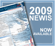
2009 NOAA Extreme Weather Information Sheet (NEWIS)
The 2009 NOAA Extreme Weather Information Sheet (NEWIS) contains valuable state and local emergency numbers, NOAA websites, media outlets, and evacuation information. |

|
Gulf of Mexico Marine Debris Project
The Gulf of Mexico Marine Debris Project responds to the severe damage Hurricane Katrina inflicted on the Gulf of Mexico coastal region. |

|
Interagency Working Group on Ocean and Coastal Mapping (IWG-OCM)
The Interagency Working Group on Ocean and Coastal Mapping (IWG-OCM) is currently developing an inventory of ocean mapping activities within the Federal government. |

|
NOAA Regional Collaboration
NOAA is committed to Regional Collaboration as an approach to engaging partners and customers and to delivering NOAA services. |

|
Subcommittee on Integrated Management of Ocean Resources (SIMOR)
This page provides an overview of the Subcommittee on Integrated Management of Ocean Resources (SIMOR). |
| [return to top] | |