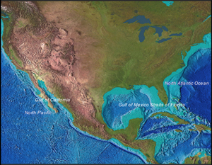
NOAA's National Coastal Data Development Center (NCDDC) provides a coordinated data management system and data discovery mechanism for atmospheric, oceanographic, and terrestrial physical sciences to facilitate sustained economic growth, scientifically sound environmental management, and public safety to the Nation and the international community. NCDDC is a leader in Regional Ecosystem Data Management (REDM) and the establishment of Regional Ecosystem Data Assembly Portals that provide access to data and information through the cataloging, formatting, archiving, and dissemination of the data streams in collaboration with federal and state agencies, regional observing system associations, academic researchers, and non-governmental organizations. NCDDC ensures that core data variables for an Integrated Ecosystem Assessment (IEA) are available to scientists in common usage formats via a web-based portal providing timely access to integrated observations data, information, products, and model analyses.
The goals of the NCDDC REDM efforts are:
- Lead development of a data integration framework to meet IEA requirements;
- Ensure Integrated Ocean Observing System (IOOS) data is compliant with IOOS Data Management and Communications (DMAC) and Global Earth Observation Integrated Data Environment (GEO-IDE) protocols;
- Support IEA activities in several regional ecosystems and/or sub-units to: emphasize data management and communication procedures; assist in the development of appropriate indicators; provide modeling and forecasting tools for understanding ecosystem response.
|
|
|
Information for data providers about the Metadata Enterprise Resource Management Aid (MERMAid) tool for use to create, to validate, manage, and ...
Quality Assurance of Real-Time Oceanographic Data (QARTOD) is a multi-agency effort to address the quality assurance and quality control issues of ...
The Priority Habitat Information System (PHINS) comprises a state/federal partnership created to identify and inventory the habitats that make up the ...

|
What's New | |
|
Check here for the latest additions and updates to the web site. |
||

|
Metadata Information | |
|
NCDDC offers metadata training and resources. |
||
|
|
Interactive Maps | |
|
NCDDC's interactive map services provide visual display of one or more data layers. |
||
|
|
IOOS | |
|
NCDDC supports data management for the Integrated Ocean Observing Systems (IOOS) Program. |
||
|
|
Outreach | |
|
NCDDC constantly seeks to strengthen its existing partnerships and form new ones through its outreach efforts. |
||


