|
Water Level Data in Support of Tsunami Research
NGDC is the long-term archive for all NOAA coastal tide gauge data. NGDC is currently archiving all 1-minute water level data from
the NOAA/NOS Center for Operational Oceanographic Products and Services (CO-OPS). In 2007, CO-OPS completed upgrades on tide stations
in Alaska, the Pacific Islands, the West Coast, and the Caribbean. The upgraded tide stations are equipped with hardware and software to
enable the collection and dissemination of 1-minute water level data. Access to this data is from the CO-OPS site.
NGDC is also working with other NOAA agencies, such as the Pacific Tsunami Warning Center (PTWC), the West Coast and Alaska
Tsunami Warning Center (WC/ATWC), and the National Data Buoy Center (NDBC) to archive high-resolution water level data. NGDC is also involved
in "A Tsunami-Focused Data Sharing Framework" being developed by the NOAA Integrated Data & Environmental Applications (IDEA) Center. For more
information on this effort, visit http://www.sealevelstations.org/. We are working to extend this partnership to agencies outside of NOAA to have a portal for all water level data related to tsunami events.
NGDC is also coordinating the conversion of tsunami-specific marigrams from analog (microfiche) to high-resolution digital images.
The microfiche were created in the 1970s from deteriorating paper records. Creating high-resolution digital images from the
microfiche will allow a wider range of use. The project is tasked through the Climate Database Modernization Program (CDMP), and will
be a multi-year effort. The microfiche collection includes records through 1981. To date, records from 1854 through 1903 have been scanned.
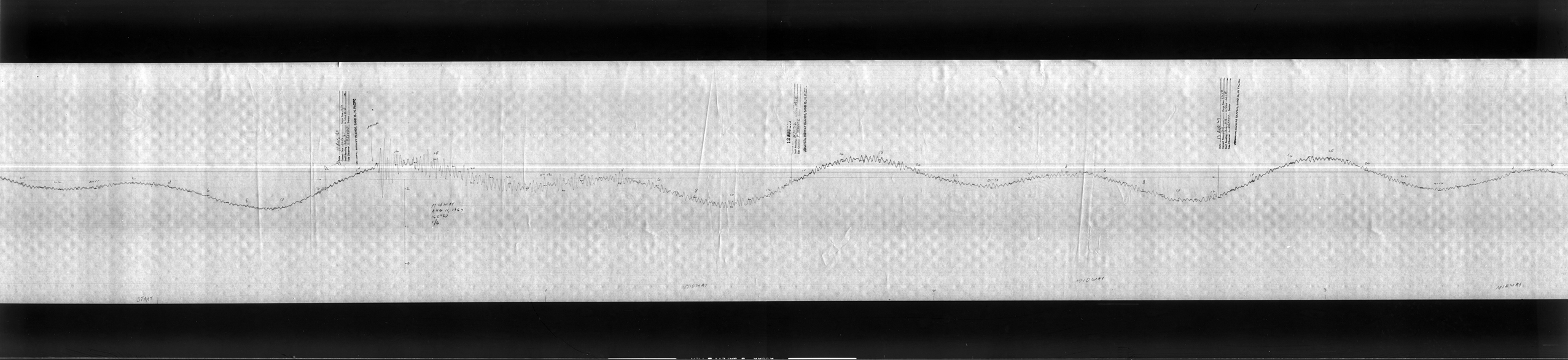
An example of a scanned marigram image (HIGH RES (99Mb) or LOW RES)
shows a run-up detected at a Midway Island station from the
magnitude 8.2 earthquake that occurred 90 km southeast of Shikotan Island October 1, 1969.
|
Tide Station Operators:
NOAA
Non-NOAA
|

