skip navigation link
 NOAA > NESDIS > NGDC > Marine Geology & Geophysics Division (MGGD)
globe with mggd discipline labels go to DEMs, bathymetry, and topography go to marine geology and geophysics data go to tsunami, earthquake, volcano natural hazards go to gravity data go to global geomagnetic data and models

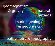
NGDC Marine Geology and Geophysics Division

The Marine Geology and Geophysics Division of NGDC provides longterm scientific stewardship for global geophysical and digital elevation data, marine geological and geophysical data, and natural hazards data.

  • Bathymetry, Topography, & Digital Elevation Models:
    NGDC produces Digital Elevation Models (DEMS), gridded data derived from bathymetric and topographic data. Bathymetric data are underway measurements (including multibeam), hydrographic soundings, and satellite altimetry estimates.

  • Global Geomagnetism & Gravity:
    NGDC compiles geomagnetic models, and offers magnetic data collected by ship, aircraft, and on land. Observatory data are stewarded by NGDC's STP Division. Gravity data are from surveys, US stations, absolute measurements, and grids.

  • Marine Geology & Geophysics:
    Marine geophysical data include underway measurements of gravity, magnetics, seismic reflection, bathymetry, and gridded ocean sediment thickness. Geologic data include descriptions, analyses, and images of sea floor and lakebed material.

  • Natural Hazards:
    Hazards information includes data on tsunami events and runups, significant earthquakes and volcanic eruptions, US coastal and deep-ocean sea levels, and historic data and imagery providing evidence of past events and their impact.

NGDC is data management lead for US exploration of potential extended continental shelf areas, provides stewardship, archive and access for NOS data supporting charts and navigation, and is the US national repository for MGG data.


International Cooperation
NGDC operates collocated World Data Centers, the IHO Data Center for Digital Bathymetry (IHO DCDB), & participates in the:
  • International Geomagnetic Reference Field (IGRF) project of International Association of Geomagnetism and Aeronomy (IAGA),

  • Intergovernmental Coordination Group for the Tsunami (Pacific & CARIB),

  • Intergovernmental Oceanographic Commission (IOC) committee on International Oceanographic Data and Information Exchange (IODE),

  • General Bathymetric Chart of the Oceans (GEBCO) & IOC regional projects.
NGDC also compiles the IOC-endorsed Index to Marine & Lacustrine Geological Samples.

Emphasis is given to data supporting programs of the International Union of Geodesy and Geophysics.