North Central River Forecast Center
Significant River Flood Outlook
Bismarck, North Dakota area Grand Forks, North Dakota area Duluth, Minnesota area Minneapolis, Minnesota area Aberdeen, South Dakota area Sioux Fall, South Dakota area Des Moines, Iowa area LaCrosse, Wisconsin area Green Bay, Wisconsin area Milwaukee, Wisconsin area Quad Cities area St. Louis, Missouri area Paducah, Kentucky area Central Illinois area Chicago, Illinois area Northern Indiana area Grand Rapids, Michigan area Detroit, Michigan area Gaylord, Michigan area Marquette, Michigan area NCRFC Significant Flood Potential image
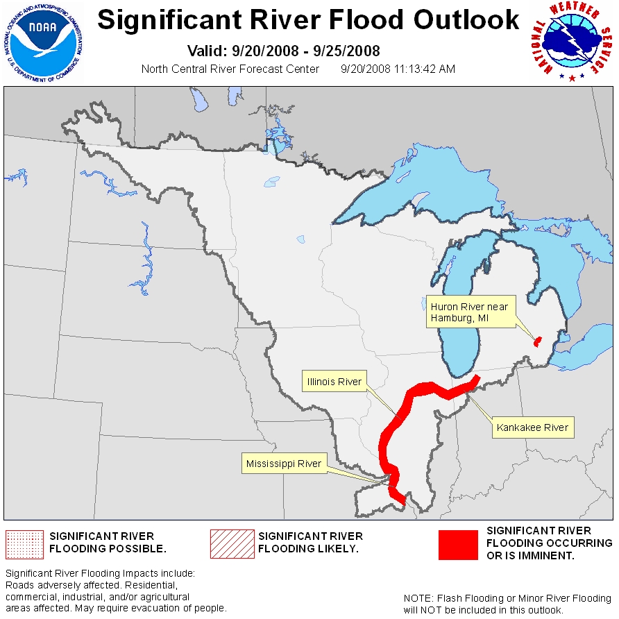
Notice: The NCRFC Significant Flood Outlook is intended to provide a general outlook for significant river flooding. It is not intended to depict all small-scale events such as localized flooding and/or flash flooding. This graphic will not depict minor river flooding as this implies only minimal or no property damage with possibly some public inconvenience. Please refer to products issued by local NWS offices for official river forecasts and warnings.

The NCRFC incorporates 5 days of QPF into the analysis for the Significant River Flood Outlook.
River forecasts from NCRFC routinely include 24 hours of QPF year round.


For a list of NWS offices and their links go to:
National WFO Map and Links


  • NOAA's National Weather Service
  • North Central River Forecast Center River Forecast Center
  • 1733 Lake Drive West
  • Chanhassen, MN 55317-8581
  • 952-361-6650
  • Page Author: NCRFC Webmaster
  • Web Master's E-mail: w-ncrfc.webmaster@noaa.gov
  • Page last modified: 3-Mar-2006 9:53 PM UTC
USA.gov is the U.S. government's official web portal to all federal, state and local government web resources and services.