Click here to skip navigation.Minerals Management Service MMS - Gulf of Mexico RegionSearchTopic IndexAbout MMSWhat's New U.S. Department of Interior
MMS - Gulf of Mexico Region
Plans Tracking Information
Deepwater Information
Information on Floating Production, Storage and Offshore Loading (FPSO's)
Royalty Relief Information
Safety Information
Overview of OCS Regulations
Notices, Letters, and Information to Lessees and Operators
Offshore Gulf of Mexico Atlas Project
Fields & Reserves Information
Assessment of Conventionally Recoverable Hydrocarbon Resources of the Gulf of Mexico and Atlantic Outer Continental Shelf
Eastern Gulf of Mexico Activities
Atlantic OCS Area Activities
Gulf OCS Region Activities
Proposed Offshore LNG Receiving Terminals in the Gulf of Mexico
Spacer Image
News Releases, Papers, Publications, Speeches, and Innovative Achievements ProgramUpcoming EventsFast FactseWell Permitting SystemProducts/Free DataAtlantic Information
Deep Gas in Shallow Water
Offshore Information
Lease Information
Environmental Information
Production Information
Hurricane Information
Online Ordering System
Public Information Ordering System
Public Information Data System
MMS Ocean Science
Spacer ImageNew e-Government Transformation Project, OCS Connect
Freedom of Information Act (FOIA)
MMS Forms for Lessee and Operators
Job Opportunties at MMS
Kid's Information Page
Privacy Act/Disclaimers
Accessibility
MMS Information Quality Guidelines
Subscrbe to Mailing Lists
Navigation Tips
Contact Us
Spacer Image The U.S. government's official
web portal
Spacer Image
Questions? Need More Information?

This page last updated: January 06, 2000


Exploration and Development Plans Tracking Information

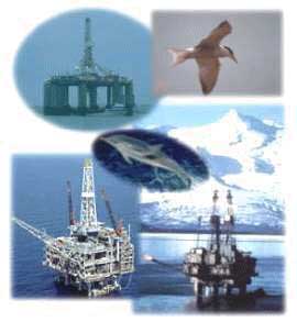
The Minerals Management Service requires that all exploration, development, and production activities except for preliminary activities be conducted in accordance with an approved Exploration Plan or a Development and Production Plan. A proposed plan may apply to one or more leases held by an individual lessee or may be submitted by a group of lessees. The Regional Supervisor, Field Operations, may authorize lessees to jointly submit environmental information for leases that are in the same planning area and have similar environmental conditions. In the mature western Gulf of Mexico, a streamlined version of a Development and Production Plan called a Development Operations Coordination Document can be used.

For information about specific plans, use the Exploration and Development Plans Online Query.


Privacy | Disclaimers | Accessibility

Home | Search | Topic Index | About MMS | What's New | Press Releases/Reports
Upcoming Events | Fast Facts | Products/Free Data | Deep Gas | Offshore Info | Lease Info
Environmental Info | Production Info | Hurricane Info | Online Ordering System | P.I. Data System
MMS Ocean Science | OEMM e-Gov | Forms | Jobs | Kid's Page | FOIA | Info Quality Guidelines
E-Mail Subscriptions | Navigation | Contact Us