| HOME | |||
| Color Enhanced Image #1 | Color Enhanced Image #2 | Color Enhanced Image #3 | Color Enhanced Image #4 |
 |
|||
Brought to you by the National Oceanic and Atmospheric Administration (NOAA)
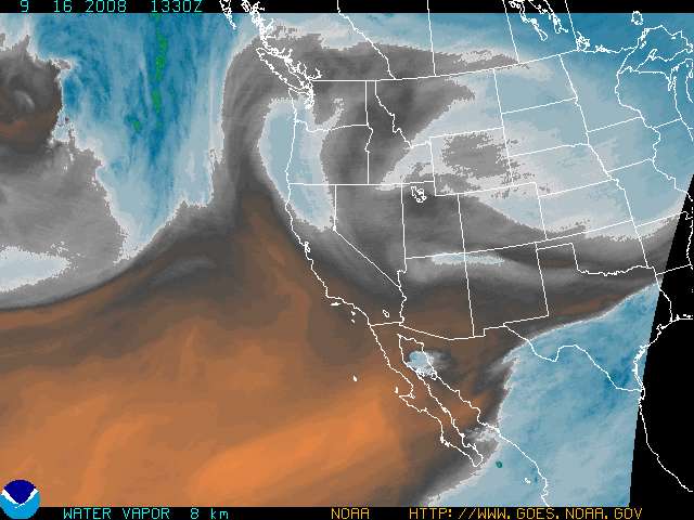
Meteorologists use color enhanced imagery as an aid in satellite interpretation. The colors enable them to easily and quickly see features which are of special interest. Usually they look for high clouds or areas with a large amount of water vapor.
In a water vapor image, white areas indicate moisture and dark areas indicate little or no moisture, so the colors typically highlight areas with large amounts of moisture.
| HOME | |||
| Color Enhanced Image #1 | Color Enhanced Image #2 | Color Enhanced Image #3 | Color Enhanced Image #4 |
|
|||
Brought to you by the National Oceanic and Atmospheric Administration (NOAA)