National Weather Service
Wichita, Kansas
|
Our Mission Statement:
To serve the public by providing severe weather and flood warnings along with public and aviation forecasts for twenty six counties in central and southeastern Kansas, primarily for the protection of life and property. This is accomplished by maximizing the use of new technology and educating the citizens to ensure appropriate response to the weather. |
NWS data and products form a national information database and infrastructure which can be used by other government agencies, the private sector, the public, and the global community.
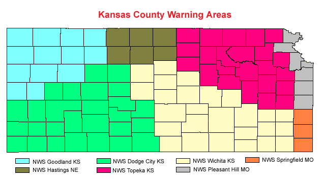
This image map below portrays the state of Kansas and the County Warning and Forecast Areas assigned to the respective National Weather Service Forecast Offices, by color code. By clicking on a particular NWS County Warning Area, this will take you to the appropriate NWS Forecast Office Homepage. The NWS Wichita County Warning Area and Forecast Area of responsibility is colored in light yellow.
Some of the new advanced technologies being utilized at the modernized NWS Forecast Offices, nationwide include: AWIPS, ASOS, WSR-88D Doppler Radar, GOES Satellite, National Center Advanced Computer Systems, and NOAA Weather Radio.