
Woods Hole Science Center
|
This server contains time series oceanographic data collected by USGS investigators at the Woods Hole Science Center, often in collaboration with others, as part of experiments to study circulation and sediment transport in the coastal ocean. The experiments were carried out between 1975 and present. Measurements include current, temperature, pressure, conductivity, light transmission (beam atttenuation) among others. Data is provided at the fastest instrument sampling interval and often as hourly averages. The data stored in Network Common Data Format (netCDF) files using the EPIC (Equatorial Pacific Information Collection) conventions defined by the NOAA Pacific Marine Environmental Laboratory. NetCDF is a general, self-documenting, machine-transportable data format created and supported by UCAR. EPIC is a set of standards which allow researchers from different organizations to share oceanographic data without having to translate "foreign" data types into the local vernacular. The files may be downloaded or accessed using OPeNDAP. The OPeNDAP (formerly DODS) framework allows users to access data from anywhere on the internet using a variety of different client/server methods. Documentation of the U.S. Geological Survey Oceanographic Time-Series Data Base is available in U.S. Geological Survey Open-File Report 2007-1194. This report describes the instruments employed, data-processing techniques, and data-quality assessment methods used to collect and process the data. The report also describes the storage format, typical file contents, and distribution and visualization methods for the data. |
 |
| Available data sets (listed by region and experiment) Click on experiment for description and links to data |
Maps showing mooring locations |
|---|---|
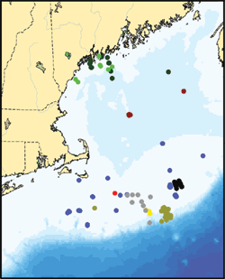
Gulf of Maine
|
 |
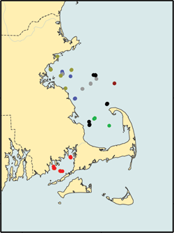
Coastal Massachusetts
|
 |
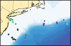
Middle Atlantic Bight
|
 |
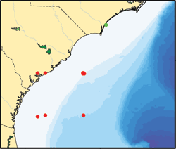
South Atlantic Bight
|
 |
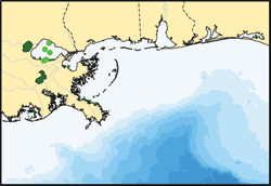
Gulf of Mexico
|
 |
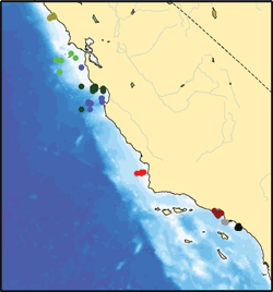
California
|
 |
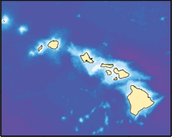
Hawaii
|
 |
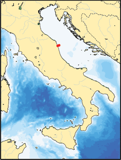
International
|
 |
Older Data Sets |

 U.S. Department of the Interior |
U.S. Geological Survey
U.S. Department of the Interior |
U.S. Geological Survey
URL: stellwagen.er.usgs.gov/index.html
Page Contact Information: WHSC Webmaster
Page Last Modified: Friday, 06-Jun-2008 12:31:06 EDT
