![]() About the Graphical Hazardous Weather Outlook
About the Graphical Hazardous Weather Outlook ![]() Hazardous Weather Outlook Text
Hazardous Weather Outlook Text
Day One Outlook
Click on each individual image for a detailed image and hazard page.
|
Spotter Outlook |
|
|

For details on the spotter outlook click here.
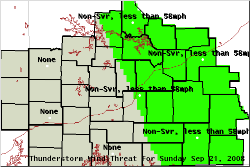
| Tornado Threat | Thunderstorm Wind Threat |
 |
 |
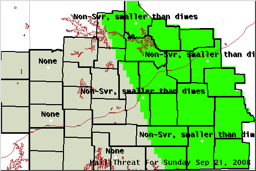
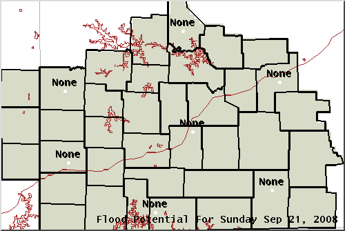
| Hail Threat | Flood Threat |
 |
 |
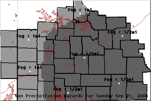
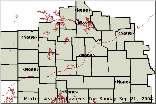
| Non-Precipitation Threats | Winter Weather Threats |
 |
|
| Fire Weather | |
 |
|
Day 2 through 7 Outlook
Click on each individual image for a detailed image and hazard page.
|
Day 2
|
Day 3
|
 |
 |
|
Day 4
|
Day 5
|
 |
 |
|
Day 6
|
Day 7
|
 |
 |
000
FLUS43 KSGF 211315
HWOSGF

HAZARDOUS WEATHER OUTLOOK
NATIONAL WEATHER SERVICE SPRINGFIELD MO
815 AM CDT SUN SEP 21 2008

KSZ073-097-101-MOZ055>058-066>071-077>083-088>098-101>106-220800-
BOURBON-CRAWFORD-CHEROKEE-BENTON-MORGAN-MILLER-MARIES-VERNON-
ST. CLAIR-HICKORY-CAMDEN-PULASKI-PHELPS-BARTON-CEDAR-POLK-DALLAS-
LACLEDE-TEXAS-DENT-JASPER-DADE-GREENE-WEBSTER-WRIGHT-NEWTON-
LAWRENCE-CHRISTIAN-DOUGLAS-HOWELL-SHANNON-MCDONALD-BARRY-STONE-
TANEY-OZARK-OREGON-
815 AM CDT SUN SEP 21 2008

THIS HAZARDOUS WEATHER OUTLOOK IS FOR PORTIONS OF THE MISSOURI
OZARKS AND EXTREME SOUTHEAST KANSAS.

.DAY ONE...TONIGHT.

AREAS OF DENSE FOG WILL REDUCE VISIBILITIES TO LESS THAN A QUARTER
MILE OVER MUCH OF THE MISSOURI OZARKS EARLY THIS MORNING.

ISOLATED THUNDERSTORMS WILL BE POSSIBLE...PRIMARILY THIS
AFTERNOON AND EAST OF MISSOURI HIGHWAY 5. NO SEVERE WEATHER IS
EXPECTED.

.DAYS TWO THROUGH SEVEN...MONDAY THROUGH SATURDAY.

NO HAZARDOUS WEATHER IS EXPECTED AT THIS TIME.

.SPOTTER INFORMATION STATEMENT...

SPOTTER ACTIVATION WILL NOT BE NEEDED THROUGH TONIGHT.

&&

THIS PRODUCT IS NOW AVAILABLE IN GRAPHICAL FORMAT...ALONG WITH
OTHER WEATHER...HYDROLOGICAL AND CLIMATE INFORMATION...AT
HTTP://WWW.CRH.NOAA.GOV/SGF(ALL LOWERCASE)

$$

ANGLE