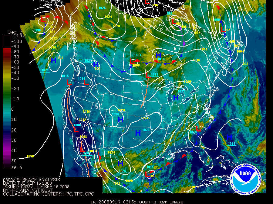
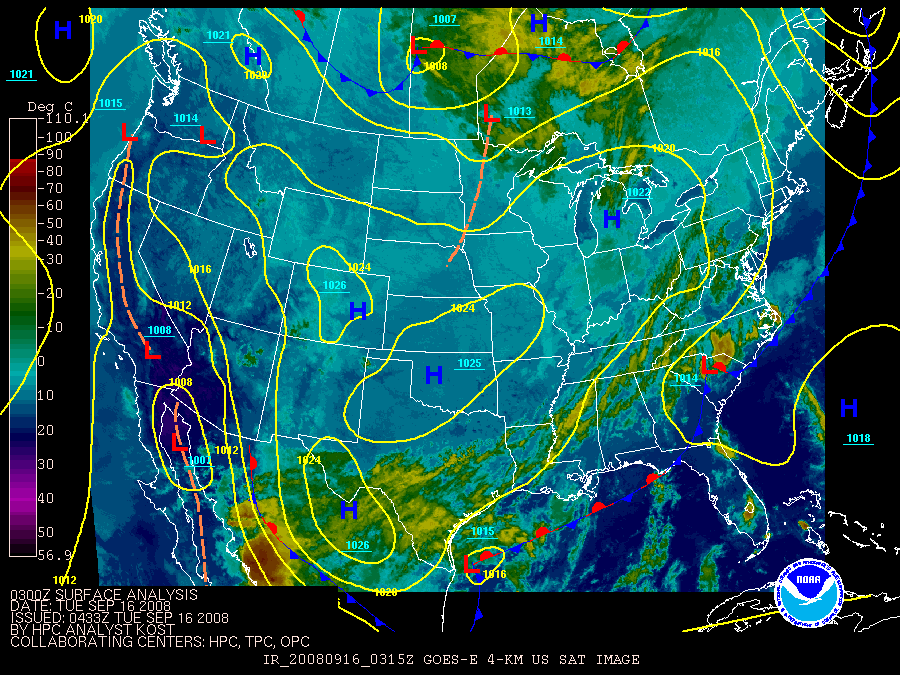
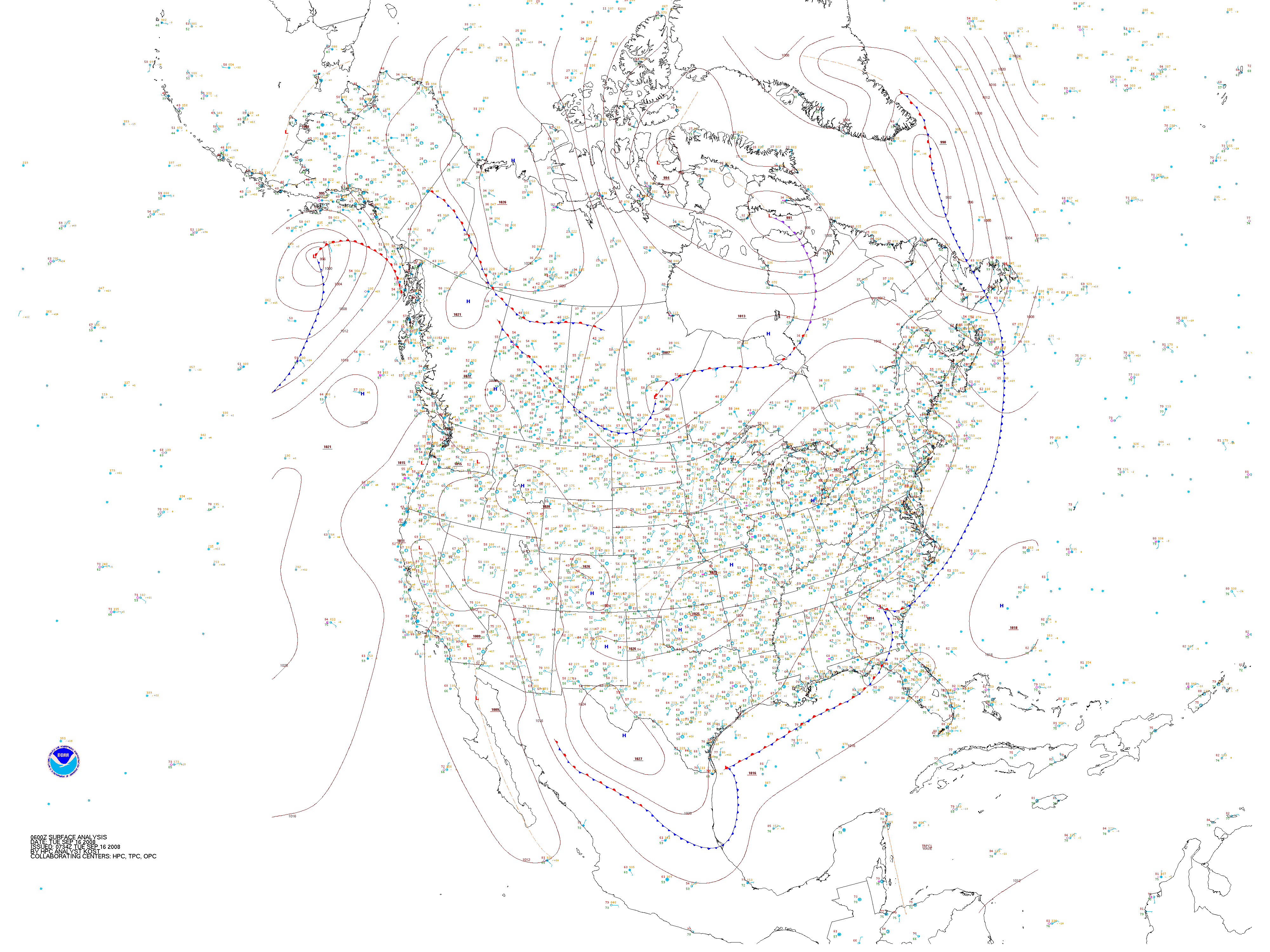
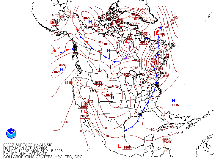
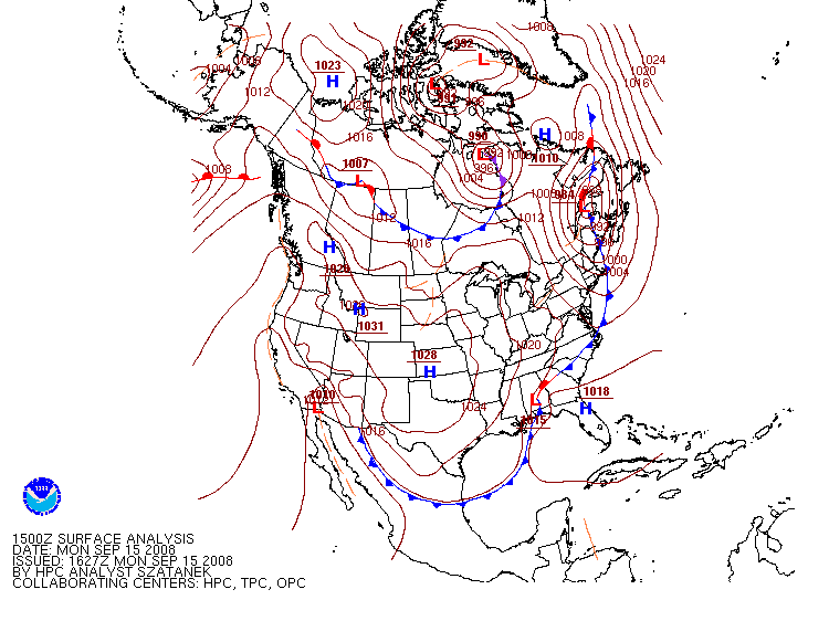
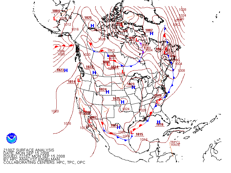
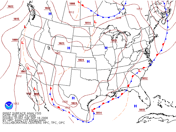
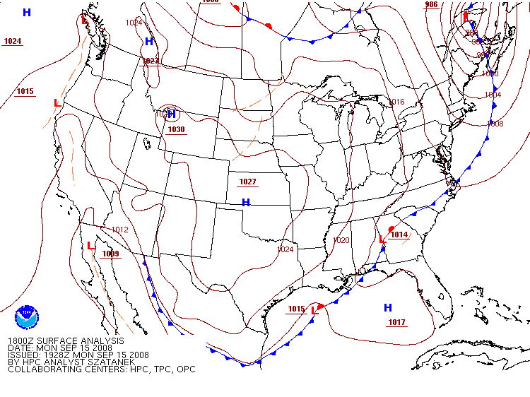
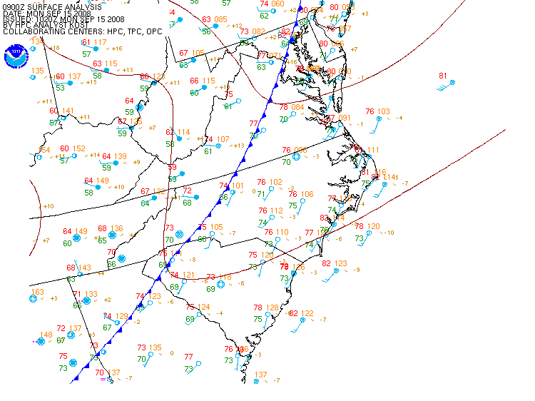
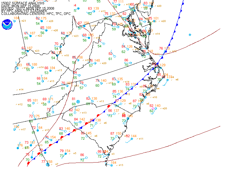
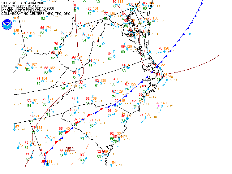
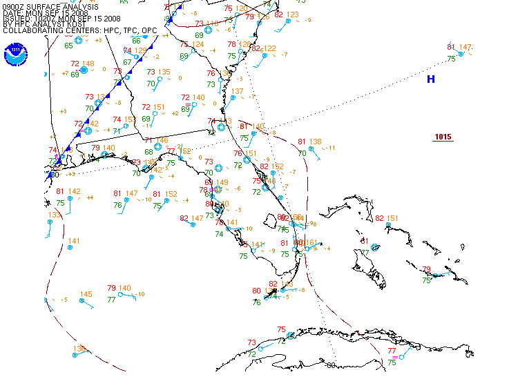
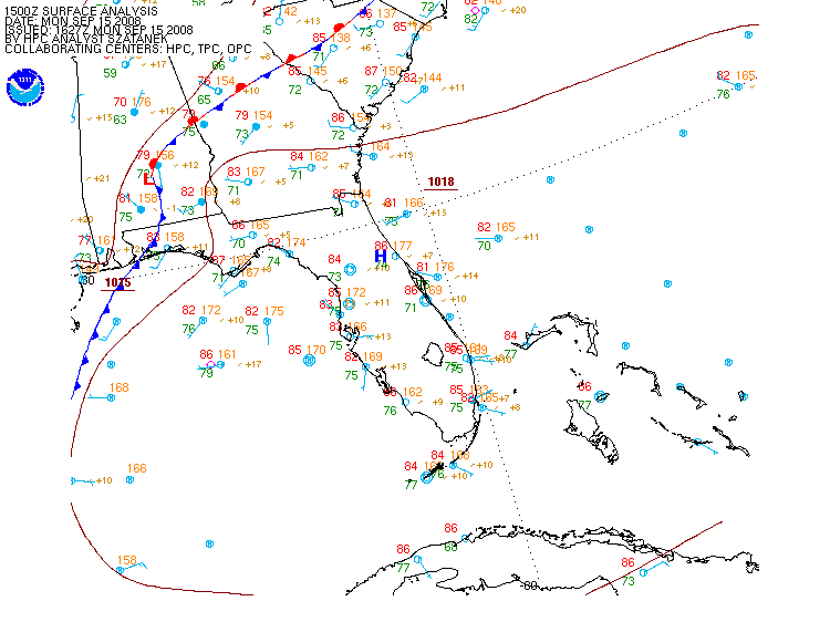
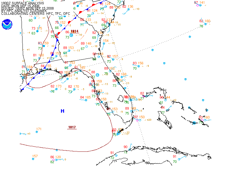
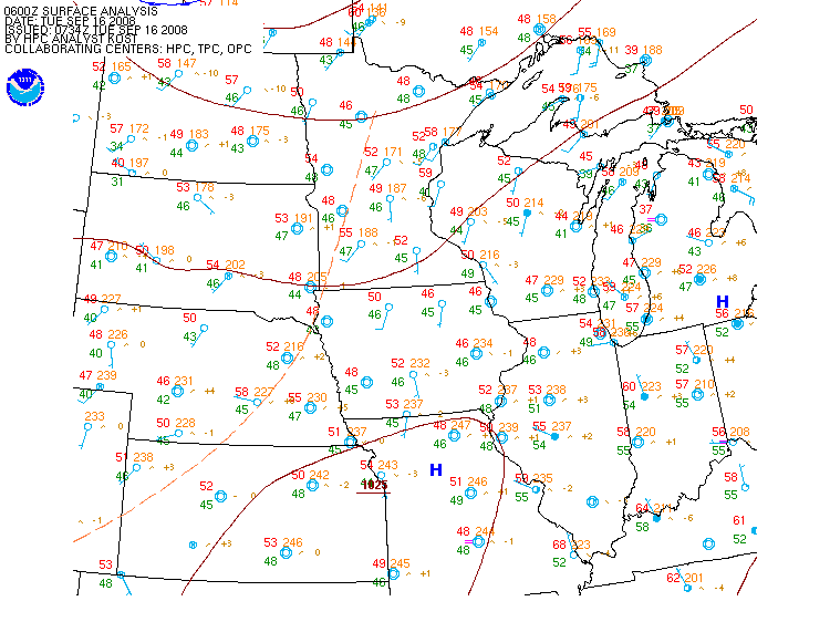
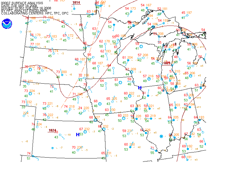
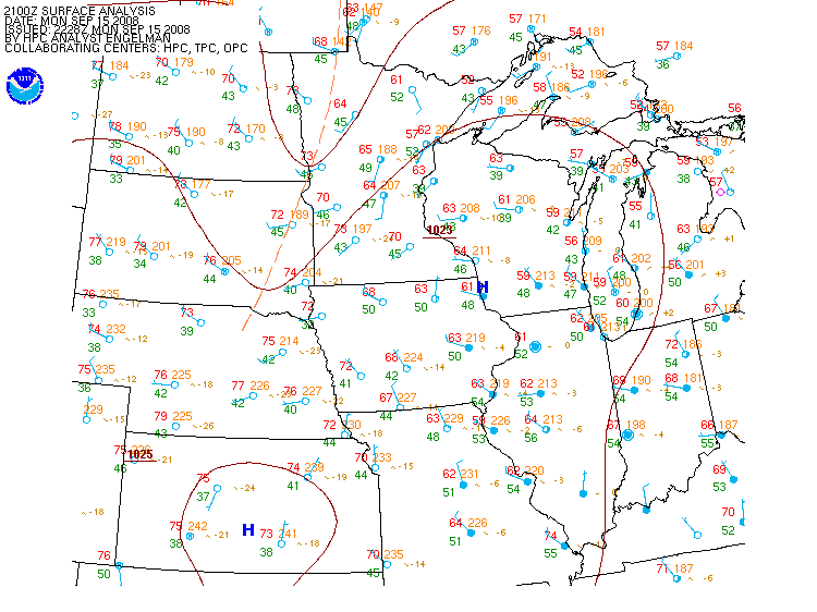
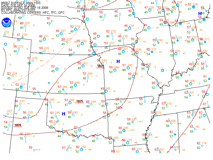
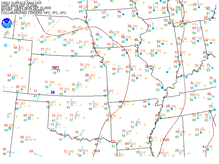
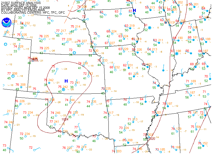
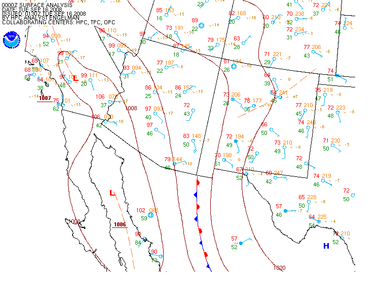
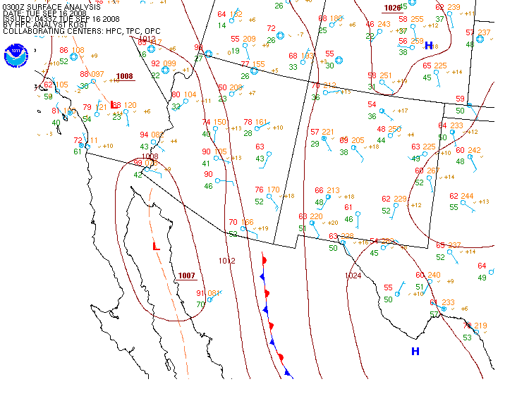
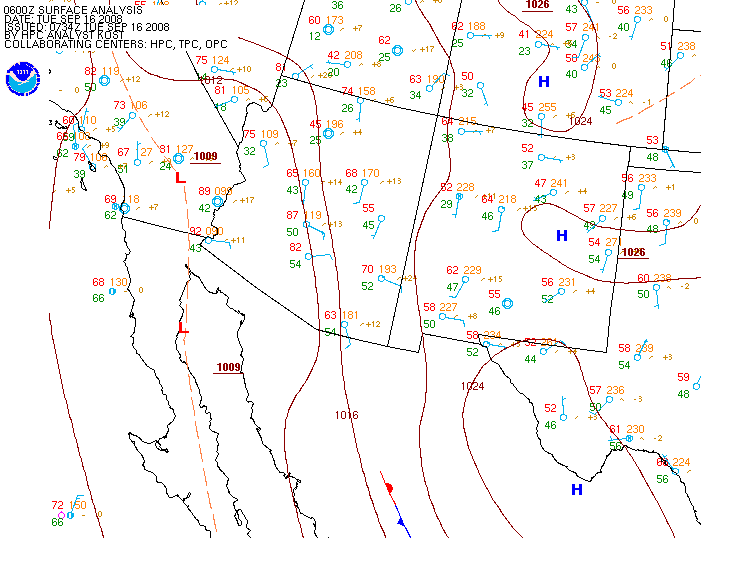
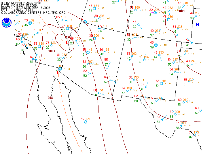
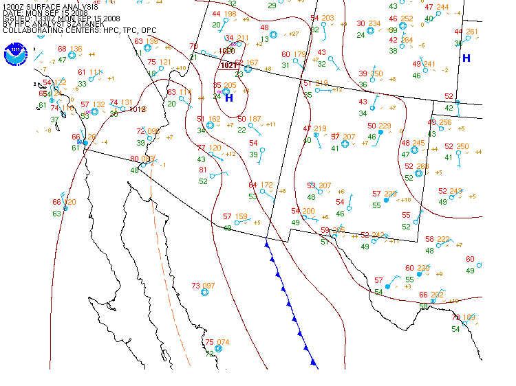
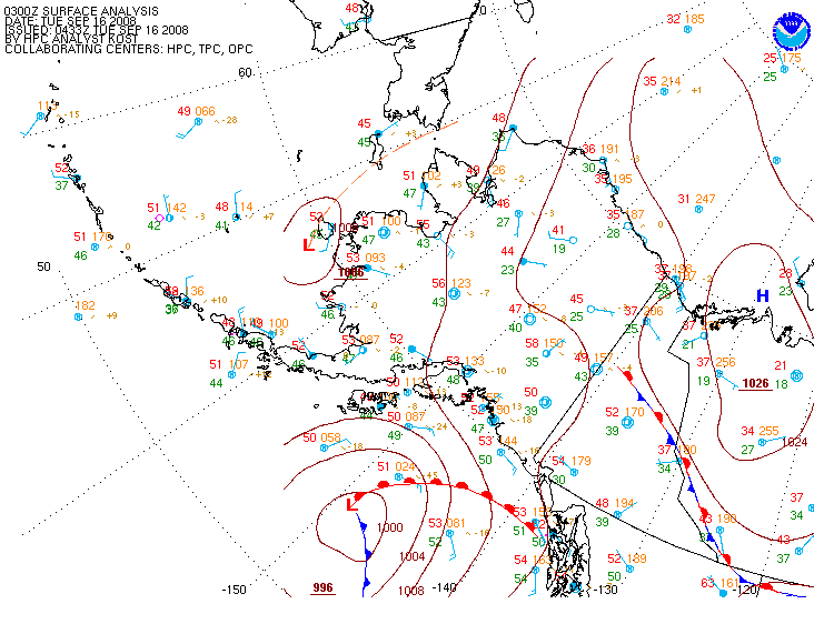
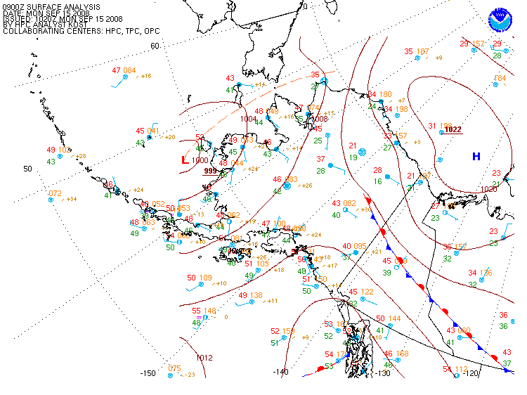
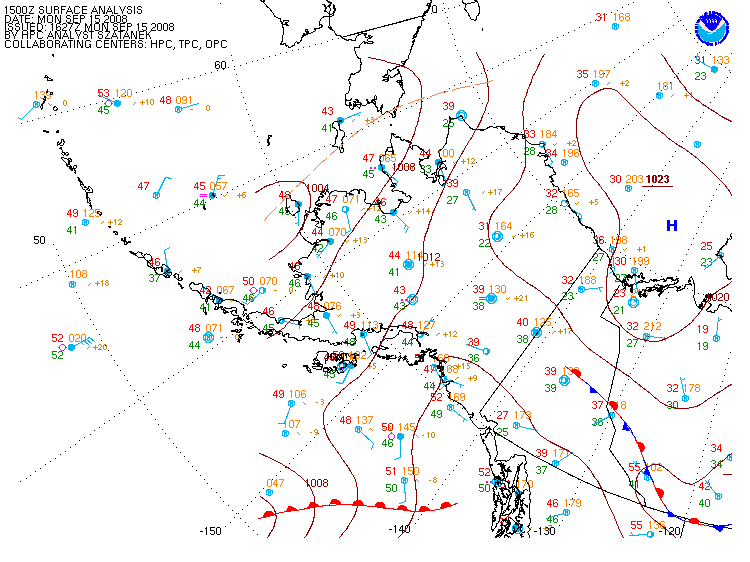
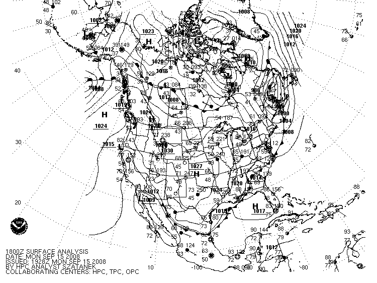
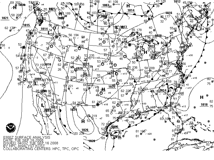
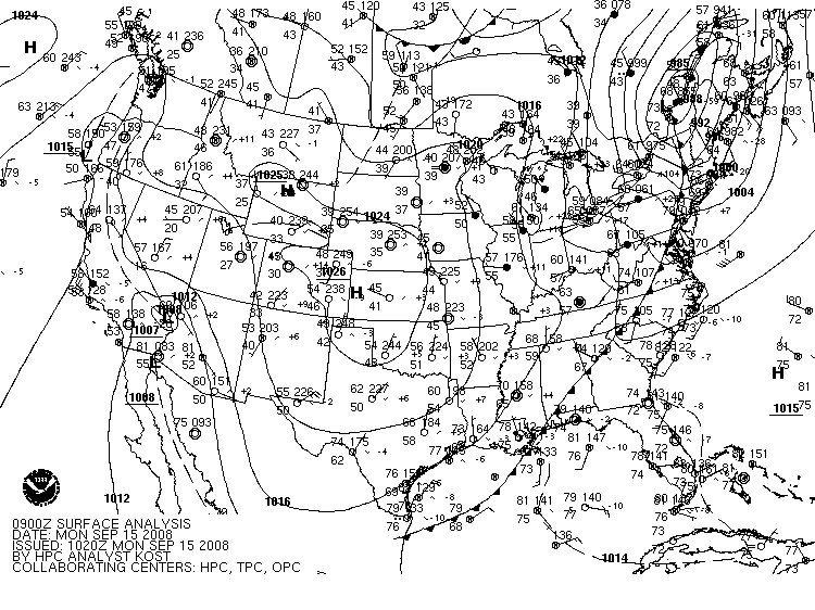
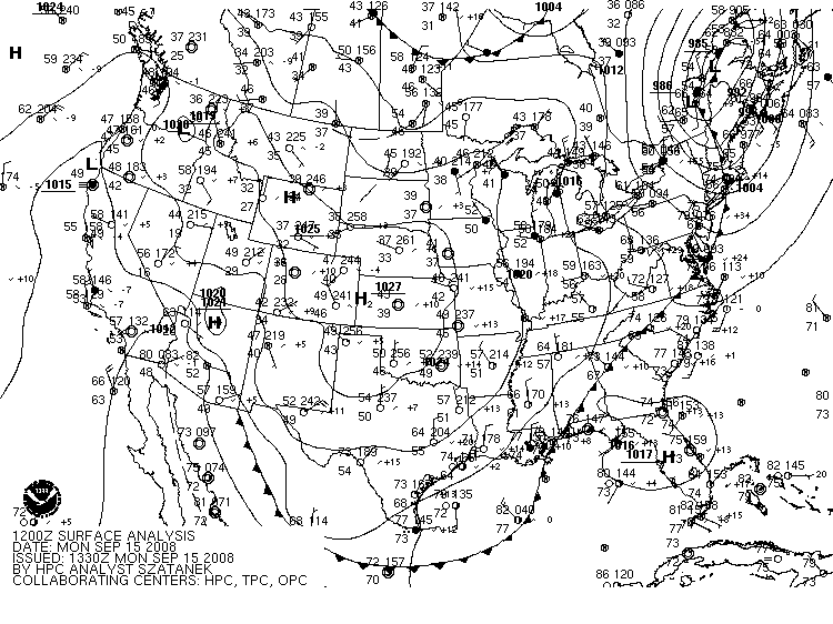
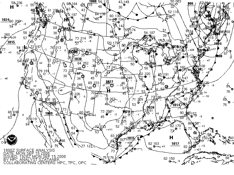
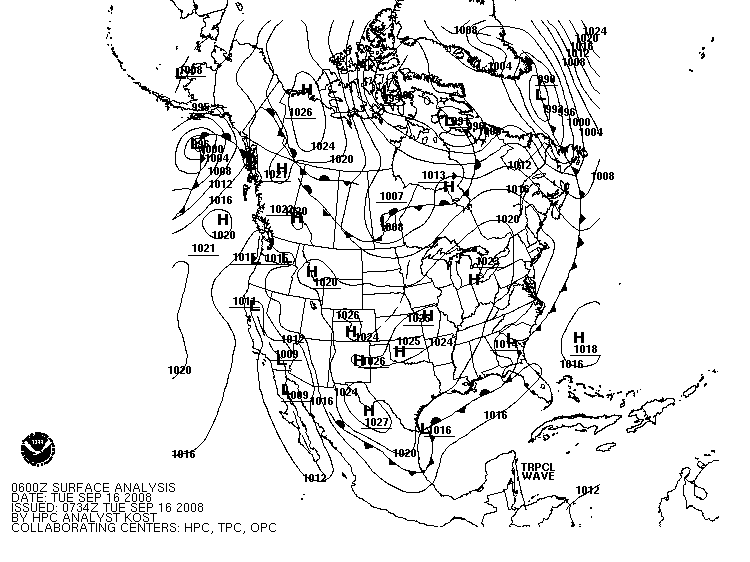
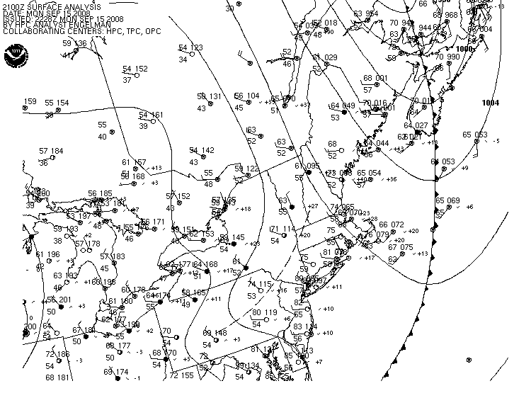
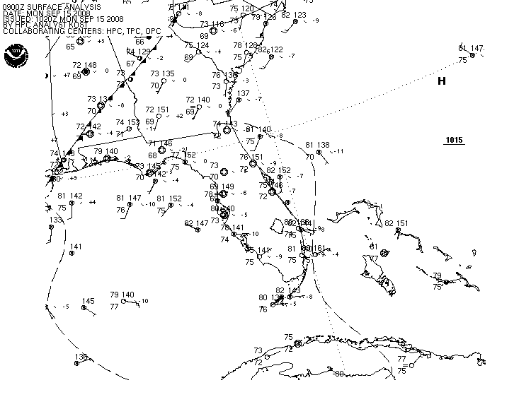
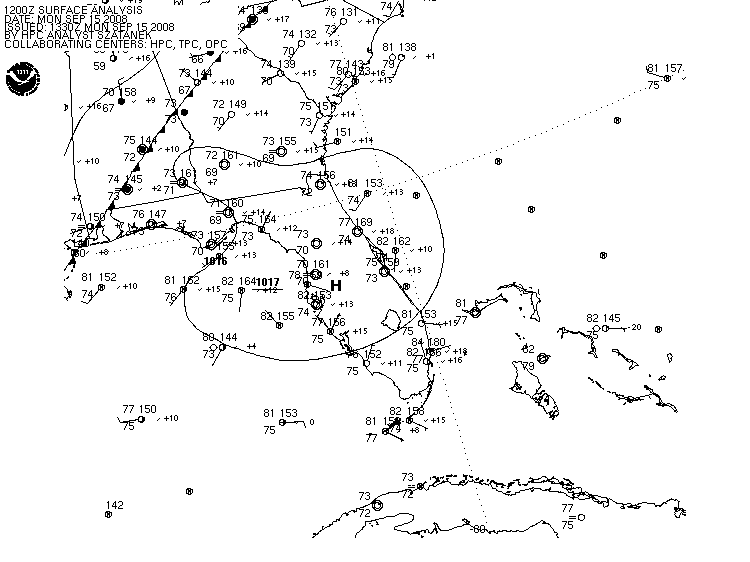
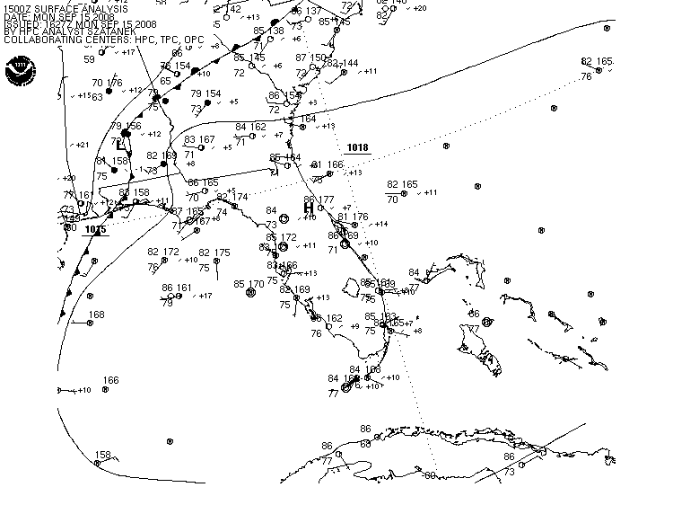
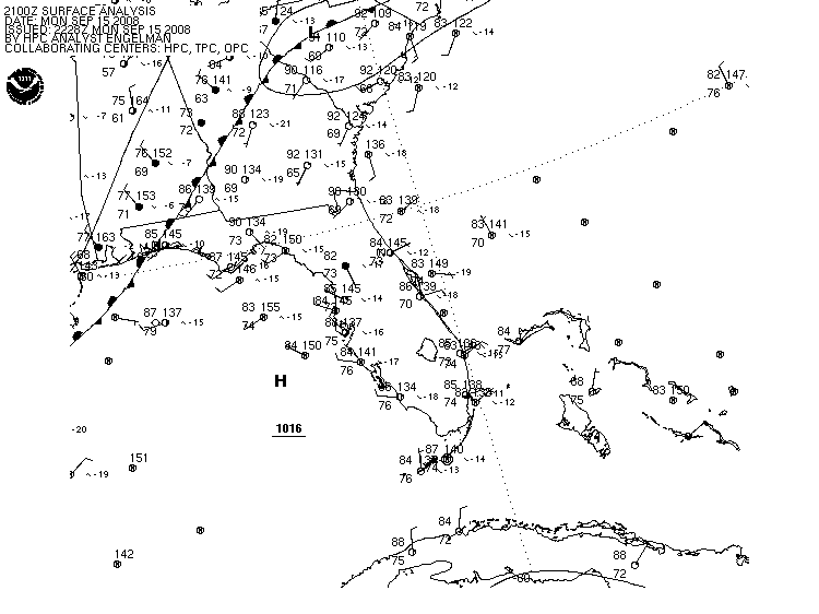
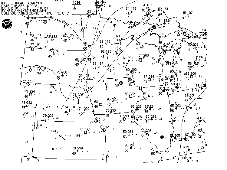
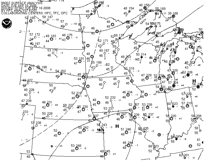
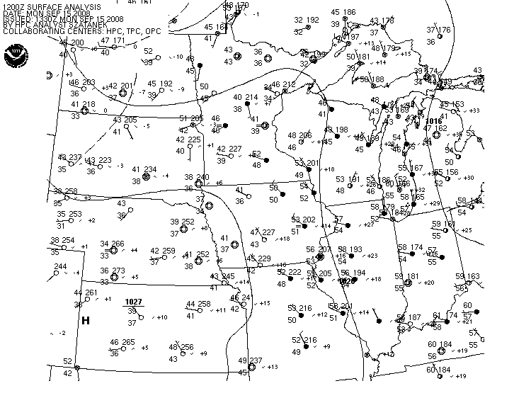
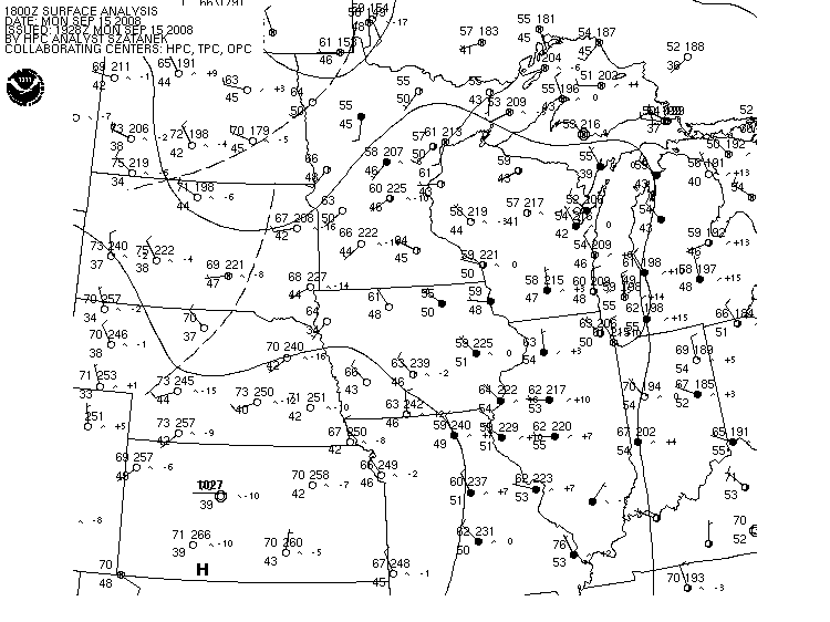
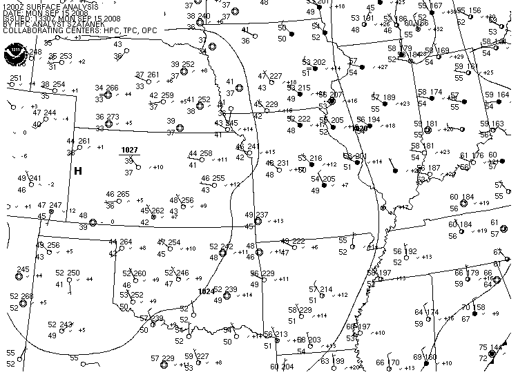
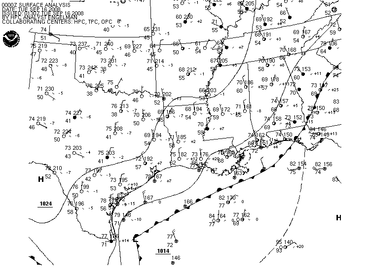
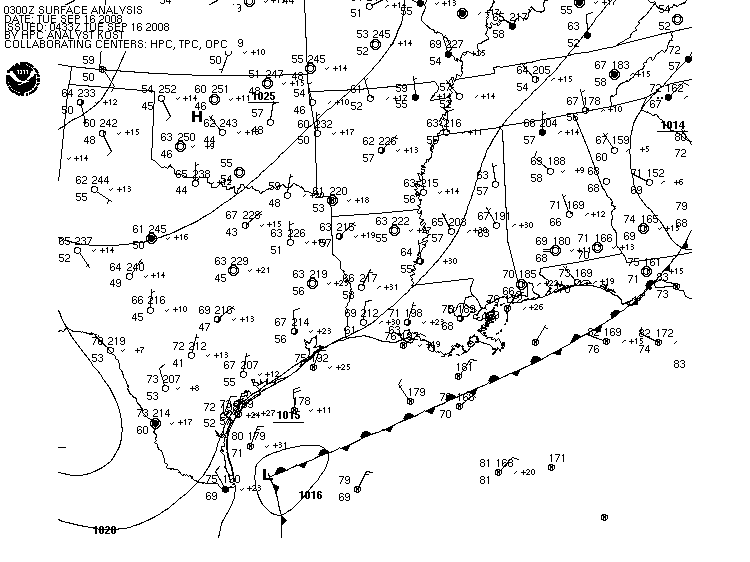
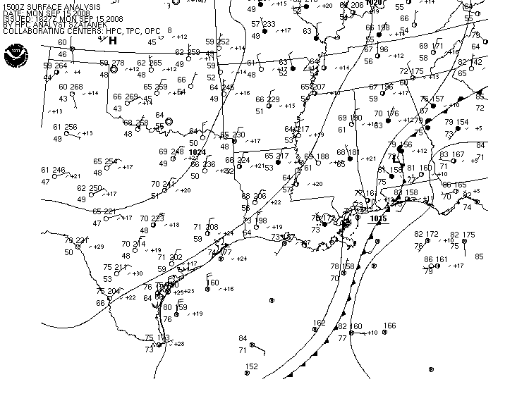
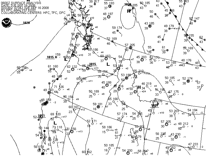
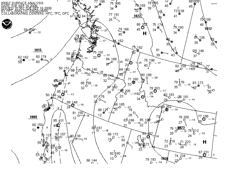
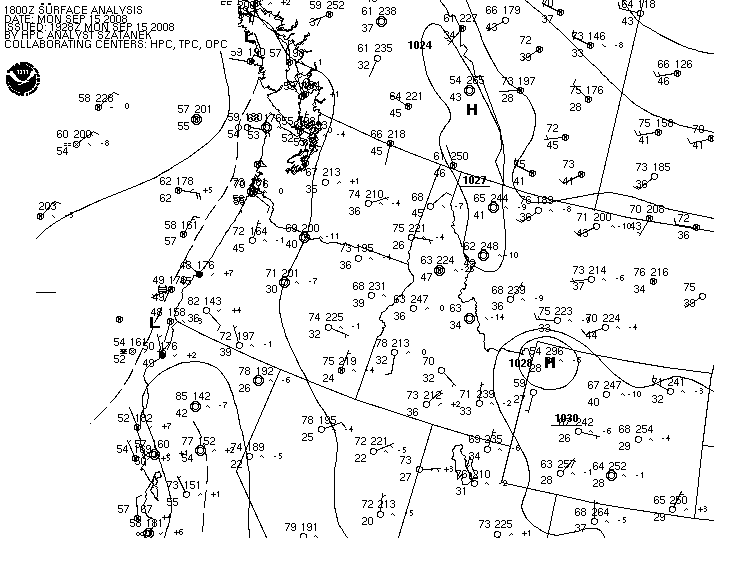
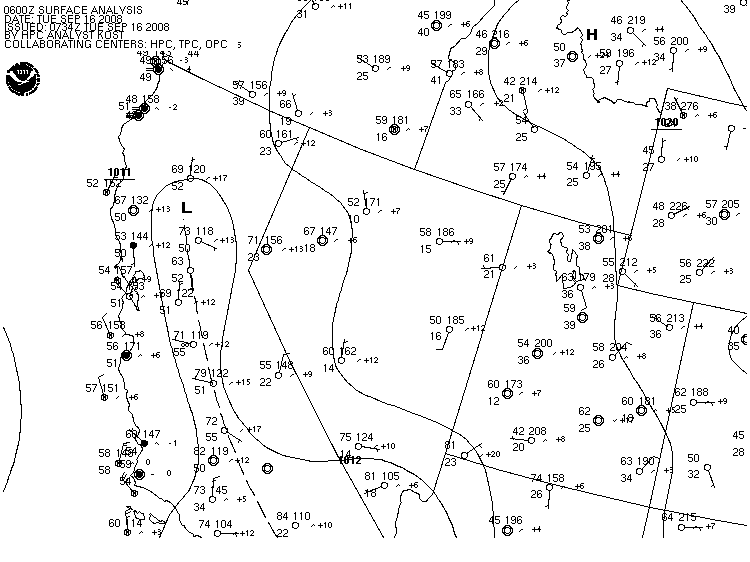
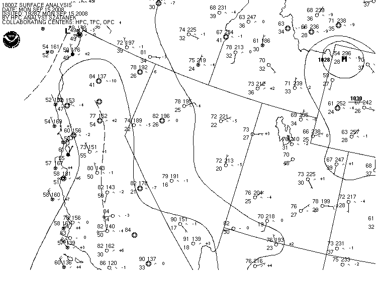
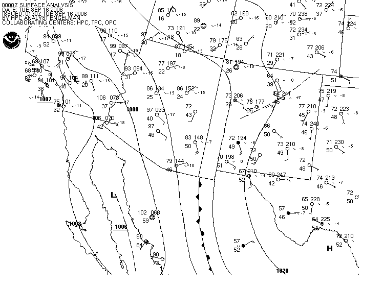
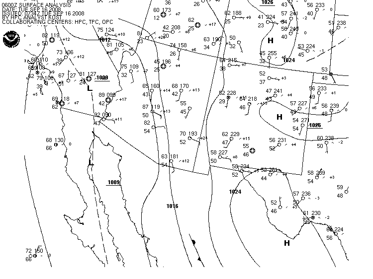
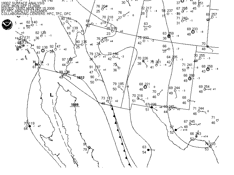
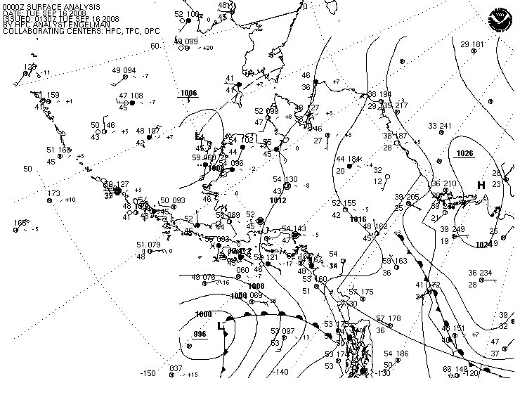
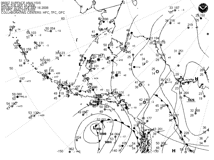
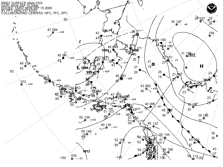
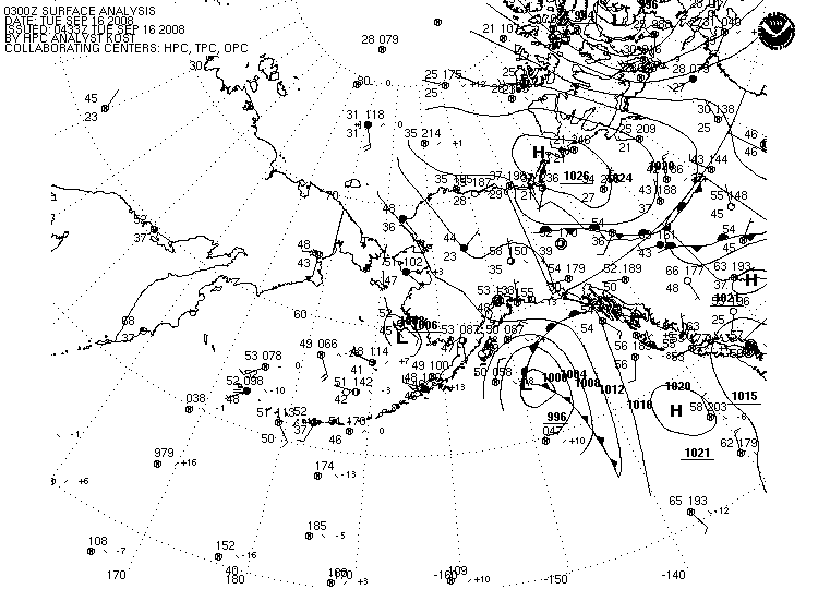
NOTE:
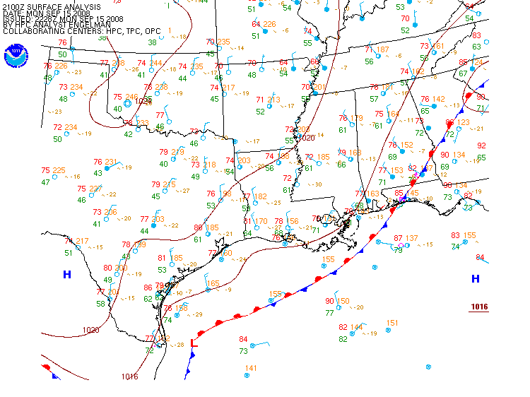
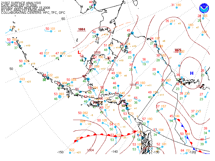
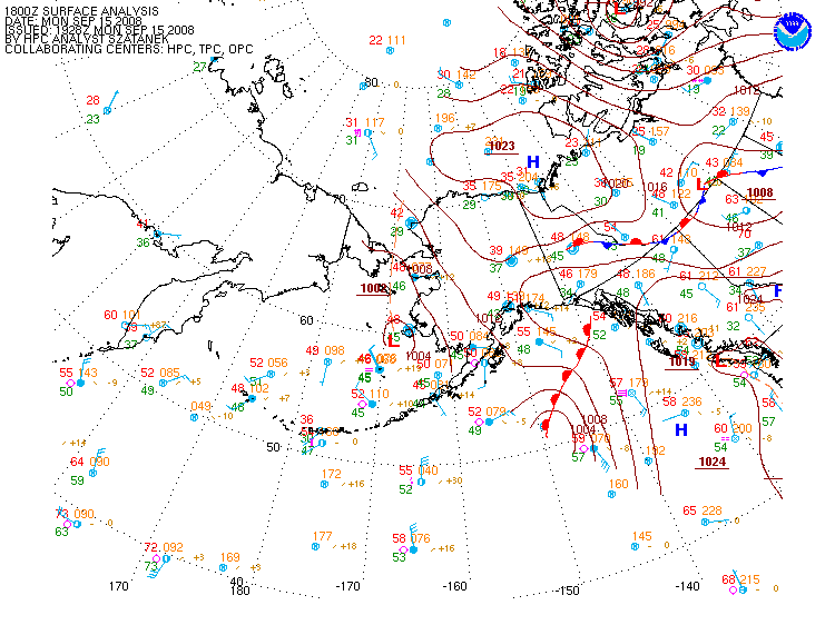
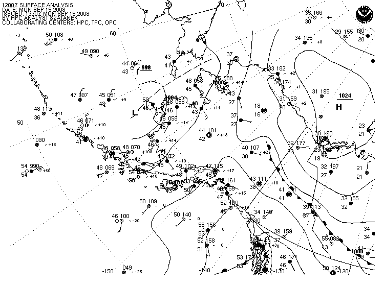
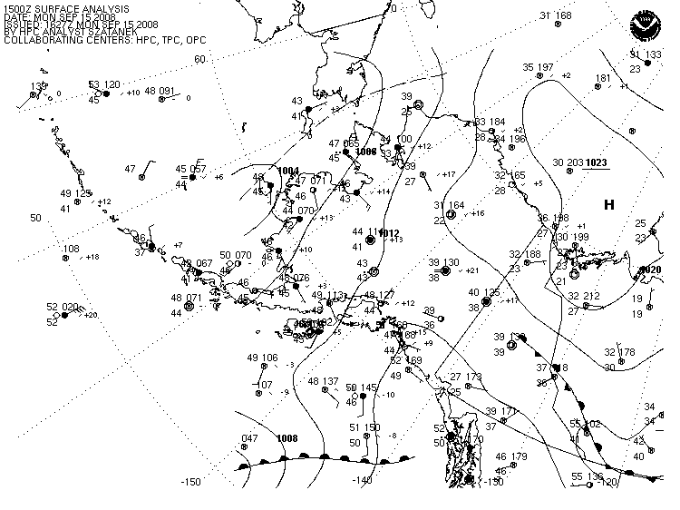
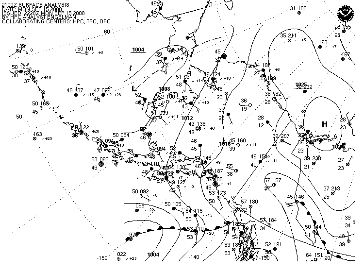
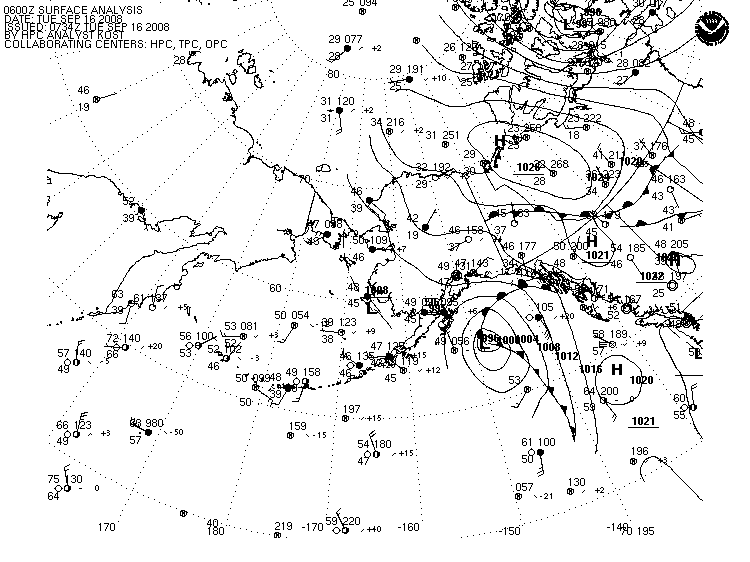
Pacific Ocean analyses north of 30oN
and Atlantic Ocean analyses north of 31oN are provided by
NCEP's Ocean Prediction Center.
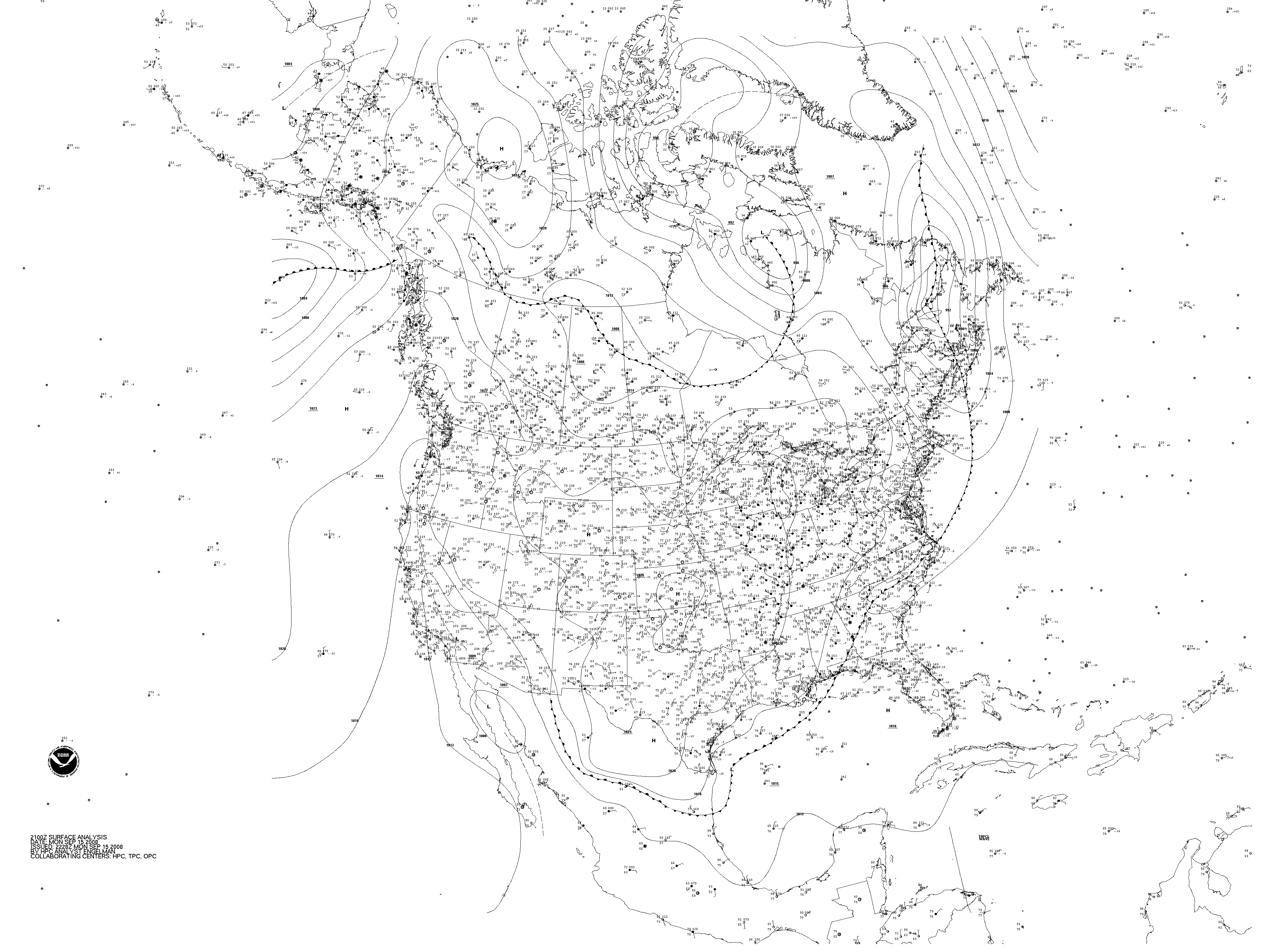
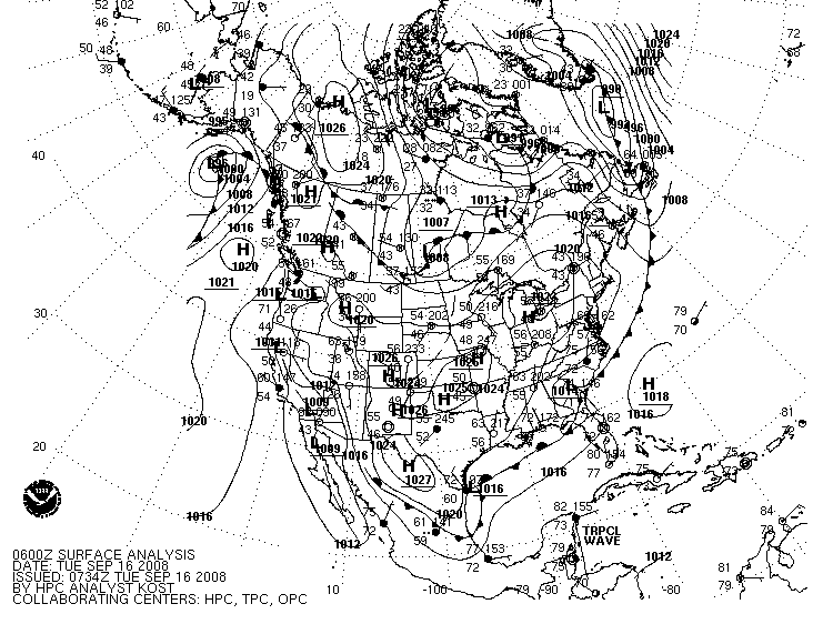
The Tropical Prediction Center
analyzes features south of 31oN
in the Atlantic (including Florida, Mexico and the Gulf of Mexico) and
south of 30oN in the Pacific Ocean. However, surface observations
outside of HPC's area of responsibility are still depicted.


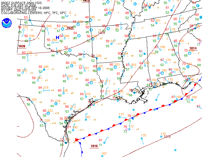
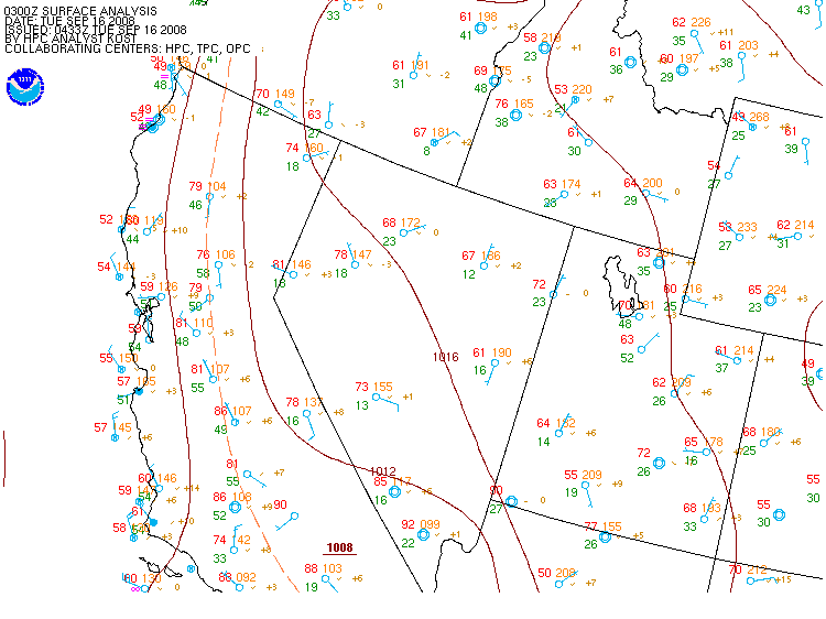
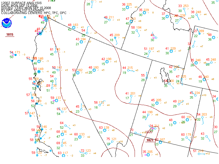
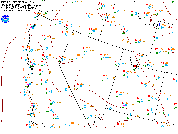
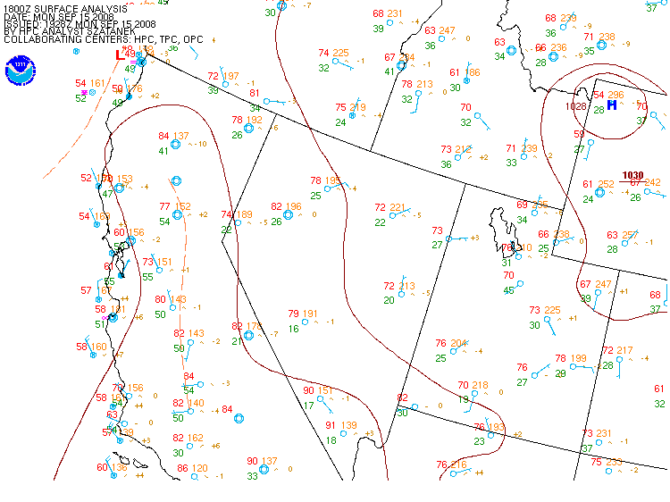
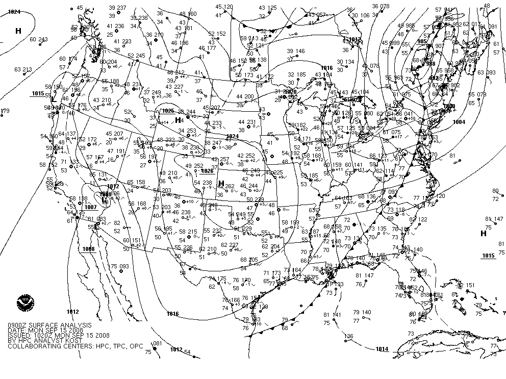
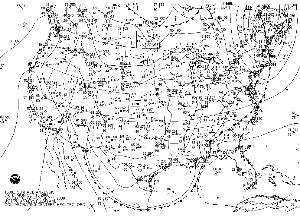
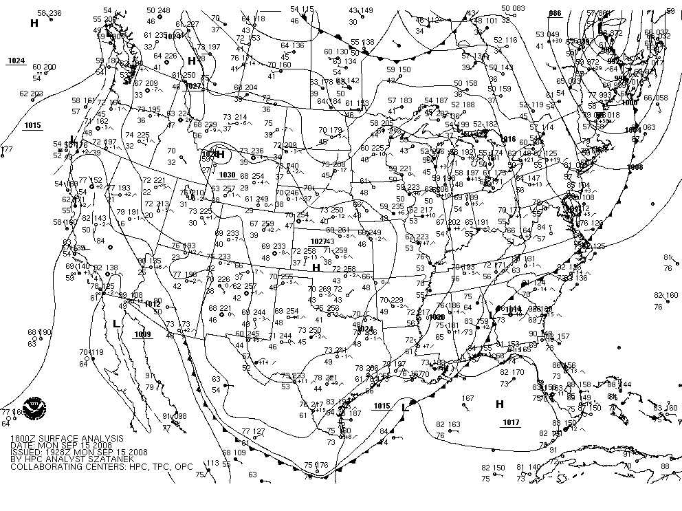
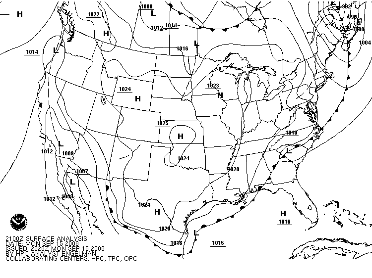
![[current sfc analysis]](https://webarchive.library.unt.edu/eot2008/20080916050755/http://www.hpc.ncep.noaa.gov/sfc/90fwbg.gif)
![[Black and White Image]](https://webarchive.library.unt.edu/eot2008/20080916050755/http://www.hpc.ncep.noaa.gov/sfc/90fbw.gif)
![[Color]](https://webarchive.library.unt.edu/eot2008/20080916050755/http://www.hpc.ncep.noaa.gov/sfc/namfntsfcwbg.gif)
![[B/W]](https://webarchive.library.unt.edu/eot2008/20080916050755/http://www.hpc.ncep.noaa.gov/sfc/namfntsfcbw.gif)
![[Color]](https://webarchive.library.unt.edu/eot2008/20080916050755/http://www.hpc.ncep.noaa.gov/sfc/namussfcwbg.gif)
![[B/W]](https://webarchive.library.unt.edu/eot2008/20080916050755/http://www.hpc.ncep.noaa.gov/sfc/namussfcbw.gif)
![[B/W Print Version]](https://webarchive.library.unt.edu/eot2008/20080916050755/http://www.hpc.ncep.noaa.gov/sfc/print_usbw.gif)
![[Color]](https://webarchive.library.unt.edu/eot2008/20080916050755/http://www.hpc.ncep.noaa.gov/sfc/usfntsfcwbg.gif)
![[B/W]](https://webarchive.library.unt.edu/eot2008/20080916050755/http://www.hpc.ncep.noaa.gov/sfc/usfntsfcbw.gif)