|
|
 |
 |
||
 |
| Site Map | News | Organization |
|
Sample Station Plot

For more information about an item marked with a (*), click on the appropriate link: WEATHER A weather symbol is plotted if at the time of observation, there is either precipitation occurring or a condition causing reduced visibility. 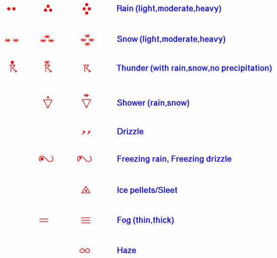
WIND Wind is plotted in increments of 5 knots (kts), with the outer end of the symbol pointing toward the direction from which the wind is blowing. The wind speed is determined by adding up the total of flags, lines, and half-lines, each of which have the following individual values: 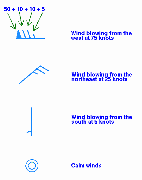
PRESSURE Sea-level pressure is plotted in tenths of millibars (mb), with the leading 10 or 9 omitted. For reference, 1013 mb is equivalent to 29.92 inches of mercury. Below are some sample conversions between plotted and complete sea-level pressure values: PRESSURE TREND The pressure trend has two components, a number and symbol, to indicate how the sea-level pressure has changed during the past three hours. The number provides the 3-hour change in tenths of millibars, while the symbol provides a graphic illustration of how this change occurred. Below are the meanings of the pressure trend symbols: 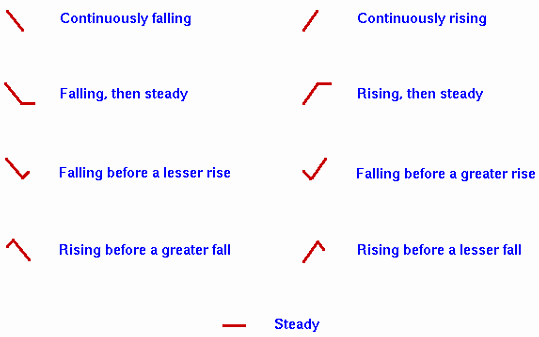
SKY COVER The amount that the circle at the center of the station plot is filled in reflects the approximate amount that the sky is covered with clouds. Below are the common cloud cover depictions: 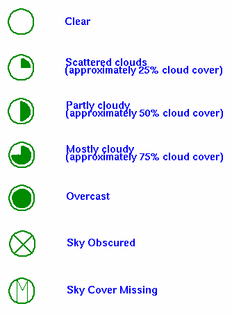
|
|||||||||||||||||||||||||||||||||