|
|
Our area of responsibility covers Southeast
and South Central Colorado, and encompasses the highest (Mt. Elbert, at
14,440 feet above sea level) and lowest ( Holly, at 3387 feet
above sea level) elevations in Colorado. The counties in our area
of responsibility are:
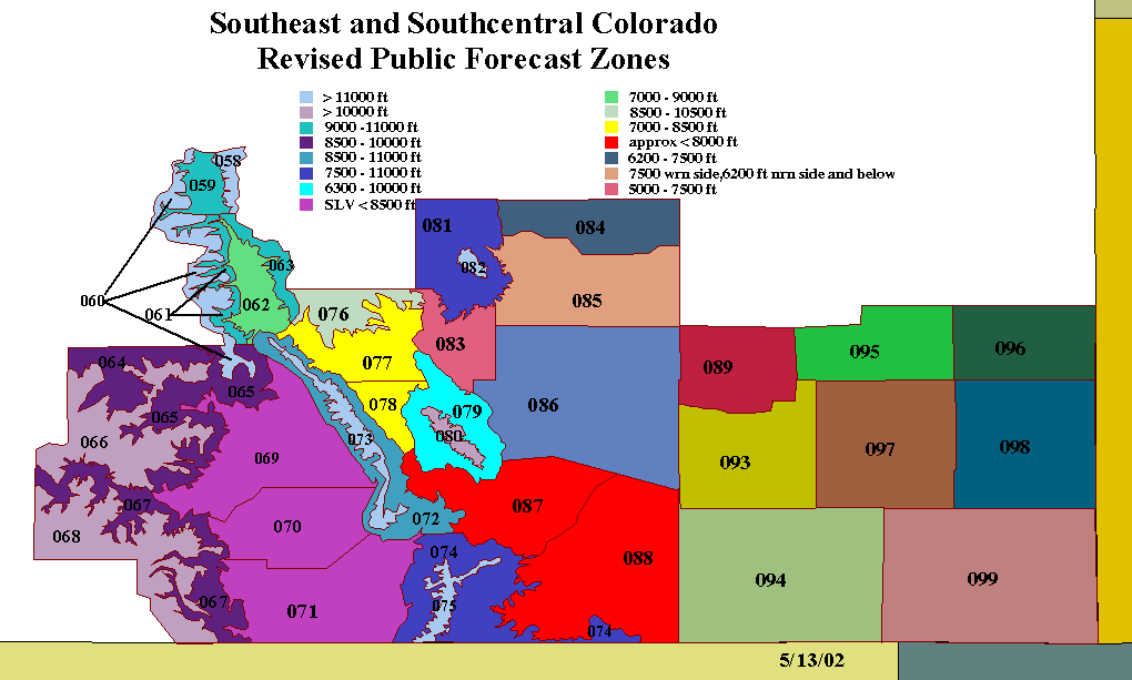
The topography of our area is extremely diverse, as you can see from the topographic map below.
 We recently realigned our zones to reflect the topography better. Many of our zone lines are based on an elevation contour. For a more detailed map showing our zones and related elevations, click on the thumbnail below.
Zone Table - Opens in New Window Our products are issued either by zone or by county. Zone codes are listed in the above table. County names, and associated FIPS (Federal Information Processing Standard) codes, are pictured below.
|


- NOAA's National Weather Service
- Pueblo, CO Weather Forecast Office
- 3 Eaton Way
- Pueblo, CO 81001-7326
- (719) 948-9429
- Page Author: PUB Webmaster
- Web Master's E-mail: w-pub.webmaster@noaa.gov
- Page last modified: 2-Nov-2005 10:11 PM UTC