Severe Weather Information |
||
|
From the NWS Office of Services...
Skywarn is a program established by the National Weather Service (NWS) in the 1970s with a goal of obtaining critical weather information during times of severe weather. Skywarn works with local organizations and private citizens who have a desire to serve their communities. Skywarn volunteers receive training in severe storm identification and evolution, and when severe weather threatens they become "storm spotters", reporting information in real-time to the local NWS office. Storm spotters are the nation's first line of defense against severe weather, and they know that their efforts may ultimately help to save lives. Their information, when combined with sophisticated technology such as Doppler radar, satellite and lightning displays, helps NWS meteorologists in their primary mission ... the issuance of warnings and advisories for the protection the protection of life and property.
The National Weather Service encourages anyone with an interest in public service and access to some type of instant communication (amateur radio, telephone, computer, cell phone) to join the Skywarn program. Volunteers include police and fire personnel, dispatchers, EMS workers, public utility workers and other concerned private citizens. Individuals affiliated with hospitals, schools, churches, nursing homes or those with a responsibility for protecting others are also encouraged to become storm spotters. Storm spotters are usually trained by National Weather Service personnel to "spot" s The NWS Doppler radar (the WSR-88D which stands for Weather Surveillance Radar, 1988 Doppler) is a very sophisticated system. However, all radar systems have limitations, and storm spotters can assist in areas where the radar may not be able to detect severe weather. For example, as radar energy leaves the antenna it climbs to greater altitudes at farther distances. When a storm is 50 miles from the radar antenna, the radar is not able to sample the lowest mile of the atmosphere! Crucial weather events such as a rapidly rotating wall cloud or developing tornado may therefore escape detection at times. In addition, Doppler radar can only give a rough estimate of hail size. That's where spotters come in. The staff at the Goodland NWS office truly appreciate the efforts of our local spotter groups! All National Weather Service offices conduct Skywarn training, typically in the Spring before severe weather begins in earnest. Classes are free and open to anyone with an interest in severe weather or storm spotting. Here on the High Plains, most classes are held weekday evenings in March and last about 2-1/4 hours.
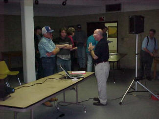
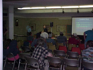
Above: NWS Spotter Training and Safety Course in McCook, Nebraska |
||
|
Links
|

 evere storm signatures. Skywarn volunteers learn about storm structure, cloud types that accompany thunderstorms, severe weather safety, how a severe thunderstorm is defined and the types of weather events that qualify for reporting. The combination of radar technology in the NWS office and human observers near or beneath the storms provide NWS Meteorologists with the best information for the issuance of warnings and followup statements. In addition, spotter reports ultimately become part of a national historical record of severe weather events and appear in the publication "Storm Data".