
Images & Animations
-
Credit
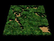
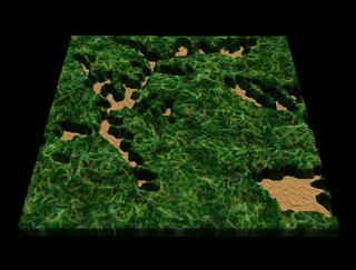
Panda Habitat Deforestation: Data
This animation uses a landsat texture, USGS dem data for elevation, and the Michigan State data for deforestation. Dissolve between 1965, 1974, and 1997 deforestation datasets.
1974 data
Metadata
-
Sensor
CORONA/Panoramic Camera -
Animation ID
2094 -
Video ID
SVS2001-0011 -
Start Timecode
01:01:13:00 -
End Timecode
01:02:08:22 -
Animator
Alex Kekesi, Lori Perkins -
Studio
SVS -
Visualization Date
2001/04/06 -
Scientist
Marc Linderman (Michigan State University) -
Datasets
DEM (30 meter) -
Keywords
Panda, Habitat, Landsat, Deforestation, Wolong -
Data Date
Landsat 5 TM (9/27/1997), MSS Landsat 1 (1/3/1974), Corona spy satellite imagery (1/20/1965) -
Animation Type
Regular