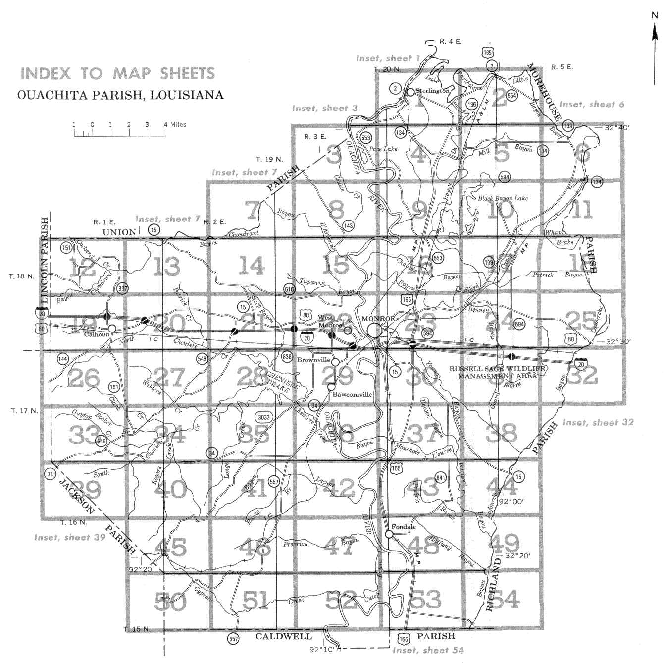
Ouachita Parish - Index To Map Sheets
Locate your area of interest on the illustration below.
Then click within the boundaries of that area to see the detailed soil map.
NOTE THAT EACH MAP SHEET CONSISTS OF TWO SCANS. CLICK ON THE LEFT OR RIGHT OF THE BOXED AREA AS APPROPRIATE.
Original soil survey map sheets were scanned at publication scale. Viewing scale and
printing scale, however, may vary from the original. Please rely on the bar scale on each
map sheet for proper map measurements. These maps are scanned and do not have the accuracy of standard soil maps.
Click here for the soil
legend and the conventional signs legend.
Land division corners are approximately positioned on these maps. Photobase
from 1970 aerial photography. Positions of 5,000-foot grid ticks are approximate
and based on the Louisana coordinate system, north zone. These soil survey maps
were compiled in 1971 as a part of a soil survey by the United States Department
of Agriculture, Soil Conservation Service, and the Louisiana Agricultural Experiment Station.
< Back to Louisiana Soil Survey
Manuscripts
|