
 |
 |
The HMS is an interactive processing system that allows the trained satellite analysts in the Satellite Analysis Branch (SAB), within the Satellite Services Division (SSD), to manually integrate data from various automated fire detection algorithms with GOES and polar (Advanced Very High Resolution Radiometer (AVHRR), Moderate Resolution Imaging Spectroradiometer Fire Algorithm (MODIS) and Defense Meteorological Satellite Program/Operational Linescan System (DMSP/OLS)) images. The result is a quality controlled display of the locations of fires and significant smoke plumes detected by meteorological satellites.
The most recent HMS product, and the automated layers used to create it, can best be viewed through our SSD Fire Web-GIS page.
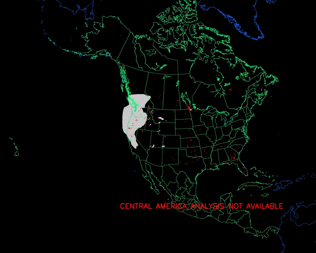
Related Products:Analysis for day 9/15/2008 last updated at 9/16/2008 2:39:16 GMT Fires are in red. Fire size has been increased so fires are visible in this large view. Smoke, when detected by the analyst, is in gray.
For the majority of the burning season which approximately covers the period from March through June, responsibility for analyzing fire locations and smoke extent over Mexico, Central America, Cuba, and the Bahamas will be assumed by the Mexican Meteorological Service (Sevicio Meteorologico Nacional). The analysis for these areas may not be available every day, particularly on the weekends and Mexican Holidays. In these cases and during the other months of the year outside of the burning season, NESDIS will perform the fire analysis over Cuba, the Bahamas, and northern Mexico and analyze significant smoke over the Gulf of Mexico and the eastern Pacific. Automated fire detection points for GOES(ABBA) , AVHRR(FIMMA) , and MODIS will still be available at all times.
The locations of any significant smoke-producing fires are fed daily to the Smoke Forecasting Demo Project at NOAA's Air Resources Lab. If you like this Demo please contact us, as we are collecting requirements to make this program operational.
A new pre-operational product, the GOES Aerosol/Smoke Product (GASP), is now available online.
The information on fire position should be used as a general guidance and for strategic planning. Tactical decisions, such as the activation of a response to fight these fires, should not be made without other information to corroborate the fire's existence and location. Users should note:
| Contact Address: SSDFireTeam@noaa.gov |
|
Contact Information: |
||
|
You are Here: http://www.ssd.noaa.gov/PS/FIRE/hms.html
|