

 Map Selection Menu
Select a week ending on a Saturday from the options below and click on "Submit" to display your selection.
BackgroundNCDC's Climate Monitoring Branch now produces weekly products to augment our standard monthly products. The maps on this web page are generated by the NOAA National Climatic Data Center from weekly data produced by the National Weather Service Climate Prediction Center. The most recent maps will be added within three days of the end of each week. For the more comprehensive suite of monthly monitoring products please refer to NCDC's monthly monitoring reports. An archive of the weekly data that go into these weekly maps can be obtained from the National Weather Service Climate Prediction Center.
Differences between these data and official monthly averagesMany climate monitoring activities at NOAA's National Climatic Data Center (NCDC) are based on analysis of monthly mean temperature. Data at this temporal scale are ideal for studying decadal to century-scale trends in the Earth's climate. In performing these analyses there are a number of different sources of temperature data that can be used. For analysis of nationally averaged temperatures, NCDC uses station data from the US Historical Climatology Network and the US Climate Division database. Current and historical data and time series graphs are available on the US Climate At A Glance website.
In addition to the traditional monthly means, customers have found an increasing need for temperatures averaged on a weekly basis. To meet this need, NCDC created this web page to provide weekly estimates of temperature averaged over each of nine US climate regions and for the nation as a whole. The source of these weekly estimates is NOAA's Climate Prediction Center (CPC). NCDC combines these weekly estimates to give a very preliminary estimate of what the month's climate anomalies may look like at the end of the month. However, the different data analyzed and different methodologies employed by the monthly vs. weekly approaches can result in values for the month using weekly data that are different from the values for the month using monthly data.
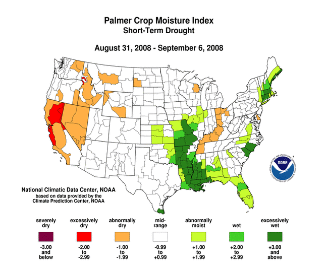
The data and methodology used by the CPC are based on daily temperature observations at several hundred first order airport stations across the country. These data are put through a linear regression analysis to create a daily gridded dataset of daily mean temperature. The gridded daily temperatures are averaged to compute daily divisional temperatures. The daily divisional temperatures are summed by CPC to compute weekly divisional temperatures for weeks ending on Saturday only. NCDC maps the CPC weekly divisional temperatures (and CPC's weekly divisional precipitation and Palmer indices) on this website. NCDC computes divisional weekly normal temperatures from 1971-2000 divisional daily normals, then takes the difference between the CPC weekly divisional temperatures and the weekly divisional normal temperatures to compute and map the weekly temperature anomaly (similarly, NCDC also computes and maps the weekly percent of normal divisional precipitation).
The weekly temperature anomalies also are combined to compute a month-to-date temperature anomaly to provide perspective on how average temperatures for the month as a whole are trending. Since the weekly data are for weeks ending only on Saturdays, some weeks will have a few days in one month and the rest of the days in the following month. For weeks that cross a month boundary, the anomaly is weighted by the number of days in the month (if x days of the week are in the month, then the weight is x/7). This estimated monthly temperature anomaly is added to the monthly normal temperature to compute a monthly temperature. If the monthly temperature anomaly is estimated before the month is over (based on data through day Y of the month), then the anomaly for the first through the Yth of the month is persisted through the end of the month and used as the monthly anomaly. The divisional temperatures are area-weighted to compute a national value. A first difference approach is used to compare the current month value to the historical values.
These estimates of month-to-date temperatures can differ from NCDC's official monthly statistics because a completely different set of stations and different methodology is used to compute the end-of-month statistics. In computing the official monthly statistics, monthly temperature data for more than one thousand Cooperative Network stations are analyzed. The temperature anomaly for each station is computed by subtracting the normal monthly temperature for each station from its monthly observed temperature. The monthly anomalies for all of the stations in each climate division are averaged to compute a monthly divisional temperature anomaly for each division. The divisional monthly anomaly is added to the divisional monthly normal temperature to compute the divisional monthly temperature. The divisional monthly temperatures are area-weighted to compute a national value. The current month values are compared directly to the historical values.
Because the differences in data sets and computational methods often result in differences between the month-to-date statistics which are based on weekly averages and the official monthly statistics, at some point in the future NCDC will transition from the use of CPC weekly averages in favor of an analysis method that more closely matches the analysis of official monthly means. For the latest official monthly averages for the nation, the nine US climate regions, the 48 contiguous US states, and selected cities, please visit NCDC's US Climate At A Glance website.
ContactsClimate Services Division
NOAA/National Climatic Data Center
151 Patton Avenue
Asheville, NC 28801-5001
fax: 828-271-4876
phone: 828-271-4800
email: info@ncdc.noaa.gov
For further information on the data presented here, contact:
David Wuertz
NOAA/National Climatic Data Center
151 Patton Avenue
Asheville, NC 28801-5001
fax: 828-271-4328
email: David.Wuertz@noaa.gov
-or-
Chief, Climate Monitoring Branch
NOAA/National Climatic Data Center
151 Patton Avenue
Asheville, NC 28801-5001
fax: 828-271-4876
email: cmb.contact@noaa.gov