National Water Information System: Web Interface

  USGS Water Resources    


News: Recent changes

USGS Real-Time Water Data for Maryland

All Data Times In MD-DE-DC Are Eastern Standard Time


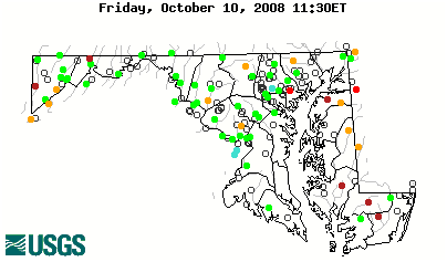
Daily Streamflow Conditions

Select a site to retrieve data and station information.
Stream gage levels in Maryland, relative to 30 year average. 01661500: Flow=29cfs,Stage=1.82ft,2008-09-17 06:30,>90,ST MARYS RIVER AT GREAT MILLS, MD 01650500: Flow=1.7cfs,Stage=1.51ft,2008-09-17 04:45,<10,NW BRANCH ANACOSTIA RIVER NEAR COLESVILLE, MD 01490000: Flow=2.6cfs,Stage=-0.21ft,2008-09-17 06:15,<10,CHICAMACOMICO RIVER NEAR SALEM, MD 01652500: Flow=22cfs,Stage=4.31ft,2008-09-17 07:00,76-90,FOURMILE RUN AT ALEXANDRIA, VA 01600000: Flow=325cfs,Stage=1.50ft,2008-09-17 06:15,76-90,NORTH BRANCH POTOMAC RIVER AT PINTO, MD 01596500: Flow=14cfs,Stage=1.18ft,2008-09-17 06:15,76-90,SAVAGE RIVER NEAR BARTON, MD 01485500: Flow=22cfs,Stage=2.13ft,2008-09-17 06:00,76-90,NASSAWANGO CREEK NEAR SNOW HILL, MD 01648000: Flow=9.5cfs,Stage=1.75ft,2008-09-17 06:15,10-24,ROCK CREEK AT SHERRILL DRIVE WASHINGTON, DC 01636500: Flow=557cfs,Stage=1.48ft,Floodstage=13.5ft,2008-09-17 07:30,10-24,SHENANDOAH RIVER AT MILLVILLE, WV 01591000: Flow=7.3cfs,Stage=1.91ft,2008-09-17 04:15,10-24,PATUXENT RIVER NEAR UNITY, MD 01589440: Flow=7.2cfs,Stage=3.19ft,2008-09-17 06:45,10-24,JONES FALLS AT SORRENTO, MD 01585500: Flow=0.38cfs,Stage=1.30ft,2008-09-17 04:30,10-24,CRANBERRY BRANCH NEAR WESTMINSTER, MD 01585100: Flow=0.91cfs,Stage=3.24ft,2008-09-17 06:30,10-24,WHITEMARSH RUN AT WHITE MARSH, MD 01581700: Flow=13cfs,Stage=1.51ft,2008-09-17 04:00,10-24,WINTERS RUN NEAR BENSON, MD 01493500: Flow=2.8cfs,Stage=1.25ft,2008-09-17 06:00,10-24,MORGAN CREEK NEAR KENNEDYVILLE, MD 01493000: Flow=8.1cfs,Stage=1.82ft,2008-09-17 06:15,10-24,UNICORN BRANCH NEAR MILLINGTON, MD 01491000: Flow=13cfs,Stage=2.05ft,2008-09-17 06:15,10-24,CHOPTANK RIVER NEAR GREENSBORO, MD 01488500: Flow=6.2cfs,Stage=2.29ft,2008-09-17 06:00,10-24,MARSHYHOPE CREEK NEAR ADAMSVILLE, DE 01486500: Flow=5.7cfs,Stage=1.03ft,2008-09-17 06:15,10-24,BEAVERDAM CREEK NEAR SALISBURY, MD 03078000: Flow=13cfs,Stage=0.83ft,2008-09-17 03:00,25-75,CASSELMAN RIVER AT GRANTSVILLE, MD 03076600: Flow=13cfs,Stage=0.97ft,2008-09-17 06:30,25-75,BEAR CREEK AT FRIENDSVILLE, MD 03075500: Flow=21cfs,Stage=1.95ft,2008-09-17 06:15,25-75,YOUGHIOGHENY RIVER NEAR OAKLAND, MD 03066000: Flow=16cfs,Stage=1.32ft,Floodstage=20.0ft,2008-09-17 06:00,25-75,BLACKWATER R AT DAVIS, WV 01661050: Flow=0.85cfs,Stage=0.71ft,2008-09-17 06:30,25-75,ST CLEMENT CREEK NEAR CLEMENTS, MD 01653600: Flow=2.9cfs,Stage=2.32ft,2008-09-17 06:30,25-75,PISCATAWAY CREEK AT PISCATAWAY, MD 01653000: Flow=37cfs,Stage=1.52ft,2008-09-17 07:30,25-75,CAMERON RUN AT ALEXANDRIA, VA 01651000: Flow=13cfs,Stage=1.26ft,2008-09-17 06:30,25-75,NW BRANCH ANACOSTIA RIVER NEAR HYATTSVILLE, MD 01649500: Flow=18cfs,Stage=1.25ft,2008-09-17 05:15,25-75,NORTH EAST BRANCH ANACOSTIA RIVER AT RIVERDALE, MD 01646500: Flow=2400cfs,Stage=2.91ft,Floodstage=10.0ft,2008-09-17 06:45,25-75,POTOMAC RIVER NEAR WASH, DC LITTLE FALLS PUMP STA 01646000: Flow=16cfs,Stage=2.84ft,2008-09-17 07:15,25-75,DIFFICULT RUN NEAR GREAT FALLS, VA 01645000: Flow=56cfs,Stage=1.99ft,Floodstage=7.5ft,2008-09-17 04:30,25-75,SENECA CREEK AT DAWSONVILLE, MD 01643500: Flow=17cfs,Stage=1.58ft,2008-09-17 06:30,25-75,BENNETT CREEK AT PARK MILLS, MD 01643000: Flow=219cfs,Stage=1.75ft,Floodstage=15.0ft,2008-09-17 03:45,25-75,MONOCACY RIVER AT JUG BRIDGE NEAR FREDERICK, MD 01639000: Flow=6.6cfs,Stage=2.01ft,2008-09-17 06:30,25-75,MONOCACY RIVER AT BRIDGEPORT, MD 01638500: Flow=2980cfs,Stage=1.66ft,Floodstage=16.0ft,2008-09-17 06:45,25-75,POTOMAC RIVER AT POINT OF ROCKS, MD 01638480: Flow=21cfs,Stage=2.83ft,2008-09-17 07:30,25-75,CATOCTIN CREEK AT TAYLORSTOWN, VA 01637500: Flow=16cfs,Stage=1.63ft,2008-09-17 04:30,25-75,CATOCTIN CREEK NEAR MIDDLETOWN, MD 01617800: Flow=6.9cfs,Stage=1.08ft,2008-09-17 06:15,25-75,MARSH RUN AT GRIMES, MD 01614500: Flow=153cfs,Stage=1.64ft,Floodstage=8.0ft,2008-09-17 06:30,25-75,CONOCOCHEAGUE CREEK AT FAIRVIEW, MD 01613000: Flow=801cfs,Stage=3.06ft,Floodstage=30.0ft,2008-09-17 06:15,25-75,POTOMAC RIVER AT HANCOCK, MD 01611500: Flow=82cfs,Stage=1.39ft,2008-09-17 07:00,25-75,CACAPON RIVER NEAR GREAT CACAPON, WV 01610000: Flow=592cfs,Stage=3.86ft,Floodstage=25.0ft,2008-09-17 06:15,25-75,POTOMAC RIVER AT PAW PAW, WV 01604500: Flow=14cfs,Stage=2.72ft,2008-09-17 07:30,25-75,PATTERSON CREEK NEAR HEADSVILLE, WV 01603000: Flow=372cfs,Stage=2.55ft,Floodstage=17.0ft,2008-09-17 06:15,25-75,NORTH BRANCH POTOMAC RIVER NEAR CUMBERLAND, MD 01601500: Flow=30cfs,Stage=1.73ft,Floodstage=10.0ft,2008-09-17 06:00,25-75,WILLS CREEK NEAR CUMBERLAND, MD 01598500: Flow=305cfs,Stage=2.47ft,Floodstage=10.5ft,2008-09-17 06:15,25-75,NORTH BRANCH POTOMAC RIVER AT LUKE, MD 01597500: Flow=60cfs,Stage=0.78ft,2008-09-17 06:15,25-75,SAVAGE RIV BL SAVAGE RIV DAM NEAR BLOOMINGTON, MD 01595500: Flow=58cfs,Stage=2.01ft,Floodstage=9.0ft,2008-09-17 06:15,25-75,NORTH BRANCH POTOMAC RIVER AT KITZMILLER, MD 01595200: Flow=8.9cfs,Stage=1.74ft,2008-09-17 07:00,25-75,STONY RIVER NEAR MOUNT STORM,WV 01595000: Flow=31cfs,Stage=2.14ft,2008-09-17 06:15,25-75,NORTH BRANCH POTOMAC RIVER AT STEYER, MD 01594000: Flow=22cfs,Stage=3.04ft,2008-09-17 04:00,25-75,LITTLE PATUXENT RIVER AT SAVAGE, MD 01593500: Flow=9.7cfs,Stage=2.31ft,2008-09-17 06:15,25-75,LITTLE PATUXENT RIVER AT GUILFORD, MD 01589500: Flow=3.4cfs,Stage=1.89ft,2008-09-17 04:30,25-75,SAWMILL CREEK AT GLEN BURNIE, MD 01589330: Flow=0.73cfs,Stage=0.64ft,2008-09-17 04:40,25-75,DEAD RUN AT FRANKLINTOWN, MD 01589300: Flow=9.1cfs,Stage=0.80ft,2008-09-17 06:30,25-75,GWYNNS FALLS AT VILLA NOVA, MD 01586000: Flow=22cfs,Stage=1.39ft,2008-09-17 04:30,25-75,NORTH BRANCH PATAPSCO RIVER AT CEDARHURST, MD 01585200: Flow=0.40cfs,Stage=0.86ft,2008-09-17 06:05,25-75,WEST BRANCH HERRING RUN AT IDLEWYLDE, MD 01584050: Flow=3.2cfs,Stage=1.00ft,2008-09-17 06:15,25-75,LONG GREEN CREEK AT GLEN ARM, MD 01583500: Flow=25cfs,Stage=0.34ft,2008-09-17 04:15,25-75,WESTERN RUN AT WESTERN RUN, MD 01582000: Flow=27cfs,Stage=0.30ft,2008-09-17 06:15,25-75,LITTLE FALLS AT BLUE MOUNT, MD 01581500: Flow=1.8cfs,Stage=0.58ft,2008-09-17 04:30,25-75,BYNUM RUN AT BEL AIR, MD 01580000: Flow=43cfs,Stage=2.03ft,2008-09-17 04:00,25-75,DEER CREEK AT ROCKS, MD 01495000: Flow=23cfs,Stage=2.14ft,2008-09-17 06:45,25-75,BIG ELK CREEK AT ELK MILLS, MD 01486000: Flow=0.69cfs,Stage=0.94ft,2008-09-17 06:15,25-75,MANOKIN BRANCH NEAR PRINCESS ANNE, MD 01485000: Flow=9.4cfs,Stage=3.65ft,2008-09-17 06:45,25-75,POCOMOKE RIVER NEAR WILLARDS, MD 01479000: Flow=36cfs,Stage=4.85ft,Floodstage=13.0ft,2008-09-17 06:15,25-75,WHITE CLAY CREEK NEAR NEWARK, DE 01478000: Flow=6.0cfs,Stage=4.29ft,2008-09-17 06:15,25-75,CHRISTINA RIVER AT COOCHS BRIDGE, DE 0158397967: Flow=0.69cfs,Stage=3.80ft,2008-09-17 04:25,Not ranked,MINEBANK RUN NEAR GLEN ARM, MD 0148471320: Flow=0.46cfs,Stage=2.84ft,2008-09-17 05:45,Not ranked,BIRCH BRANCH AT SHOWELL, MD 03076500: Flow=76cfs,Stage=2.20ft,2008-09-17 06:45,Not ranked,YOUGHIOGHENY RIVER AT FRIENDSVILLE, MD 03075905: Flow=2.9cfs,Stage=2.09ft,2008-09-17 06:15,Not ranked,CHERRY CREEK AT STATE PARK ROAD NEAR MCHENRY, MD 03075800: Flow=0.11cfs,Stage=2.68ft,2008-09-17 06:15,Not ranked,POLAND RUN NEAR SWANTON, MD 03065400: Flow=11cfs,Stage=0.89ft,2008-09-17 07:30,Not ranked,BLACKWATER R NR DAVIS,WV 01660920: Flow=0.75cfs,Stage=1.28ft,2008-09-17 06:30,Not ranked,ZEKIAH SWAMP RUN NEAR NEWTOWN, MD 01660795: Stage=1.25ft,2008-09-17 06:54:00,Not ranked,POTOMAC RIVER NEAR NEWBURG, MD 01658000: Flow=0.24cfs,Stage=1.90ft,2008-09-17 04:15,Not ranked,MATTAWOMAN CREEK NEAR POMONKEY, MD 01651800: Flow=0.91cfs,Stage=-0.68ft,2008-09-17 06:15,Not ranked,WATTS BRANCH AT WASHINGTON, DC 01651750: Not ranked,ANACOSTIA RIVER AQUATIC GARDENS AT WASHINGTON, DC 01649190: Flow=1.2cfs,Stage=1.40ft,2008-09-17 04:45,Not ranked,PAINT BRANCH NEAR COLLEGE PARK, MARYLAND 01649150: Flow=0.20cfs,Stage=1.67ft,2008-09-17 04:45,Not ranked,PAINT BRANCH TRIBUTARY NEAR COLESVILLE, MD 01647850: Flow=0.33cfs,Stage=1.38ft,2008-09-17 06:45,Not ranked,TURKEY BRANCH NEAR ROCKVILLE, MD 01647600: Stage=3.61ft,2008-09-17 06:54:00,Floodstage=7.0ft,Not ranked,POTOMAC RIVER AT WISCONSIN AVE, WASHINGTON, DC 01646305: 0000-00-00 00:00,Stage=1.16ft,2008-09-17 07:00:00,Not ranked,Rating being developed or revised,DEAD RUN AT WHANN AVENUE NEAR MCLEAN, VA 01644375: Flow=1.1cfs,Stage=0.56ft,2008-09-17 05:00,Not ranked,LITTLE SENECA CREEK TRIBUTARY NEAR GERMANTOWN, MD 01644372: Flow=0.04cfs,Stage=4.54ft,2008-09-17 04:40,Not ranked,LITTLE SENECA CREEK TRIBUTARY AT BRINK, MD 01644371: Flow=0.32cfs,Stage=3.24ft,2008-09-17 04:55,Not ranked,LITTLE SENECA CREEK TRIBUTARY NEAR CLARKSBURG, MD 01644280: Flow=21cfs,Stage=2.37ft,2008-09-17 07:30,Not ranked,BROAD RUN NEAR LEESBURG, VA 01643590: Flow=1.9cfs,Stage=0.54ft,2008-09-17 07:45,Not ranked,LIMESTONE BRANCH NEAR LEESBURG, VA 01643395: Flow=0.42cfs,Stage=0.30ft,2008-09-17 04:40,Not ranked,SOPER BRANCH AT HYATTSTOWN, MD 01642438: Stage=2.81ft,2008-09-17 06:45,Not ranked,Rating being developed or revised,LINGANORE CREEK NEAR LIBERTYTOWN, MD 01642190: Flow=170cfs,Stage=1.65ft,2008-09-17 04:45,Not ranked,MONOCACY RIVER AT MONOCACY BLVD AT FREDERICK, MD 01638595: Stage=3.83ft,2008-09-17 06:45:00,Not ranked,POTOMAC RIVER AT TUSCARORA, MD 01638420: Flow=2.6cfs,Stage=1.77ft,2008-09-17 07:15,Not ranked,N F CATOCTIN CREEK AT RT 681 NEAR WATERFORD, VA 01638350: Flow=6.4cfs,Stage=1.68ft,2008-09-17 07:15,Not ranked,S F CATOCTIN CREEK AT RT 698 NEAR WATERFORD, VA 01636690: Flow=2.1cfs,Stage=0.95ft,2008-09-17 07:15,Not ranked,PINEY RUN NEAR LOVETTSVILLE, VA 01620000: Not ranked,POTOMAC RIVER AT HARPERS FERRY, WV 01619500: 2008-09-12 12:00,Not ranked,Equipment malfunction,ANTIETAM CREEK NEAR SHARPSBURG, MD 01619000: Flow=45cfs,Stage=2.30ft,2008-09-17 06:45,Not ranked,ANTIETAM CREEK NEAR WAYNESBORO, PA 01618100: 0000-00-00 00:00,Stage=0.79ft,2008-09-17 07:30:00,Not ranked,ROCKYMARSH RUN AT SCRABBLE, WV 01614060: Stage=2.12ft,2008-09-17 06:45:00,Not ranked,POTOMAC RIVER AT WILLIAMSPORT, MD 01613525: Flow=33cfs,Stage=1.93ft,2008-09-17 06:00,Not ranked,LICKING CREEK AT PECTONVILLE, MD 01613095: Flow=8.0cfs,Stage=1.98ft,2008-09-17 06:45,Not ranked,TONOLOWAY CREEK NEAR HANCOCK, MD 01613020: Stage=43.93ft,2008-09-17 07:00:00,Not ranked,UNNAMED TRIB TO WARM SPR RUN NR BERKELEY SPR, WV 01610155: Flow=4.0cfs,Stage=0.70ft,2008-09-17 06:00,Not ranked,SIDELING HILL CREEK NEAR BELLEGROVE, MD 01609000: Flow=9.6cfs,Stage=1.90ft,2008-09-17 06:30,Not ranked,TOWN CREEK NEAR OLDTOWN, MD 01605002: Stage=20.81ft,2008-09-17 07:30:00,Not ranked,PAINTER RUN NEAR FORT ASHBY, WV 01599000: 2008-09-14 16:00,Not ranked,Equipment malfunction,GEORGES CREEK AT FRANKLIN, MD 01598650: Flow=0.50cfs,Stage=1.75ft,2008-09-17 06:35,Not ranked,SAND SPRING RUN AT FROSTBURG, MD 01595800: Flow=225cfs,Stage=2.99ft,2008-09-17 06:15,Not ranked,NORTH BRANCH POTOMAC RIVER AT BARNUM, WV 01594526: Flow=13cfs,Stage=1.19ft,2008-09-17 04:15,Not ranked,WESTERN BRANCH AT UPPER MARLBORO, MD 01594440: 2008-09-17 04:15,Not ranked,Equipment malfunction,PATUXENT RIVER NEAR BOWIE, MD 01592500: Flow=20cfs,Stage=4.39ft,2008-09-17 04:30,Not ranked,PATUXENT RIV NEAR LAUREL, MD 01591700: Flow=4.7cfs,Stage=0.64ft,2008-09-17 04:30,Not ranked,HAWLINGS RIVER NEAR SANDY SPRING, MD 01591610: Flow=56cfs,Stage=1.77ft,2008-09-17 04:15,Not ranked,PATUXENT RIVER BELOW BRIGHTON DAM NEAR BRIGHTON,MD 01589795: Flow=0.24cfs,Stage=3.71ft,2008-09-17 04:35,Not ranked,SOUTH FORK JABEZ BRANCH AT MILLERSVILLE, MD 01589352: Flow=22cfs,Stage=1.70ft,2008-09-17 06:25,Not ranked,GWYNNS FALLS AT WASHINGTON BLVD AT BALTIMORE, MD 01589351: 0000-00-00 00:00,Stage=1.02ft,2008-09-17 06:50:00,Not ranked,Rating being developed or revised,MAIDENS CHOICE RUN AT WILKENS AVE AT BALTIMORE, MD 01589320: Flow=0.33cfs,Stage=2.58ft,2008-09-17 06:15,Not ranked,DEAD RUN TRIBUTARY AT WOODLAWN, MD 01589317: Flow=0.23cfs,Stage=0.67ft,2008-09-17 06:40,Not ranked,TRIBUTARY TO DEAD RUN TRIBUTARY AT WOODLAWN, MD 01589316: 0000-00-00 00:00,Stage=0.13ft,2008-09-17 06:55:00,Not ranked,Rating being developed or revised,DEAD RUN TRIBUTARY NEAR WOODLAWN, MD 01589315: Flow=0.78cfs,Stage=0.26ft,2008-09-17 06:25,Not ranked,DEAD RUN AT WOODLAWN, MD 01589312: Flow=0.05cfs,Stage=0.31ft,2008-09-17 06:15,Not ranked,DEAD RUN NEAR CATONSVILLE, MD 01589305: Flow=0.87cfs,Stage=2.27ft,2008-09-17 04:30,Not ranked,POWDER MILL RUN NEAR LOCHEARN, MD 01589290: Flow=0.60cfs,Stage=0.95ft,2008-09-17 04:30,Not ranked,SCOTTS LEVEL BRANCH AT ROCKDALE, MD 01589242: Stage=1.68ft,2008-09-17 06:40,Not ranked,Rating being developed or revised,HORSEHEAD BRANCH NEAR OWINGS MILLS, MD 01589240: Flow=7.5cfs,Stage=1.94ft,2008-09-17 06:45,Not ranked,GWYNNS FALLS AT MCDONOGH, MD 01589238: Flow=0.007cfs,Stage=0.20ft,2008-09-17 04:30,Not ranked,GWYNNS FALLS TRIBUTARY AT MCDONOGH, MD 01589230: 2008-09-16 15:40,Stage=1.18ft,2008-09-17 06:45:00,Not ranked,Rating being developed or revised,RED RUN NEAR OWINGS MILLS, MD 01589197: Flow=1.4cfs,Stage=0.08ft,2008-09-17 05:00,Not ranked,GWYNNS FALLS NEAR DELIGHT, MD 01589180: Flow=0.00cfs,Stage=0.77ft,2008-09-17 04:30,Not ranked,GWYNNS FALLS AT GLYNDON, MD 01586210: Flow=20cfs,Stage=0.65ft,2008-09-17 04:30,Not ranked,BEAVER RUN NEAR FINKSBURG, MD 01585230: Flow=0.25cfs,Stage=1.58ft,2008-09-17 04:56,Not ranked,MOORES RUN AT RADECKE AVE AT BALTIMORE, MD 01585225: Flow=0.04cfs,Stage=2.46ft,2008-09-17 04:15,Not ranked,MOORES RUN TRIB. NEAR TODD AVE AT BALTIMORE, MD 01585104: Flow=0.41cfs,Stage=0.53ft,2008-09-17 04:15,Not ranked,HONEYGO RUN NEAR WHITE MARSH, MD 01585095: Flow=0.00cfs,Stage=0.72ft,2008-09-17 04:15,Not ranked,NORTH FORK WHITEMARSH RUN NEAR WHITE MARSH, MD 01585090: Flow=0.99cfs,Stage=1.50ft,2008-09-16 21:05,Not ranked,WHITEMARSH RUN NEAR FULLERTON, MD 01583600: Flow=10cfs,Stage=1.36ft,2008-09-17 04:30,Not ranked,BEAVERDAM RUN AT COCKEYSVILLE, MD 01583580: Flow=0.45cfs,Stage=1.14ft,2008-09-17 06:15,Not ranked,BAISMAN RUN AT BROADMOOR, MD 01583570: Flow=0.071cfs,Stage=1.20ft,2008-09-17 06:30,Not ranked,POND BRANCH AT OREGON RIDGE, MD 01583100: Flow=7.8cfs,Stage=1.42ft,2008-09-17 04:15,Not ranked,PINEY RUN AT DOVER, MD 01582500: Flow=103cfs,Stage=0.96ft,2008-09-17 04:15,Not ranked,GUNPOWDER FALLS AT GLENCOE, MD 01581960: Flow=6.0cfs,Stage=0.62ft,2008-09-17 04:15,Not ranked,BEETREE RUN AT BENTLEY SPRINGS, MD 01581920: Flow=68cfs,Stage=1.76ft,2008-09-17 06:15,Not ranked,GUNPOWDER FALLS NEAR PARKTON, MD 01581830: Flow=3.0cfs,Stage=0.12ft,2008-09-17 03:45,Not ranked,GRAVE RUN NEAR BECKLEYSVILLE, MD 01581757: Flow=18cfs,Stage=0.85ft,2008-09-17 04:00,Not ranked,OTTER POINT CREEK NEAR EDGEWOOD, MD 01581752: Flow=0.70cfs,Stage=0.98ft,2008-09-17 04:15,Not ranked,PLUMTREE RUN NEAR BEL AIR, MD 01581649: Flow=1.5cfs,Stage=2.74ft,2008-09-17 06:45,Not ranked,JAMES RUN NEAR BELCAMP, MD 01580700: Flow=0.71cfs,Stage=2.62ft,2008-09-17 06:15,Not ranked,SWAN CREEK AT SWAN CREEK, MD 01580520: Flow=79cfs,Stage=1.16ft,2008-09-17 04:00,Not ranked,DEER CREEK NEAR DARLINGTON, MD 01578475: Flow=113cfs,Stage=2.73ft,2008-09-17 07:45,Not ranked,Octoraro Creek near Richardsmere, MD 01578310: Flow=3510cfs,Stage=8.92ft,Floodstage=23.5ft,2008-09-17 06:30,Not ranked,SUSQUEHANNA RIVER AT CONOWINGO, MD 01494150: Flow=1.1cfs,Stage=0.43ft,2008-09-17 06:00,Not ranked,THREE BRIDGES BRANCH AT CENTREVILLE, MARYLAND 01492500: Flow=2.2cfs,Stage=0.96ft,2008-09-17 06:15,Not ranked,SALLIE HARRIS CREEK NEAR CARMICHAEL, MD 01491500: Flow=15cfs,Stage=0.96ft,2008-09-17 06:45,Not ranked,TUCKAHOE CREEK NEAR RUTHSBURG, MD 01490140: Flow=-406cfs,2008-09-17 06:36,Stage=0.22ft,2008-09-17 06:42:00,Not ranked,LITTLE BLACKWATER RIVER AT SEWARD, MD 01490120: Stage=1.58ft,2008-09-17 06:42:00,Not ranked,LITTLE BLACKWATER RIVER NR CAMBRIDGE, MD 01488110: Stage=1.78ft,2008-09-17 06:42:00,Not ranked,NANTICOKE RIVER AT SHARPTOWN, MD 01484719: Flow=0.30cfs,Stage=11.53ft,2008-09-17 04:30,Not ranked,BASSETT CREEK NEAR IRONSHIRE, MD 01484701: Stage=0.50ft,2008-09-17 06:36:00,Not ranked,LITTLE ASSAWOMAN BAY AT FENWICK ISLAND, DE 01484696: Stage=0.64ft,2008-09-17 06:36:00,Not ranked,JEFFERSON CREEK AT SOUTH BETHANY, DE 01483155: Flow=1.9cfs,Stage=0.49ft,2008-09-17 06:00,Not ranked,SILVER LAKE TRIBUTARY AT MIDDLETOWN, DE 01478650: Flow=30cfs,Stage=5.96ft,Floodstage=11.5ft,2008-09-17 06:15,Not ranked,WHITE CLAY CREEK AT NEWARK, DE 01478245: Flow=28cfs,Stage=2.93ft,Floodstage=9.5ft,2008-09-17 07:30,Not ranked,White Clay Creek near Strickersville, PA
Explanation
[color code for] High
[color code for] > 90th percentile
[color code for] 75th - 89th percentile
[color code for] 25th - 74th percentile
[color code for] 10th - 24th percentile
[color code for] < 10th percentile
[color code for] Low
[color code for] Not ranked
The colored dots on this map depict streamflow conditions as a percentile, which is computed from the period of record for the current day of the year. Only stations with at least 30 years of record are used.
The gray circles indicate other stations that were not ranked in percentiles either because they have fewer than 30 years of record or because they report parameters other than streamflow. Some stations, for example, measure stage only.


NOTICE (08/11/2008) --Data collection at the following gages will be discontinued on September 30, 2008 due to funding reductions from partner agencies. Although historic data will remain accessible, no new data will be collected unless one or more new funding partners are found. Users who can contribute funding for the non-Federal share of costs to continue operation of these streamgages should contact Jim Gerhart, Director of the USGS Maryland-Delaware-DC Water Science Center at (443-498-5501, jgerhart@usgs.gov).
Gage Number Stream Gage Name Length of Record Comment
01595500 North Branch Potomac River at Kitzmiller, MD 28 years Just QW (specific conductance, temperature, pH)
01595800 North Branch Potomac River at Barnum, WV 28 years Just QW (specific conductance, temperature, pH)
01596500 Savage River near Barton, MD 60 years
01598500 North Branch Potomac River at Luke, MD 23 years Just QW (specific conductance, temperature, pH)
01600000 North Branch Potomac River at Pinto, MD 70 years
01613000 Potomac River at Hancock, MD 76 years
01651750 Anacostia River Aquatic Gardens at Washington, DC 4 years Discontinued on May 15, 2008.
01614060 Potomac River At Williamsport, MD 1.5 years
01638595 Potomac River At Tuscarora, MD 9 months

Statewide Streamflow Table


Statewide Ground-Water Table


Statewide Water-Quality Table


Real-time data typically are recorded at 15-60 minute intervals, stored onsite, and then transmitted to USGS offices every 1 to 4 hours, depending on the data relay technique used. Recording and transmission times may be more frequent during critical events. Data from real-time sites are relayed to USGS offices via satellite, telephone, and/or radio and are available for viewing within minutes of arrival. All real-time data are provisional and subject to revision.
Build Table Build a custom summary table for one or more stations.
Build Sequence Build a custom sequence of graphical or tabular data for one or more stations.

Questions about sites/data? Top
Feedback on this web site Explanation of terms
  Subscribe to NWISWeb notifications
Automated retrievals

Accessibility FOIA Privacy Policies and Notices

Take Pride in America logo USA.gov logo U.S. Department of the Interior | U.S. Geological Survey
Title: USGS Real-Time Water Data for Maryland
URL: http://waterdata.usgs.gov/md/nwis/rt?

Page Contact Information: Maryland NWISWeb Maintainer
Page Last Modified: 2008-09-17 09:28:51 EDT
0.74   0.72 sd04