|
Climate of the Interior West: Drought/Flood Monitoring | |
| Description | Sample Product |
|---|
-
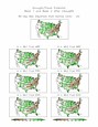
Current drought monitor
-
From the National Drought Mitigation Center. Current drought conditions, analysis and forecasts. The center's webpages also include extensive background on droughts, their causes and drought impact.
|

|
-
CPC US
Drought Assessment
-
Various products relating to real-time precipitation monitoring
and future drought/flood potential.
|
|
-
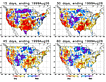
High Plains Regional Climate Center Precipitation
Plots
-
Various precipitation maps on time scales from one day ago to 2 years ago. Totals, departures from normal and percent of normal are available for the US as a whole or subregions of the US. Easy to use.
|
|
-
PSD: Recent Western US Precipitation
-
Users can plots maps of accumulated precipitation for the western US. Overlays of topography, counties, rivers, climate divisions, and hydrologic regions
relationships can be added. A similar page allows users to plot line plots of accumulated precipitation for a selected location.
|
|
-
PSD US drought monitoring page
-
Regions of recent and ongoing drought are analyzed
with respect to climate processes and historical
relationships.
|
|
-
CPC
precipitation monitoring
-
Users can select stations for various regions around the
globe including the Southwest U.S.
for accumulated precipitation and precipitation deficits over
timescales of 30, 90 and 365 days. Maps are also available.
|

|
-
Western Snowpack (SNOTEL) Map based access and Station based access
-
Snotel products include maps and reports on SNOTEL station
snowpack, precipitation and temperature. Both current and historic
data are available.
|

|
-
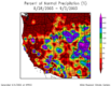
Western State River Basins
-
Colorado River Basin.
Arkansas River Basin.
Missouri River Basin (subpage of the Riverwatch page for the Mississippi basin).
Northwest River Basin.
West Gulf River Basin.
California/Nevada River Forecast Center.
River forecasts, weather information, climatologies and related information are available from these forecasts centers.
|

Map of River Basins
|
-
US Water Supply Outlook NRCS
-
A collection of products including reservoir and river supply/forecasts,
precipitation, snowpack and other information relating to water supply.
Information is divided by type and by region.
|

|
-
NWS's Riverwatch
-
A collection of links to river forecasts for the Mississippi River Basin.
|
|


