

Images & Animations
-
Credit
Jeff Schmaltz, MODIS Rapid Response Team, NASA/GSFC
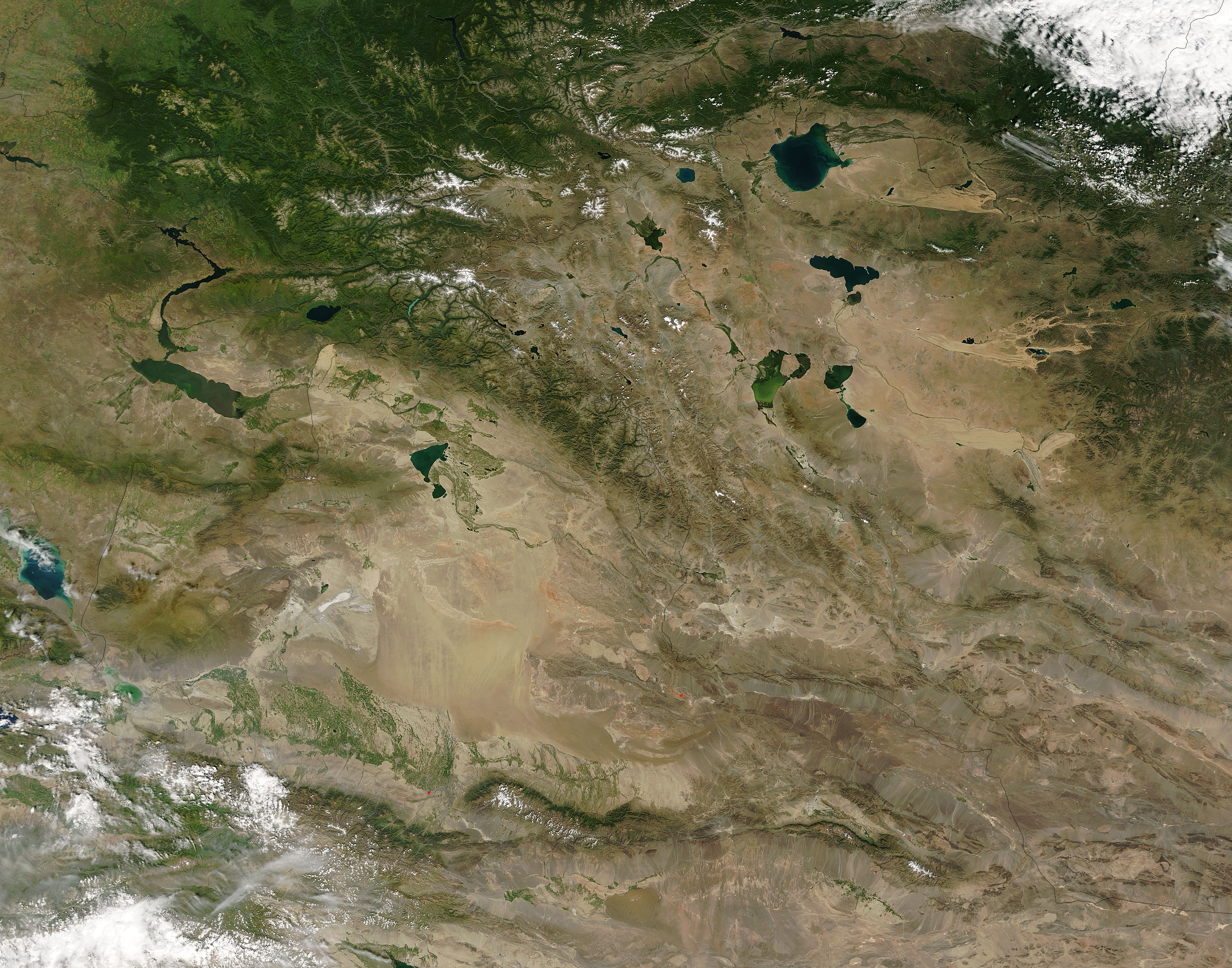
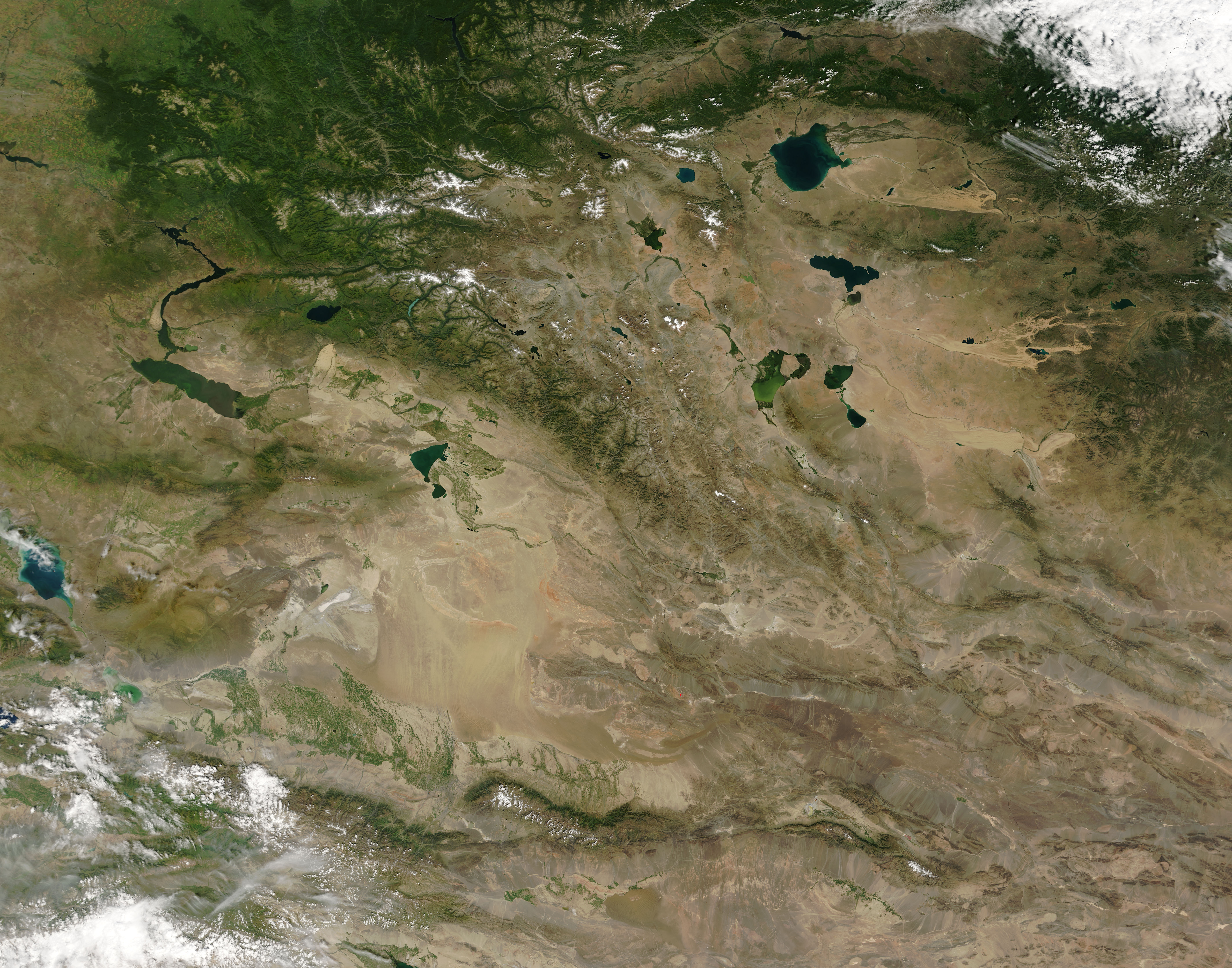
The Altay Mountains wrinkle the border where Kazakhstan (left), Russia (top), Mongolia (right), and China (bottom) meet on the upper left side of this image. In the north, the mountains are covered with deep green forest and capped with snow above the tree line. The mountains form a natural barrier between the four nations and between several different climate regions. Steppes, tundra, forest, and desert surround the mountains. Melting snow flows off the mountains into rivers, which feed several of the large lakes visible throughout the image. A web of green irrigated crop land surrounds many of the lakes, particularly in China and Kazakhstan.
In China, the agricultural land surrounds Ulungur Lake just beyond the point that green of the mountains gives way to desert. The dusty expanse between Ulungur Lake and the green strip formed by the Tian Shan along the lower edge of the image is the Junggar Pendi or Dzungarian Basin. Dzungar is the name of a Mongol tribe that once ruled the region. Wind-blown dust has scoured long lines into center of the basin. On the southern side of the basin, green irrigated crops stretch into the desert. The water for these crops comes from snowfall in the Tian Shan.
The Moderate Resolution Imaging Spectroradiometer (MODIS) on NASA’s Terra satellite acquired this image on August 16, 2005.
Metadata
-
Sensor
Terra/MODIS -
Visualization Date
2005-08-16