
Northern Rocky Mountain Science Center (NOROCK)
Home | About Us | Science | Product Library | News & Events | Staff | Students | Partners | Contact Us
Northern Rocky Mountain Science Center (NOROCK)
Home | About Us | Science | Product Library | News & Events | Staff | Students | Partners | Contact Us
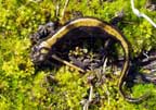
Long-toed salamander (Stephen Corn)
These materials prepared by the Climate Change in Mountain Ecosystems Program -- U.S. Geological Survey, Glacier Field Station. Dan Fagre, Program Coordinator, email: dan_fagre@usgs.gov. For more information, visit the Glacier Field Station - Climate Change in Mountain Ecosystems program (CCME) web site.

The Flattop Mountain SNOTEL (SNOw TELemetry) station is one of nearly 600 similar stations operated throughout the western United States by the Natural Resources Conservations Service (NRCS, U.S. Department of Agriculture). These stations measure and record Snow Water Equivalent (SWE), which is the weight of snow water equivalent to inches of water. Most SNOTEL sites also measure temperature and precipitation; many now measure snow depth as well. Various agencies and organizations use the data from the stations to forecast water availability, floods, and avalanche hazard.
The Flattop Mountain SNOTEL station has operated since October 1st, 1969. To help calculate water storage and availability during agricultural growing seasons, the data are compiled by water year; a water year runs from 1 October - 30 September. SWE records from the station extend for 33 water years (1970-2002). Precipitation records from the station start water year 1979, with temperature records starting water year 1983.
 The Flattop Mountain SNOTEL station is located at approximately 6300 feet in elevation on Flattop Mountain, a high plateau between the Lewis and Livingston Ranges in Glacier National Park, Montana. The site is three air miles south of the Continental Divide. During the winter, complex combinations of weather and terrain determine snowfall at the site. Westerly weather systems dominate, bringing moisture from the Gulf of Alaska or Pacific Ocean. Less frequent northerly systems spill drier Arctic air through passes on the Continental Divide as
they slide south along the Rocky Mountain Front. Flattop Mountain's position between the Livingston and Lewis Ranges amplifies the effects of these large-scale weather systems; the two ranges rise 2-4000 feet above the site and orographically wring moisture from both westerly and upslope easterly storms. Flattop Mountain is a useful indicator of snowfall throughout Glacier National Park because it is subject to the factors that influence conditions elsewhere in the park.
The graph below shows the current water year SWE at Flattop Mountain along with snow depth and average daily temp:

A .PDF version of this graph is available at SWE, depth and temperature.
A graph comparing SWE for significant water years is below.

A more detailed .PDF version of this graph is available for printing or viewing at SWE Comparison Graph.
For more information, see the climate prediction center's El Nino/ENSO Discussion.
