
Northern Rocky Mountain Science Center (NOROCK)
Home | About Us | Science | Product Library | News & Events | Staff | Students | Partners | Contact Us
Northern Rocky Mountain Science Center (NOROCK)
Home | About Us | Science | Product Library | News & Events | Staff | Students | Partners | Contact Us
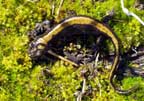
Long-toed salamander (Stephen Corn)
These materials prepared by the Climate Change in Mountain Ecosystems Program -- U.S. Geological Survey, Glacier Field Station. Dan Fagre, Program Coordinator, email: dan_fagre@usgs.gov. For more information, visit the Glacier Field Station - Climate Change in Mountain Ecosystems program (CCME) web site.
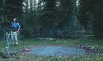 The Flattop Mountain SNOTEL (SNOw TELemetry) station is one of nearly 600 similar stations operated throughout the western United States by the Natural Resources Conservations Service (NRCS, U.S. Department of Agriculture). These stations measure and record Snow Water Equivalent (SWE), which is the weight of snow water equivalent to inches of water. Most SNOTEL sites also measure temperature and precipitation; many now measure snow depth as well. Various agencies and organizations use the data from the stations to forecast water availability, floods, and avalanche hazard. The Flattop Mountain SNOTEL station has operated since October 1st, 1969. To help calculate water storage and availability during agricultural growing seasons, the data are compiled by water year; a water year runs from 1 October - 30 September.
The Flattop Mountain SNOTEL station is located at approximately 6300 feet in elevation on Flattop Mountain, a high plateau between the Lewis and Livingston Ranges in Glacier National Park, Montana. The site is three air miles south of the Continental Divide. During the winter, complex combinations of weather and terrain determine snowfall at the site. 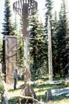 Westerly weather systems predominate, bringing moisture from the Gulf of Alaska or Pacific Ocean. Less frequent northerly systems spill drier Arctic air through passes on the Continental Divide as they slide south along the Rocky Mountain Front. Flattop Mountain’s position between the Livingston and Lewis Ranges amplifies the effects of these large-scale weather systems; the two ranges rise 2-4000 feet above the site and orographically wring moisture from both westerly and upslope easterly storms. Flattop Mountain is a useful indicator of snowfall throughout Glacier National Park because it is subject to the factors that influence conditions elsewhere in the park.
The graph below shows the current water year SWE at Flattop Mountain compared to SWE from other significant water years.

The data plotted above includes:
The 2002 snow accumulation/ ablation cycle at the Flattop Mountain SNOTEL station began October 10, 2001 and ended July 19, 2002. Snow cover at the site was continuous for 282 days, or more than nine months. The station also recorded snow on August 13 and September 28-30.
As the graph shows, the 2002 water year was notable for two things: the number of large storms and the atypical late season SWE accumulation. Flattop recorded five days with 2 inches or more of SWE accumulation:
In 1972, Flattop SNOTEL recorded four days with 2 inches or more of SWE, and three days each in 1986, 1990, and 1998. Though there have undoubtedly been many more 24-hour periods with 2 inches or more SWE, they are difficult to determine from daily records.
Even more significant than the large storms was the atypical late-season accumulation. Prior to late February, the SWE at the station generally tracked the thirty-year average. For the remainder of the winter and spring, however, the station recorded SWE accumulations dramatically above average. Between April 1 and June 21 (the summer solstice),
The atypical late-season snowfall also resulted in an especially slow melting snowpack.
|
Peak |
Water |
Date |
July |
Meltout |
|
74.9” /74.8” |
1972 |
April |
4.2” |
July |
|
67.9” |
1997 |
May |
0” |
July |
|
63” |
1991 |
May |
4.4” |
July |
|
62.2” |
1974 |
April |
0 |
July |
|
61.6” |
1996 |
May |
0 |
July |
|
60.3” |
2002 |
May |
0” |
July |
|
60.1” |
1999 |
May |
5.9” |
July |
|
30.8” |
2001 |
April |
0” |
June |
|
47.32”/ |
1970-99 |
April |
.5”/ |
July |
There is one other SNOTEL station in Glacier National Park; it is located nine miles east of Flattop Mountain in the Many Glacier Valley. Because the site is across the Continental Divide and approximately 1500 feet lower in elevation, it is much drier than Flattop Mountain. Other nearby SNOTEL stations include Pike Creek, Emory Creek, Stahl Peak, and Grave Creek.
