A catalog of NASA images and animations of our home planet
Skip Navigation (key s)
.
Home
Terms of Use
Frequently Asked Questions
Browse By:
Satellite
Sensor
Collections
Country
U.S. State
GCMD Topic
All Categories
»
Geographic Regions
»
Countries
»
United States
Extensive Fires in the Western U.S.
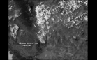
Animation of Sequoia Forest Fire
Perspective View, Landsat Overlay, …
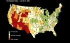
Fire Potential Index
Smoke Over Western United States
Smoke From West to East over U.S.
SRTM Radar - Landsat Image …
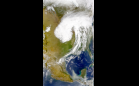
Midwest Storm System and Central …
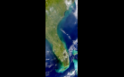
U.S. Gulf Coast
United States
Montana Fires Animation
Drought in the Rockies
TOPEX/El Nino Watch - Los Ninos …
Largest-ever Ozone Hole over …
Hurricane Irene After-effects
Clear Day in the Central U.S.
Sort By: Data Date
↑
↓
Visualization Date
↑
↓
ID
↑
↓
«
‹
1
2
3
…
6
7
8
9
10
…
15
…
20
…
25
…
30
31
32
›
»
Subcategories