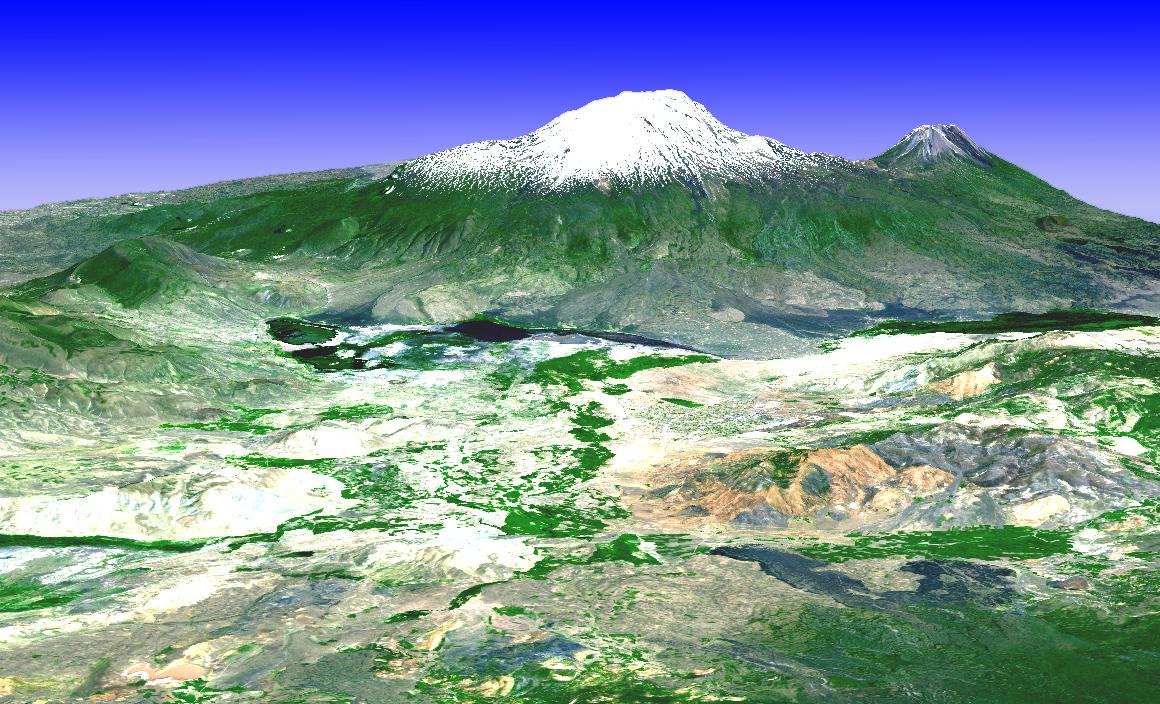
Spacer
Spacer
  NASA Logo
Jet Propulsion Laboratory
California Institute of Technology

Vertical spacer bar
+ View the NASA Portal
Spacer
JPL Home Spacer Earth Spacer Solar System Spacer Stars and Galaxies Spacer Technology
Spacer
Aster
Spacer
Gray Bar
Spacer

Spacer
ArrowHOME
Spacer
ArrowMISSION
Spacer
Arrow GALLERY
DividerDividerDivider
Archaeology Archaeology
Divider
Cities Cities
Divider
Geology Geology
Divider
Glaciers Glaciers
Divider
Hydrology Hydrology
Divider
Land Use Land Use
Divider
Natural Hazards Natural Hazards
Divider
Volcanoes Volcanoes
Divider
 red arrowMost Popular Images
Spacer
ArrowDATA
Spacer
ArrowABOUT US
Spacer
Arrow PRESENTATIONS &
   DOCUMENTS
Spacer
ArrowLINKS
Spacer


ASTER


Spacer

Mt. Ararat
Click Image to Enlarge
Mt. Ararat
 (JPG) (211,618 bytes) ( 1,160 x 704 )
Mount Ararat is located in extreme northeast Turkey, close to the border of Armenia, Azerbaijan, and Iran. Ararat consists of two volcanic peaks: Big Ararat (5137 m) and Little Ararat (3,914m). The top of Big Ararat is covered with snow all year long. The Old Testament story of Noah says that Noah’s ark came to rest on Ararat following the Great Flood. This image is a 3-D perspective view looking from the southwest, created by draping a simulated natural color image over an ASTER-derived digital topography model. The image was acquired on 25 June 2002, and is located at 39.75 degrees North latitude, 44.4 degrees East longitude.

Please give credit for these images to:
NASA/GSFC/METI/ERSDAC/JAROS,
and U.S./Japan ASTER Science Team

Spacer
FIRST GOV
CL 97-1376
43730 hits since 09/15/06.
Added: 5/3/2004 12:35:16 PM
NASA Home Page Questions? Comments? Contact:
Howard Tan
Spacer
Spacer