Where is it and what do we seek to know?
The Basin and Range Province is a high elevation, internally drained
region of the western United States that is currently experiencing
active tectonic deformation (Figure
1). The province extends south through Arizona and into Mexico,
and north into Oregon, Idaho, and Montana. The region is actively
extending in the East/West direction. In other words, the state of
California moves away from Colorado, (roughly "stable" North
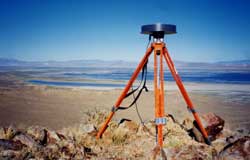
America) at approximately 1 cm/year. Our group uses extremely precise space-based geodetic methods,
such as the Global Positioning System (GPS)
to measure these tiny tectonic motions of the Earth's crust. Currently
we can measure velocities as small as a few millimeters per year.
|  and the caption")
Figure 1 (96 kb).
Shown are locations were data is being collected in GPS campaigns
(red triangles). We concentrate our measurements in regions
of active deformation, i.e. where the continent is changing
shape the fastest. Also our arrays are quasi-linear, crossing
active geologic strucutures in order to maximize the amount
of deformation seen. The dotted line shows the approximate perimeter
of the Basin and Range |
The scientific objectives of our research include the detailed
mapping of velocities throughout the Basin and Range, and other
tectonically interesting portions of the West. With these geodetic
measurements we can identify and characterize the regions that are
actively deforming. This will allow us to better constrain seismic
hazard in the interior western US where geodetic data is currently
sparse, and will contribute to our understanding of the reasons
for the deformation. For example, GPS velocity measurements can
assess how far the tractions from the Pacific plate are transferred
into North America. See the enclosed paper by Thatcher
et al, [1999] for greater detail.
This effort will be complemented by quantitative modeling of the
crustal deformation. For example, the use of finite element analysis
provides a means of applying physical constraints to the problem
of inferring Earth properties from a geodetic signal. This allows
us to rigorously test models for Earth processes against the observations.
This work is done in conjunction with a multi-institution initiative
known as The Plate
Boundary Observatory whose goal is to evaluate the deformation
the entire Pacific/North American plate boundary in unprecedented
detail and scope. Our work has been funded by NASA's Solid Earth & Natural Hazards Program and the USGS's National Earthquake
Hazards Program.
|