A catalog of NASA images and animations of our home planet
Skip Navigation (key s)
.
Home
Terms of Use
Frequently Asked Questions
Browse By:
Satellite
Sensor
Collections
Country
U.S. State
GCMD Topic
All Categories
»
GCMD Topics
»
Land Surface
»
Land Use/Land Cover
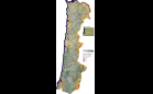
Spotted Owl Habitat
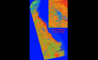
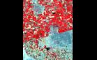
Delaware Land Use Map
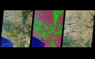
Deforestation in Tierras Bajas, …
Muar, Malaysia
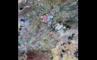
San Fernando Valley, California
Space radar image of Mississippi …
Perspective View, Landsat Overlay, …
Perspective with Landsat Overlay: …
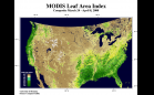
MODIS Measures Total U.S. Leaf Area
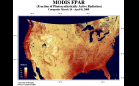
MODIS Measures Fraction of …
High Resolution View of Amazonia
Wisconsin Supercell Thunderstorm …
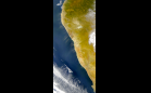
Dust Blowing from Angola and South …
ASTER: Mexicali
MISR Looks at Yugoslavia
Early SAFARI Data: Pietersburg, RSA
Sort By: Data Date
↑
↓
Visualization Date
↑
↓
ID
↑
↓
« ‹ 1
2
›
»
Subcategories
Land Classes
(3)
Land Cover
(13)
Land Management
(8)
Land Productivity
(1)
Land Resources
(0)
Land Tenure
(0)
Land Use Classes
(1)
Watershed Characterist…
(1)