Search NASA:
Welcome to the Earth Sciences Division
The Earth Sciences Division at the NASA Goddard Space Flight Center plans, organizes, evaluates, and carries out a broad program of scientific research, both theoretical and experimental, to study the Earth. We are delighted you found us here and hope you will return many times to visit and experience the excitement we feel about our mission. Our mission ranges from basic research, to the definition and development of flight missions and instruments, to mission operations, data analysis, and distribution.
TOP STORIES

- NASA-USAID Earth Observation System Expands to Africa
- NASA, the US Agency for International Development (USAID) and their partners are in Nairobi, Kenya, to launch SERVIR-Africa, a program that helps scientists, government leaders and local communities address concerns related to natural disasters, disease outbreaks, biodiversity and climate change.
- Water Vapor Confirmed as Major Player in Climate Change
- Researchers have estimated more precisely than ever the heat-trapping effect of water in the air, validating the role of the gas as a critical component of climate change.
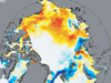
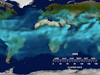
- Arctic Sea Ice Decline Shakes Up Ocean Ecosystems
- Researchers took advantage of NASA satellite images to show that the microscopic floating plants are teeming in regions of recent ice melt.

- NASA Gauges Sea Level, Glacier Changes
- Researchers have used satellite data to make the most precise measurements to date of changes in Alaskan glaciers.
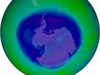
- 2008 Ozone Hole Maximum Announced
- The Antarctic ozone hole reached its annual maximum on Sept. 12, 2008, stretching over 27 million kilometers, or 10.5 square miles.
- NASA-Enhanced Dust Storm Predictions To Aid Health Community
- NASA satellite data can improve forecasts of dust storms in the American Southwest in ways that can benefit public health managers. Scientists announced the finding as a five-year NASA-funded project nears its conclusion.

- Climate Change Seeps Into the Sea
- The ocean has helped slow global warming by absorbing much
of the excess heat and heat-trapping carbon dioxide
that has been going into the atmosphere since the start
of the Industrial Revolution.
-- Good news has turned out to be bad.
ITEMS OF INTEREST
- NSPIRES Research Opportunities
- Supporting research in science and technology is an important part of NASA's overall mission
- NASA Science For Educators
- "To inspire the next generation of explorers"
- Goddard Diversity Council
- Diversity at Goddard
+ Home