|
Christina River Watershed Database and Mapping Project Software & Data
The Christina River, a tributary of the Delaware River, historically supported large populations of anadromous sturgeon, Atlantic salmon, shad and herring. The Christina project combines sediment contaminant data and bioassay results collected by the state of Delaware, with contaminant data from three Superfund site investigations. The combined data sets are shown on maps of drainage areas, wetland types, fish species distribution, and land use. This information is used to predict the biological effects of contaminants in river sediment, to evaluate clean-up alternatives, and to plan restoration projects.
Wetlands are evaluated for habitat restoration based on size, degree of contamination, proximity to ongoing contaminant sources, and fish usage by using the ArcView® GIS program. The Christina River project is both a successful model for other NOAA watershed projects and an outreach tool for public education.
What the examples illustrate
The Christina River Project examples illustrate how mapping several data types simultaneously helps evaluate, sort, and communicate information that may affect project success. The process begins with a broad view of restoration possibilities and ultimately produces a map that identifies a few priority restoration projects using the variables that are most important for each project. For the Christina River Project, the goal is to restore migratory herring and shad populations.
This type of desktop analysis is used to clarify restoration priorities and evaluate potential projects. The final selection of a restoration project requires visiting and sampling a proposed project location.
The sampling and analysis data used in this project are from reports by local, state and federal agencies. There may be additional data for the Christina River area that are not represented here.
 |
|
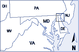
Location of the Christina River Watershed
|
For more information on using this project:
|
|
|
- Query Manager and MARPLOT An introduction to the Query Manager and MARPLOT applications that are used extensively throughout the ARD watershed projects
|
|
|
Downloads & Publications:
|
|
|
|
|
|
|
|
|
Other Christina River Project Pages:
|
|
|
|